The mistake most winter visitors make is picking the desert trail with the biggest name and the least thought about what their legs and schedule can actually take. Camelback at nine on a Saturday is not a hike, it is a queue with a staircase attached.
November through March here is a cool, dry 55-75°F window, not the summer-heat cliché, and the real decision is which trailhead town, what distance and climb, which fee and how much crowd you want to trade for the view.
The spread is wide: 0.6 mile and 150 ft of gain at Palm Canyon, up to 7.5 miles and 1,900 ft at Romero Canyon, entry free to about $25 per vehicle. The name on the sign is a poor substitute for those numbers.
So work the rule: match distance, gain, drive, pass, exposure and parking to your fitness, your free hours and your appetite for remote roads. Get that right and a sunrise start is all that is left to decide.
Quick Tips Before You Start
Start at sunrise
Trails like Echo Canyon fill their lot before 7 a.m.; early light is also the coolest hour of the day.
2 liters minimum
Carry at least 2 liters per person and 3 on the longer Tucson climbs, even in January.
Check the pass
State parks, national monuments and Red Rock Pass all have their own rules; confirm the current fee before you drive.
Grip over cushion
Loose granite and slick rock steps want a sticky sole, not a soft running shoe.
Aim for 55–75°F
That is the working range for these trails; a 90°F day turns an easy loop into a serious outing.
Check road conditions
Remote trailheads on dirt require a call or a look at the official site before you commit.
1. Treasure Loop at Lost Dutchman
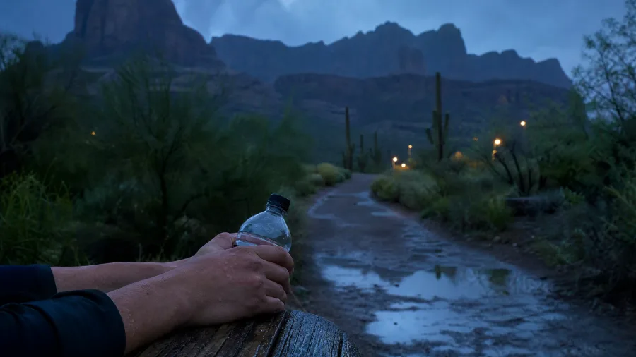
With 2.4 miles, 500 ft of gain and a trailhead inside Lost Dutchman State Park in Apache Junction, yes, comfortably, and without wrecking the rest of your day.
You start in the state park, climb through saguaro-dotted slopes as the volcanic rock of the Superstitions fills the skyline, and finish back where you began. It is a first-timer's route and a good one for families with older kids, because the distance is honest and the gain is a climb, not a scramble. Go in a November-March morning aiming at 55-75°F, start early, and carry at least 2 liters of water. Summer heat is the wrong season for this exposed loop. Entry runs about $10 per vehicle, and because fees and gate hours shift, confirm both before you drive.
💡 Tip: The postcard view of the Superstitions is from the Siphon Draw trailhead lot, not the loop itself. Take five minutes there before you start.
| Trail | Round-trip distance | Elevation gain | Trailhead town | Winter note |
|---|---|---|---|---|
| Treasure Loop | 2.4 mi | 500 ft | Apache Junction | State park entry about $10/vehicle |
| Gateway Loop | 4.4 mi | 700 ft | Scottsdale | Free; weekend lots fill early |
| Echo Canyon | 2.4 mi | 1,280 ft | Phoenix | Lot fills before 7 a.m. |
| Hidden Valley via Mormon Trail | 3.4 mi | 700 ft | Phoenix | Free; exposed city-edge trail |
| Peralta to Fremont Saddle | 4.8 mi | 1,300 ft | Gold Canyon | Confirm Tonto forest pass |
| Romero Canyon | 7.5 mi | 1,900 ft | Tucson | Park entry about $7/vehicle |
| Cactus Forest Trail | 2.5 mi one-way | 150 ft | Tucson (east) | Park entry about $25/vehicle |
| Palm Canyon | 0.6 mi | 150 ft | Kofa Refuge | Free; remote dirt access |
| Arch Canyon | 1.2 mi | 400 ft | Ajo / Why | Monument entry about $25/vehicle |
| Bell Rock Pathway | 3.6 mi | 350 ft | Sedona | Check Red Rock Pass |
| Horseshoe Bend Trail | 1.5 mi | 200 ft | Page | Parking about $10/vehicle |
2. Gateway Loop in McDowell Sonoran
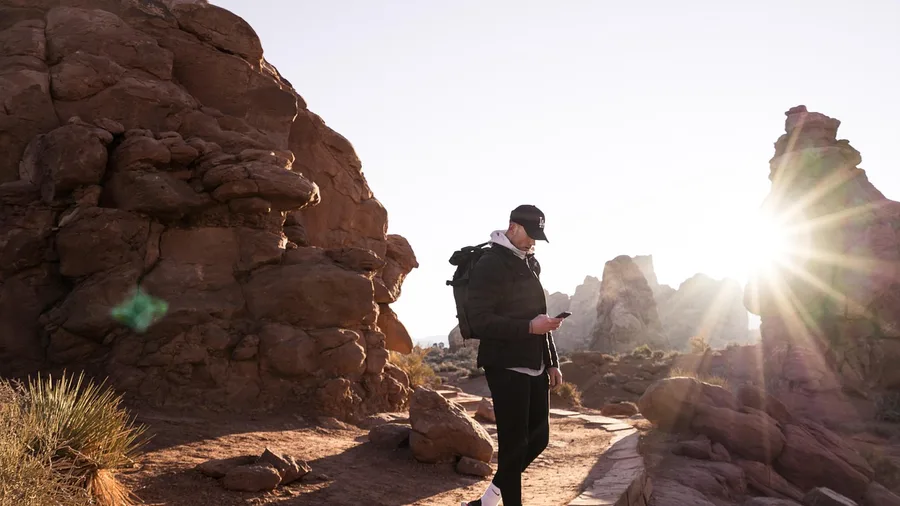
Know before you go: this is free, wide and always busier than the photos suggest, so the weekday matters as much as the hour. The Gateway Trailhead in Scottsdale puts you on a 4.4-mile loop with about 700 ft of gain and a rolling, runnable grade.
That free preserve access is the reason locals use it instead of paying for a resort-adjacent walk. Trail runners and fit beginners get an easy half-day, but there is little shade, so start early and still carry at least 2 liters of water even in the 55-75°F winter window. Parking peaks on weekends; sunrise buys you cooler air and a space.
So the tradeoff is plain: no fee, no gate, rolling climb, and the crowds that come with all three. Short and paid in the Superstitions asks less of your legs and more of your wallet; this asks the reverse.
💡 Tip: Fit beginners can jog the flats and power-hike the climbs; this is one of the few loops on the list where running makes sense.
⚠️ COMMON MISTAKE
A Free Hike Is Not a Free Trailhead
Several trails on this list are free to hike but sit on land with its own pass, entry fee or permit rule. Hiking free and A parking free are different facts. Check the managing agency's site for the trailhead, not just the trail name.
3. Echo Canyon on Camelback Mountain
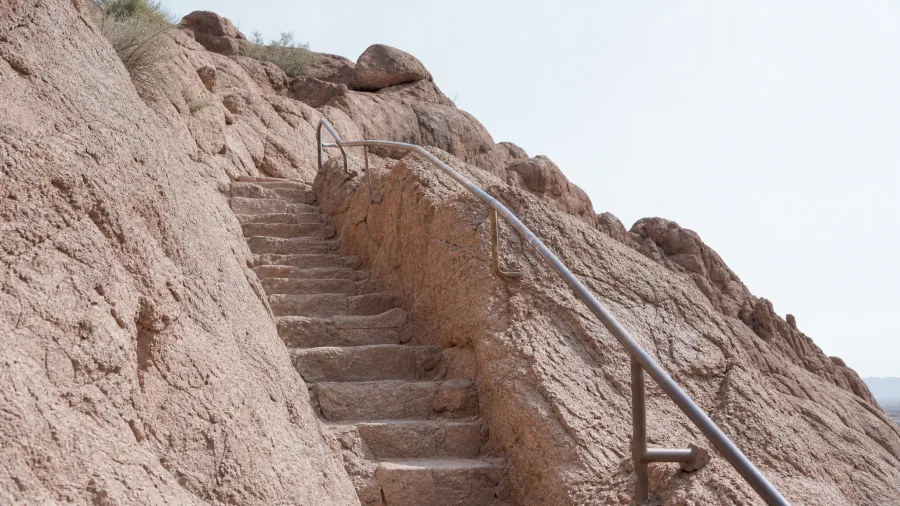
Two point four miles, 1,280 feet of gain, and a parking lot that is full before 7 a.m. Free access does not mean easy entry at Echo Canyon on Camelback Mountain, the steep scramble that follows the runnable Scottsdale preserve routes as the next test of Phoenix legs.
Expect handrails set into rock, stone steps cut into the slope, and stretches where both hands are useful. This is a climb, not a walk, so it suits hikers comfortable on exposed rock; anyone uneasy with heights should turn around early. The mountain's resident chuckwallas and the occasional desert bighorn are a real possibility on the quieter upper slopes, but treat any sighting as a bonus, not a plan.
November through March gives the cool window this trail needs, yet the small lot still fills before dawn on weekends. Arrive for sunrise with at least 2 liters of water per person and you get shade on the climb and space at the railings. The payoff is a famous Phoenix workout and a summit view over the whole valley, and the crowd is simply the price of the name.
💡 Tip: Coming down is slower than going up on this one. Budget the same time for the descent.
💡 PRO TIP
The 7 a.m. Rule
Three trails on this list (Echo Canyon, Gateway Loop and Bell Rock) have parking that decides your day. On any of them, arriving after 8 a.m. in January means waiting or rerouting. Set the alarm.
4. Hidden Valley via Mormon Trail
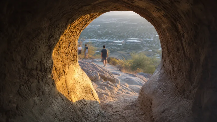
The granite on South Mountain holds the morning cool, and the climb out of Mormon Trailhead is in shade before eight. This is a 3.4-mile loop with 700 feet of gain, and the access costs nothing.
Where a steep stacked-stone scramble concentrates the crowd, this loop spreads it out. The draw is Hidden Valley itself, a pocket of rock tunnels and tight passages on the back half, which gives the walk more variety than a flat desert path ever will. You climb, thread through, and drop back on the Mormon Trail; it is a moderate workout for a Phoenix half-day, not a peak attempt.
The exposure is the honest catch. There is little shade after the first mile, so in the November-March window you still want a sunrise start and at least 2 liters of water per person, more than seems necessary for a hike this short. Free South Mountain access, a short drive, and varied terrain for the effort: it suits anyone who wants a real climb without leaving the city.
💡 Tip: The loop direction matters less than the hour. Late afternoon gives you the valley in warm light and the lot half empty.
Peralta Trail to Fremont Saddle — At a Glance
📏 Distance
4.8 mi out-and-back
⛰️ Climb
1,300 ft
🅿️ Trailhead
Near Gold Canyon
🎟️ Pass
Tonto NF — confirm
⏱️ Allow
A full morning
🌵 Payoff
Weaver's Needle view
Who it suits
Hikers with steady climbing legs and a full morning, not a quick stop.
5. Peralta Trail to Fremont Saddle
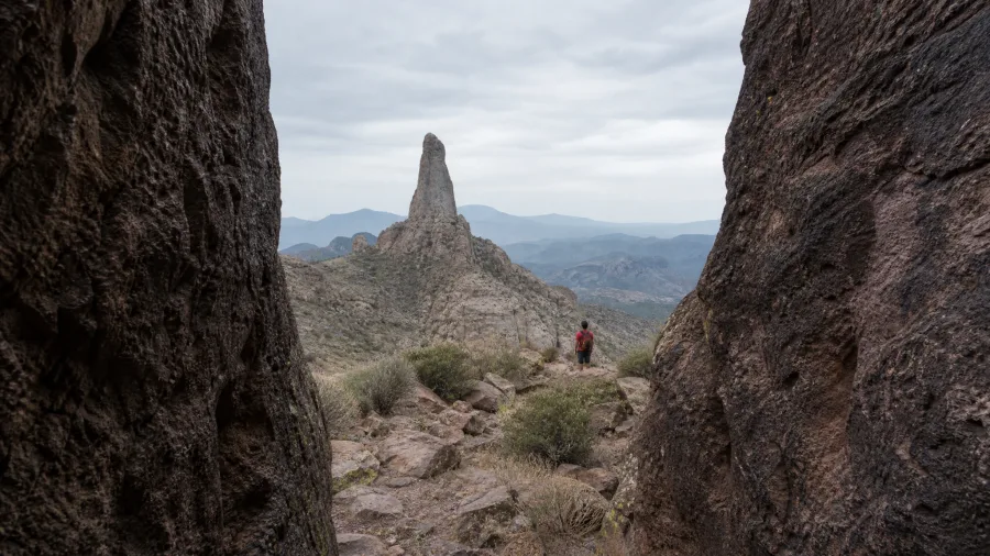
Pay the pass, drive past Gold Canyon, and climb Peralta. This one is worth the toll and the morning.
The numbers set the deal: 4.8 miles out-and-back and 1,300 feet of gain to Fremont Saddle, in the Superstition Wilderness east of the Valley. It is roughly twice the sustained effort of a city-edge loop, and it buys you something a fenced park cannot: the saddle opens and Weaver's Needle stands out over the ridge, a stone spire with the whole Superstition range behind it.
The climb is rocky and exposed, with shade in short supply, so the November-March start is doing real work here. Leave early, carry at least 2 liters of water, and give it a full morning. Steady climbing legs matter more than raw cardio; this is a grade that keeps asking for a little longer than you think.
The splurge is the pass rather than a ticket booth. Peralta sits on Tonto National Forest land, and pass requirements there can shift with the season and the trailhead, so check the official Forest Service source before you drive out. Budget for the pass, and budget the time to reach the trailhead, which is well east of the city and not a spur-of-the-moment detour.
What you are buying with that drive and that fee is the view from the saddle: Weaver's Needle framed by open wilderness. If your day runs to a full morning and your legs are up for it, this is the climb to spend it on.
💡 Tip: Most people stop at the saddle. The continuation toward Boulder Canyon is for confident route-finders only.
6. Romero Canyon in Catalina State Park
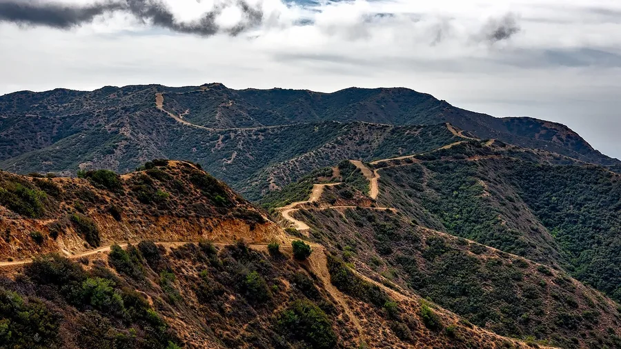
Romero Canyon charges about $7 per vehicle at Catalina State Park and asks more of your legs than anything else on this list: 7.5 miles out-and-back and 1,900 feet of gain, the biggest climb here, plus a Tucson drive.
Start early with 2-3 liters of water and hike the desert-to-canyon route to the pools, using them as your turnaround before the grade turns serious. Confirm current park hours and fees before you go. Fit hikers get a genuine workout; schedule and water supply, not the scenery, are what will limit the day.
💡 Tip: Fit hikers who want a longer winter workout get more out of this than any other trail here. Casual walkers should pick Cactus Forest instead.
Romero Canyon vs Cactus Forest: Same Park System, Different Day
Choose Romero Canyon if
- You want a real 7.5-mile workout
- You have a full morning and 3 liters of water
- You climb confidently and like a challenge
- You are fine with 1,900 ft of gain
Choose Cactus Forest if
- You have kids or a slow morning
- You want 150 ft of gain, not 1,900
- You would rather watch birds than climb
- You are fitting a hike around other plans
7. Cactus Forest Trail in Saguaro East
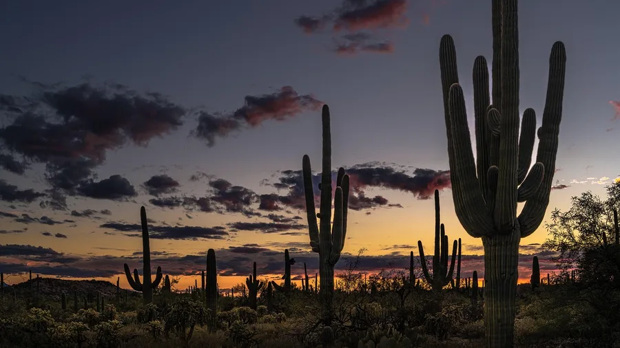
The Cactus Forest Trail is the easy morning in Saguaro National Park East. It runs about 2.5 miles one way with only 150 feet of gain, so the whole walk stays gentle enough that anyone in the group can turn around whenever they want.
You pay roughly $25 per vehicle to enter the park, which is a real number for a stroll, so make it earn the day. The visitor center is where you confirm current entry details and which loop option fits your time. Families, birders and slow winter mornings all fit here, and carrying at least 2 liters of water still applies even on a cool November-to-March day.
The reward is quiet: a forest of saguaro and palo verde with almost no climb to fight. It is the calm counterweight to a steep climb, and the tradeoff is that the low effort matches a low payoff. The fee and the visitor-center check are the two planning items that decide whether it fits your day.
💡 Tip: Walk it one-way and arrange a second car, or turn around at the halfway mark. The trail is not a loop.
8. Palm Canyon in Kofa Refuge
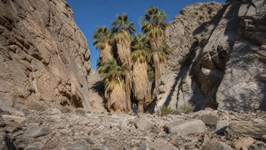
You hear the palms before you see them, a dry rattle in the breeze off a rock wall. That is Palm Canyon in Kofa National Wildlife Refuge, and it is free and genuinely remote.
The walk is 0.6 mile out and back with about 150 feet of gain on a rocky path, ending at a native palm grove tucked into a canyon. This is not a stand-alone destination hike. It suits campers and anyone already rolling along US 95, and the drive is the real cost.
Sort road conditions and all your water before the detour, because there are no services nearby. The hiking demand is tiny; the access demand is high. Winter is the workable window, and the palm grove is the payoff.
💡 Tip: Do not cut across the wash for a shortcut. The marked route keeps you off unstable rock.
9. Arch Canyon in Organ Pipe
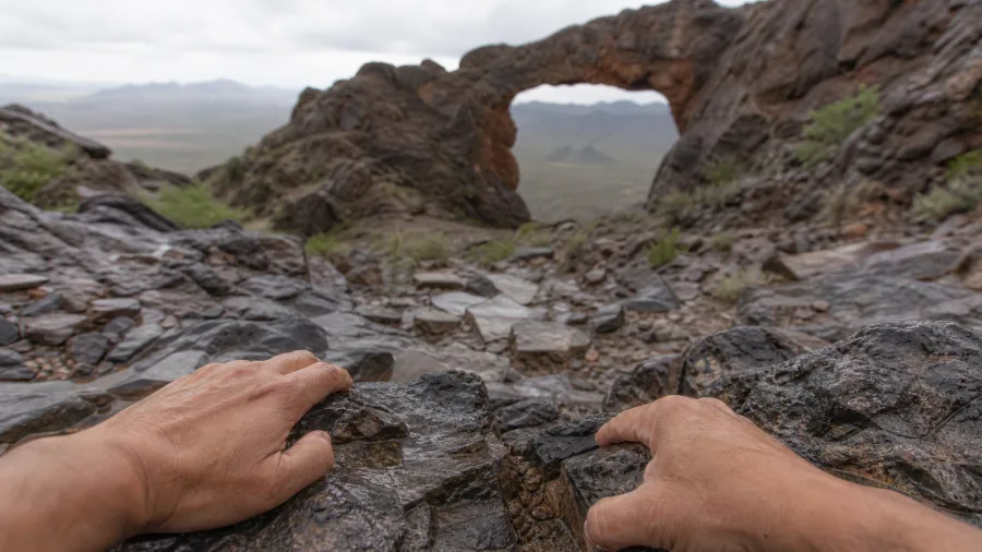
Arch Canyon is the short Organ Pipe hike worth the border-country drive, a 1.2-mile out-and-back with about 400 feet of gain that ends at a rock arch punched through the ridge. Monument entry runs about $25 per vehicle, and current conditions should be checked before you set out in this remote setting. It suits travelers already exploring Ajo or Why; give it a cool November-to-March morning, and sun protection and water are mandatory. Stand just below the arch on the return, when the light drops through the opening and the desert floor glows behind you.
The distance and gain are modest, so the deciding factor is the drive and the day, not the trail. Two extra liters of water and a look at the forecast matter more here than fitness.
💡 Tip: This one earns its place in the trip, but the catch is the drive. It is a light hike and a heavy travel day.
10. Bell Rock Pathway near Sedona
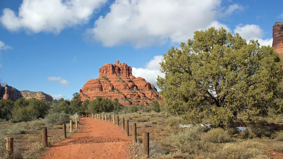
Sedona charges you for the view one way or another, and the charge here is $5-ish at a machine, not sweat. A Red Rock Pass is required to park along much of the highway corridor around Bell Rock, and the requirement shifts by lot and by year, so check the official source before you drive out rather than trusting a sign you half-remember. That is the catch: the hike is easy, the paperwork is not automatic.
The path itself is 3.6 miles out and back with about 350 feet of gain, a wide red-dirt track that curls around the base of the rock rather than up it. You are walking a circuit of views, not summiting anything. The formations change color as you move, and the bell-shaped butte stays in front of you the whole way like a fixed point you keep circling.
After the remote detours that ask you to sort road conditions and water before you even leave the pavement, this is the opposite commitment: you park, you walk, the scenery arrives. First-timers get the whole postcard without a scramble, and photographers get a subject that holds up in flat light. Two liters of water still goes in the pack, because the November-to-March window is cool and dry, not wet.
Timing is the crowd control, and it is the only crowd control. Come at first light or in the last hour before sunset and the lot has room and the rock glows; come at eleven on a Saturday in February and you are sharing the trail with everyone who had the same idea. The light and the parking solve each other, which is rare.
So treat it as the low-effort red-rock day, not the wilderness day. It fits a schedule that has an afternoon to spare and no appetite for a climb, and it earns the stop on the view alone. Just decide your arrival hour before you decide anything else.
💡 Tip: If the Bell Rock lot is full, use a shuttle or come back after 3 p.m. when the day hikers clear out.
Desert Trail Words You'll See on Every Sign
11. Horseshoe Bend Trail near Page
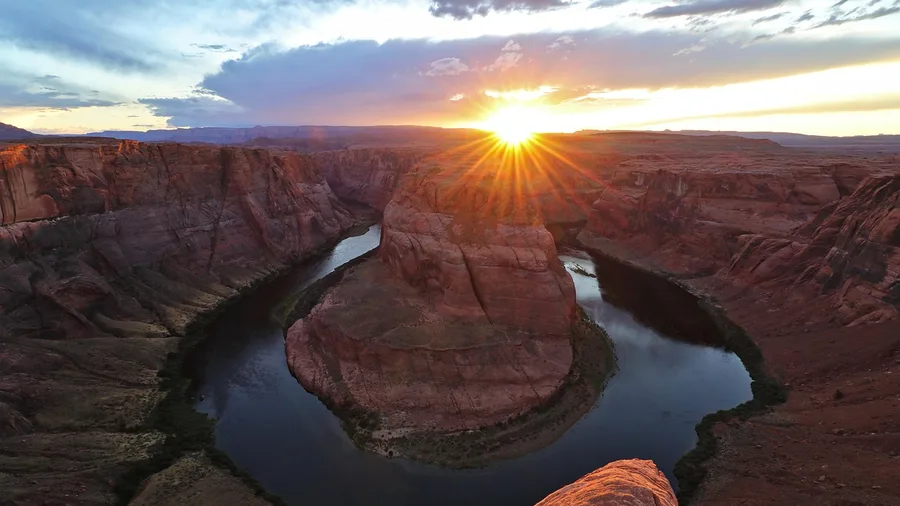
It is 1.5 miles out and back, about 200 feet of gain, and roughly $10 to park, which tells you most of what you need to know: this is a short, paid, famous walk, not a hike. The path is exposed the whole way, so the sun is on you from the moment you leave the lot, and two liters of water still belongs in the pack even in the cool window. The reward is the bend itself, the Colorado curling back on itself below the rim.
Road-trippers and photographers get the most from it, and early or late is when the light softens and the wind drops. Go in the middle of the day in February and you will be in a slow line of people at the rail. The payoff is high, the effort is minimal, and the tradeoffs are the parking fee and the lack of shade. Worth the stop once, on your way to or from Page, as long as you time it.
💡 Tip: The far left side of the rim is usually less crowded than the main rail. Same view, fewer elbows.
Sorting the Eleven by the Day You Have
- ✅ Go: Treasure Loop, Cactus Forest, Gateway Loop — Short, free or cheap, low commitment; perfect half-days.
- ✅ Go: Hidden Valley, Bell Rock — Moderate distance and varied scenery without a huge drive.
- ⚠️ Careful: Echo Canyon, Peralta, Romero Canyon — Real climbs with real exposure; start early and carry 3 liters.
- ⚠️ Careful: Horseshoe Bend — Short but crowded and windy; go early or late.
- 🛑 Skip if you have one free day: Palm Canyon, Arch Canyon — The drive and remote roads, not the hike, decide these.
- 🛑 Skip in summer: all of them — These are November-to-March trails for a reason.
Frequently Asked Questions
Do I need a pass for these desert trails?
Several do require one. Lost Dutchman charges about $10 per vehicle, Catalina about $7, Saguaro East and Organ Pipe about $25, and Horseshoe Bend parking about $10. Peralta sits on Tonto National Forest land and Bell Rock may need a Red Rock Pass. Check the managing agency's site before you drive.
How much water should I carry in winter?
At least 2 liters per person on every trail here, and 2 to 3 on Romero Canyon and Peralta. Cool air hides how much you sweat, and Arizona's dry wind pulls moisture out faster than you notice. If you finish with water left, that is the right outcome, not a waste.
Which of these is best for families with kids?
Treasure Loop at Lost Dutchman and Cactus Forest Trail in Saguaro East are the two safest picks. Both are short, low-gain and easy to bail out of. Echo Canyon and Peralta are not family trails, whatever the photos suggest.
Can I hike more than one of these in a day?
Yes, if you stay in one town. Pair Treasure Loop with Peralta if you are based in Apache Junction, or Cactus Forest with Romero Canyon out of Tucson. Do not try to link Phoenix, Sedona and Page in one day; the driving eats the hiking.
When do the trails get the most crowded?
Weekend mornings from 8 to 11 a.m. are the crush, especially at Echo Canyon, Gateway Loop and Bell Rock. Sunrise starts get you cooler air and a parking space. Weekdays in January and early February are noticeably calmer.
Is winter hiking in Arizona actually safe?
November to March is the safest window all year: expect roughly 55 to 75°F, dry trails and good visibility. The real risks are exposure, thin water supply and loose rock, not weather. Start early, tell someone your trail, and turn around when your water hits half.
Match the Trail to the Person You Brought
Match the trail to the person you brought. A first-timer with half a day near Phoenix takes Treasure Loop or Gateway Loop, Cactus Forest or Bell Rock. Families do best on Treasure Loop with older kids or Cactus Forest. Peak-baggers want Echo Canyon, Peralta and Romero. A fit beginner after a city half-day takes Gateway Loop or Hidden Valley. Remote-road explorers take Palm Canyon and Arch Canyon. Photographers take Bell Rock in morning light, Horseshoe Bend late.
Then pick your trailhead town, Apache Junction, Scottsdale, Phoenix, Gold Canyon, Tucson, Ajo or Why, Sedona or Page, check the official park or forest page for the current pass, fee and road conditions, and set the alarm for sunrise. That hour decides your parking, your temperature and your photographs.
Stay inside the 55-75°F window, carry at least two liters of water, and the free day works. The best trail is not the most famous one. It is the one whose distance, gain, fee and drive fit the day you actually have.
Pick One Trail and One Trailhead Town
Before you drive, confirm the pass or entry fee on the managing agency's site, then plan to be at the trailhead at first light. That check takes five minutes and saves the day.