The planning mistake is building the waterfall day around Laurel Falls and Rainbow Falls because the sign on the parkway made the choice for you. The queue, not the map, is what you came to avoid.
The quieter falls get passed over for concrete reasons: a gravel pull-off that holds eight cars, a trail that turns to mud, a faint spur you have to hunt for, a flight of 160 stairs, creek crossings that soak your boots. None of that makes the waterfall lesser. It makes the approach selective.
So the question for each of the ten is the same. What does the approach filter out, and what does the payoff look like once it has?
The ten run 0.3 to 4.4 miles with 100 to 900 feet of climb, and half sit well outside the Gatlinburg corridor, in Tremont, Cosby, Big Creek and over the North Carolina line. By the end you will be able to pick one by the hours you have and the legs you brought: a 45-minute stop, a half day, a family walk, a steep quiet payoff. You will know which trailhead to drive to.
Quick Tips Before You Start
Arrive by 8am
Most of these trailheads hold fewer than ten cars, and the overflow means parking on a curve.
Shoes with grip
Tremont, Cosby and Meigs Creek run wet; slick rock is the reason people turn around.
Buy the parking tag
The park requires a tag for any parked vehicle, so sort it before the first trailhead.
Download the map
Cell signal dies past Tremont and Big Creek; a saved offline map saves the route-finding.
No facilities
None of these ten trailheads has a restroom or water. Fill bottles at the visitor center.
1. Spruce Flats Falls from Tremont
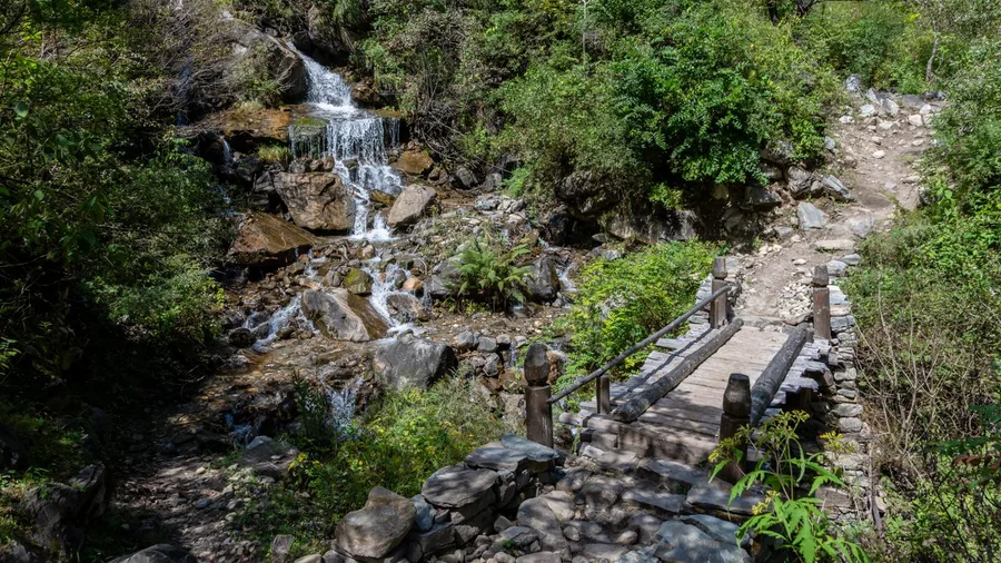
Two miles round trip, 450 feet of climbing, and a trailhead most drivers roll straight past. Spruce Flats Falls asks for ninety minutes and gives back a 30-foot fan fall that sees a fraction of the foot traffic at Laurel Falls.
The entrance does the filtering before you take a step. You are not parking at the Tremont visitor center; you are hunting a small gravel pull-off on Tremont Road, the kind of wide spot that gets smaller the more you look at it. Miss it and you will be halfway to Cades Cove before you figure it out. Find it and the lot is already near capacity by mid-morning, because it holds a handful of cars and nobody thinks to arrive early for a waterfall they have never heard of.
The climb itself is short, and on a map it looks like a warm-up. The last stretch corrects that impression: rock, roots, and a finish that wants your hands free and your boots planted rather than your phone out. What the rough finish buys you is the quiet, because anyone looking for a paved stroll turns around well before the fall, and the ones who stay are the ones who wanted it enough to scramble.
Then the water opens up in front of you, 30 feet of fan-shaped current spreading over the rock, close enough to feel the spray on a heavy day. Compare that to the guardrail-and-shoulder crowds at the famous falls and the arithmetic gets easy. Less spectacle, far fewer elbows.
Give it ninety minutes and traction-ready shoes, and treat the gravel pull-off as a small test you have to pass. Blow past it and you get Laurel Falls with everyone else. Find it and you get a fall mostly to yourself.
💡 Tip: If the pull-off is full, do not park on the grass. Drive to the Tremont Institute lot and walk the extra quarter mile.
The Numbers Behind a Quiet Waterfall Day
2. Hen Wallow Falls in Cosby
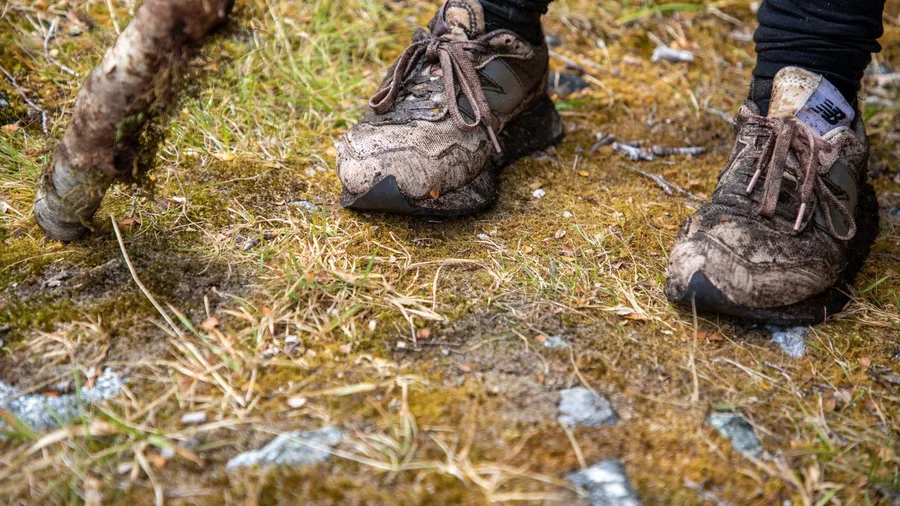
On the Cosby side, yes, if your shoes can handle mud. The distance and the dirt are the whole point, and they thin the trail the same way a rough, short scramble does elsewhere in this range, only stretched over four and a half miles.
The route runs 4.4 miles round trip out of Cosby, and the ground is often wet and slick, the kind of trail where you watch your footing instead of your phone. That mud is a filter working in your favor. Pair it with 900 feet of gain on a side of the park quieter than the Gatlinburg corridor, and by the time the trail opens onto the fall you may be sharing it with two or three other people.
The payoff is a 90-foot curtain dropping in a broad sheet, worth the wet socks. Budget half a day, wear shoes with real grip, and accept the long muddy walk as the entry fee. Check the park site for closures, and carry water because there are no facilities out here.
💡 Tip: Check the weather the night before. After two dry weeks Hen Wallow is a wet streak, not a curtain.
| Hike | Round trip | Elevation gain | Waterfall height | Trailhead area | Why it gets passed |
|---|---|---|---|---|---|
| Spruce Flats Falls | 2.0 mi | 450 ft | 30 ft | Tremont | Small gravel pull-off, no sign |
| Hen Wallow Falls | 4.4 mi | 900 ft | 90 ft | Cosby | Long muddy climb |
| Mouse Creek Falls | 4.0 mi | 300 ft | 45 ft | Big Creek | Falls easy to miss from the trail |
| Juney Whank + Indian Creek | 2.4 mi | 400 ft | 80 ft / 25 ft | Deep Creek | Loop gets overlooked |
| Cataract Falls | 1.1 mi | 150 ft | 60 ft | Sugarlands | Behind the visitor center |
| Baskins Creek Falls | 3.0 mi | 600 ft | 25 ft | Roaring Fork | Faint spur, route-finding |
| Meigs Creek Cascades | 3.6 mi | 500 ft | 20 ft | Little River Road | Creek crossings, wet feet |
| Mingo Falls | 0.5 mi | 160 stairs | 120 ft | Cherokee, NC | Off the main loop, stairs |
| Soco Falls | 0.3 mi | 100 ft | 50 ft | Maggie Valley, NC | Roadside pull-off, scramble |
| Middle Prong Cascades | 2.6 mi | 250 ft | 15-30 ft | Tremont | No single famous destination |
3. Mouse Creek Falls on Big Creek
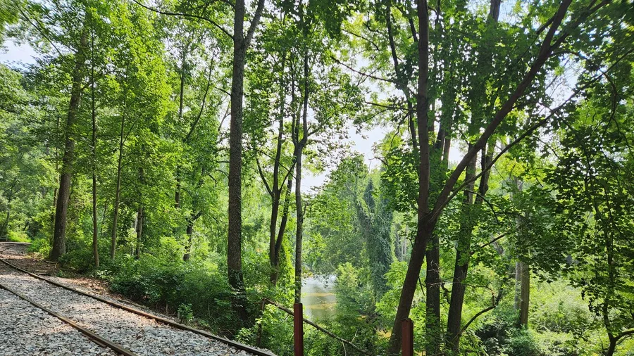
Where a 900-foot climb demands commitment, a gentle 300 feet spread over four miles does the opposite: it lets distance, not steepness, keep the crowds down. Mouse Creek Falls runs along an old railroad grade out of Big Creek, 4.0 miles round trip, and the grade stays mild enough that you talk while you walk.
It costs nothing beyond the drive and the gas, and it earns its place because so few people make the trip. The Big Creek start is out of the way, and drivers headed elsewhere can miss the 45-foot falls entirely. The trade is simple: an easy four miles for families and older hikers who want distance without the stairs or the scrambles, and a quiet fall at the end of it.
⚠️ COMMON MISTAKE
Do Not Rely on the Trailhead Sign
Several of these ten start at a pull-off with no sign at all, and one of the falls sits off the trail with nothing pointing at it. Load the hike on an offline map before you drive, because the signal stops past Tremont and Big Creek.
4. Deep Creek's Juney Whank and Indian Creek
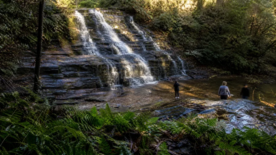
Watch for the split at the loop junction and take Juney Whank first. The 2.4-mile loop out of Deep Creek, near Bryson City, puts 80 feet of Juney Whank and 25 feet of Indian Creek on the same walk, but the trail forks early and people who guess wrong add a mile of backtracking in the wrong direction.
Juney Whank drops in a wet, tiered slide under hemlock, close enough at the base that the spray cools the air ten degrees. Indian Creek, lower on the loop, is a shorter, straighter curtain that spills across a wide rock lip and reads smaller than its 25 feet because the pool below is big. The gain is 400 feet over the whole loop, spread thin, so nothing feels like a climb.
The two-for-one is the whole argument for picking Deep Creek over a single famous name. Set aside roughly an hour and a half, add nothing by way of a second trailhead, and you come out with two falls in one short outing. Walkers who want volume without a long approach get the most here; hikers chasing a big drop should read on.
5. Cataract Falls behind Sugarlands
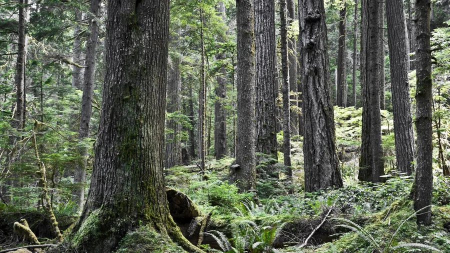
The air cools as soon as the pavement ends and the path drops into hemlock shade behind Sugarlands Visitor Center, with the falls audible before you see the water. That sound is 60 feet of Cataract Falls, and it is 1.1 miles round trip with 150 feet of gain from the back of the lot. No long drive, no big climb, just a rooty, damp path that stays slick after rain.
It suits travelers with 45 minutes or a rainy-day window who want something green and moving instead of another hour in the car. It genuinely does not suit strollers or anyone in smooth-soled shoes; the roots and wet rock are the small filter, and the easy grade is the reason so many people drive past toward Laurel Falls without stopping. If damp footing is a dealbreaker, skip it.
💡 Tip: Ask at the visitor center desk which way to the trailhead. It is not obvious from the parking lot.
6. Baskins Creek Falls in Roaring Fork
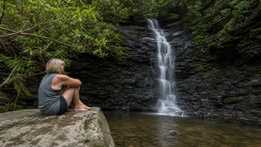
Baskins Creek Falls is a quiet 25-footer reached by a faint spur off the Roaring Fork Motor Nature Trail, and the hardest part of the day is finding where the spur leaves the main path. The round trip is 3.0 miles with 600 feet of gain, and drivers pass the pull-off on the way to better-known stops without a second glance.
The spur is overgrown at the mouth and barely maintains itself in places, so you will be route-finding rather than following a worn line. That is the entire filter. Anyone expecting signage turns back, and the hikers who read the terrain right get the pool and the low ledge almost to themselves, with the creek talking over the noise of the road.
Give it a half day and plan to sit. The fall is small enough that the trip is really an hour at the base of it, boots off, watching water find its way over the rock, and the quiet is the reward you paid 600 feet for. Come down before the afternoon light leaves the hollow.
7. Meigs Creek Cascades off Little River Road
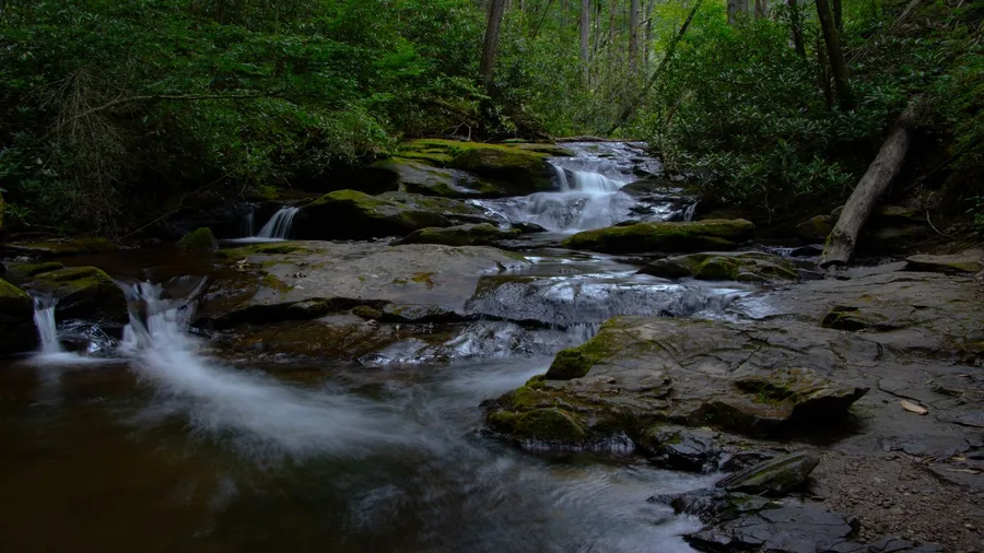
You hear the water before you see any single fall: a low churn that builds as the trail folds in tight against the creek. The first cascade shows up small, maybe 20 feet of water spilling over a rock shelf, and then it keeps going. That is the shape of the whole walk off Little River Road.
The route is 3.6 miles round trip with about 500 feet of gain, and it asks you to cross the creek several times. Expect wet feet. That is the filter: the crossings and the soaked boots keep the walk quiet, and what they buy you is a string of small cascades instead of one named destination. Stand at the shelf where the creek bends and the downstream tiers stack into frame, and shoot in the afternoon when the light gets down into the gorge. Some hikers would rather have one big fall; the ones who come here trade that for a chain.
🚗 A Quiet Waterfall Day, Start to Finish
Night before
Buy the parking tag and check the park site for closures on your chosen trailhead road.
7:30am
Leave your base so you reach the pull-off before the small lots fill.
8am
Park, boot up, and note the trailhead on an offline map before signal drops.
Mid-morning
Hike your first fall and give it the time it deserves instead of rushing to a second.
Lunch
Drive into Townsend, Cosby or Bryson City to eat rather than picnicking at a full lot.
Afternoon
Add one short stop like Cataract or Soco on the way back rather than a third long climb.
8. Mingo Falls near Cherokee
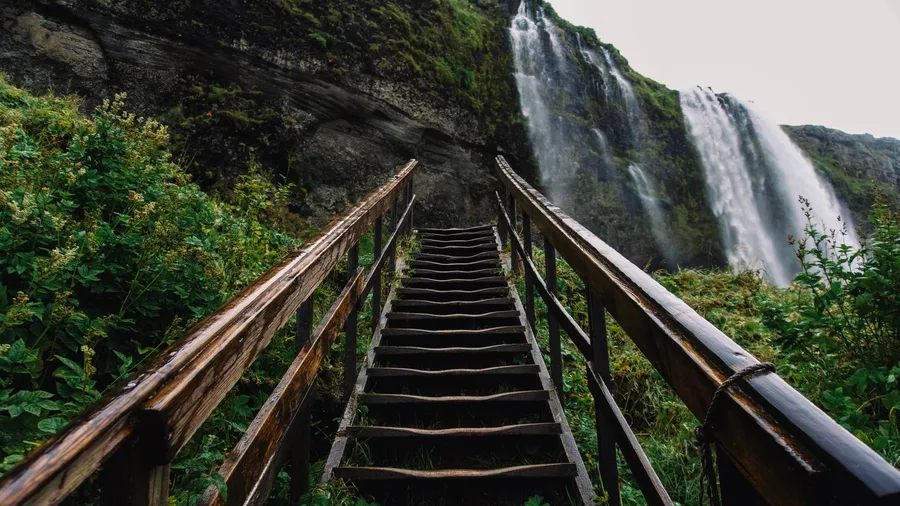
If it is Mingo: half a mile and 160 stairs buys you 120 feet of falling water. That is the whole trade, and for a traveler with half a day, it is the best one on this list.
The trail is near Cherokee, NC, out of the main corridor and easy to miss. The distance is a half-mile round trip, so the downhill takes about ten minutes. What stands between you and the fall is a steep staircase of 160 steps. The stairs are the filter here, not the distance.
So it costs time, not money, at the trailhead; the park charges nothing to park or hike, and Cherokee has gas and food a short drive off. The payoff is a tall, vertical fall framed by rock and green, and the stairs are the reason the crowd thins at the bottom of them.
The climb is short but steep, so budget more minutes than the mileage suggests. Take it slow, rest on the landings, and watch for slick tread in wet weather.
Get there early. The half-mile length draws a lot of people, and the stair landing is narrow when several hikers try to pass.
💡 Tip: The stairs are steep and there is no railing on parts of the climb. Take them slowly and let faster hikers pass.
When the Quiet Trail Is Worth It, and When It Is Not
Take the quiet trailhead
- You have 90 minutes to half a day and no fixed schedule
- You will trade mud, roots or a faint spur for an empty frame
- You are already on that side of the park, Cosby or Tremont or Cherokee
- You want a fall you can sit in front of instead of photograph and leave
Skip it this trip
- You have 45 minutes and no grippy shoes
- You are hiking with someone who cannot manage 160 stairs or a 900-foot climb
- You are arriving after 10am, when even the small lots are full
- You want a paved path and a sign at every junction
9. Soco Falls off Maggie Valley
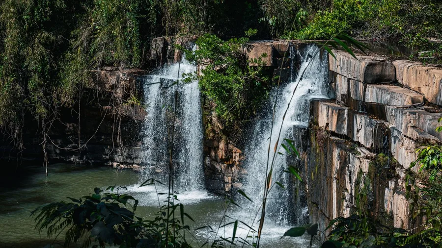
Soco Falls is easy to drive past, and that is part of the point. Watch for the roadside pull-off near Maggie Valley, NC, on the route toward Cherokee, and do not expect a full lot. What you are looking for is 50 feet of twin fall, two strands that split around a rock and drop together. The drive is the easy part; the last stretch is a short, steep scramble of about 0.3 miles round trip with 100 feet of gain. The scramble thins the crowd, and that is what keeps a roadside fall feeling like a local stop.
Residents treat Soco as the quick pull-off on the way somewhere else. Photographers know it too, and the scramble and the short distance are the whole filter. You are not committing to a hike here; you are stepping out of the car and down to the rock for a 50-foot double fall.
💡 Tip: The best view of both falls is from the wooden platform at the top of the scramble, not the bottom.
10. Middle Prong Cascades from Tremont
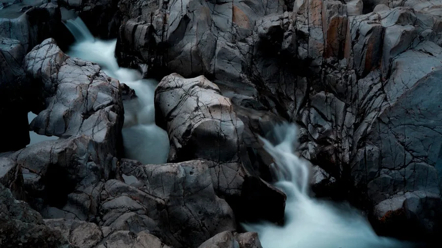
The water over the cascades at Middle Prong runs loud enough in spring that you hear it from the trailhead gravel, and cool enough in October that the air coming off it feels a few degrees colder than the parking area. That is the sound and the temperature that make this walk worth building a morning around.
The route is a wide old railroad grade along Middle Prong, 2.6 miles round trip and about 250 feet of gain, starting from the Tremont trailhead. The 15- to 30-foot cascades slide through a chain, not one named fall with a crowd pinned to a railing, so the destination is a stretch of creek you pick for yourself. Best in April through June, when the flow is strongest, and again in September and October.
Go early, before the light clears the ridge and the pull-off fills, because the trailheads up here have no facilities and a full lot means backing down the road. Check the park site before you drive for closures and parking tags. This is the one for hikers who want the option to turn around early: the wide grade and the run of small falls let you set your own distance and stop when the creek is enough.
How the Day Fills Up
Where to Base Yourself for These Trailheads
Pick your base by which side of the park you plan to hike, not by which town looks best online, because hopping back and forth eats the day.
Townsend is the best base for Tremont, Middle Prong and Meigs Creek, and it keeps you off the Gatlinburg strip. It is quiet, close to the Foothills Parkway, and the drive to the Tremont Road pull-off is short enough to be there by 8am. Cosby suits Hen Wallow and the northeast side. It is cheaper and much quieter than Gatlinburg, but you are 40 minutes from the Sugarlands visitor center, so plan a day around one side rather than crossing the park twice.
For Deep Creek and the North Carolina falls, Bryson City covers Juney Whank, Indian Creek and Mingo, with Cherokee close by, while Maggie Valley puts Soco Falls on your way in or out. Gatlinburg is the fallback for Cataract and Baskins Creek, walkable but loud and priced accordingly.
Match the town to the trailhead and the morning gets shorter, not longer.
Four Things That Wreck a Waterfall Day
Frequently Asked Questions
Do I need a parking tag for these trailheads?
Yes. The park requires a parking tag for any vehicle parked at a trailhead, and the tag is separate from any camping or backcountry permit. Buy it before your first stop and display it clearly.
Which of these is the easiest waterfall hike?
Soco Falls is the shortest at 0.3 miles, but the scramble at the end is steep. Cataract Falls is the easiest full walk at 1.1 miles round trip with a gentle grade, and Middle Prong is the flattest longer option.
Can a family with young kids do any of these?
Mouse Creek Falls on Big Creek is the best family pick: 4 miles on a mild railroad grade with only 300 feet of gain. Cataract is fine for kids who can handle roots. Skip Hen Wallow and the Baskins Creek spur.
When is the best time of year for these waterfalls?
April through June gives you the most water, and September through October gives you color and cooler air. Late summer is the weakest window unless a storm has just passed through.
Are these hikes safe?
All ten are on established park or forest trails, but wet rock and slick clay are real hazards. Stay off waterfall faces, cross creeks where the water is shallow, and turn around if a crossing is running high.
How many of these can I do in one day?
Two, realistically, plus a short third stop. Pair one longer climb with one short walk in the same area, such as Hen Wallow in the morning and Cataract on the drive back.
Pick Your Waterfall by the Day You Have
The Laurel-and-Rainbow queue that sent you looking has an answer, and it was never a secret list. It is the approach: the small lot, the mud, the faint spur, the stairs, the crossings. Ten hikes, sorted by time and tolerance, so the quiet payoff is a planning choice rather than luck.
Families and anyone short on time take Cataract, Mingo or Soco. Half-day hikers take Spruce Flats, Middle Prong or the Deep Creek loop. Steep quiet payoff is Hen Wallow. Check the park site for closures and parking tags the night before, then be at the trailhead by 8am, because these lots are small.
That is the whole fix to the mistake in the first line. Skip the sign the parkway picked for you, drive to the pull-off that holds eight cars, and the waterfall at the end is mostly yours.
Match the Hike to Your Legs
Pick your distance from the table at the top of this article, check the park site for closures tonight, and set the alarm for 7:30am. That is the whole plan.