Fourteen trails, and the shortest is 1.0 mile round trip while the longest runs 4.8. Not one of them asks you to strap on snowshoes. If you have a free winter weekend and a pair of ordinary hiking shoes, that number should reframe how you see a season you probably wrote off in November. The lazy option is to wait for May, and it costs you the best light of the year, empty trailheads, and views summer crowds see only from behind a shuttle bus. Winter here means December through February, a start between 8 and 10 a.m., and a finish before sunset at 4:30 to 5:15 p.m., with 20 to 65°F and ice most likely in shaded canyon and Northeast stretches.
Your choice comes down to surface, ice, timing, parking and fee. Every trail here sits on packed, paved or dry ground with 30 to 1,100 feet of gain. Pack microspikes, layers, water and a headlamp, and carry $0 to $15 for trailhead parking.
National-park entries may need a pass or a timed reservation, so check the official NPS, USFS or state-park page for closures and current ice before you drive. A few trails want traction for short icy patches. Snowshoes, never.
Quick Tips Before You Start
Spikes only for shaded ice
Most of these trails need nothing. Put them on for north-facing canyon and Northeast sections where the sun never reaches; leave them off on paved and packed stretches.
Work backward from sunset
A 4.8-mile trail at an easy pace takes about 2.5 hours. Starting at 2 p.m. leaves no margin if the ice slows you down. Start early or pick a shorter route.
Water matters more than you think
Cold air kills thirst, so you drink less and cramp at altitude. One liter per person for anything over 3 miles. A headlamp covers a late finish.
Dress for the swing, not the forecast
A 20°F morning at 1,100 feet of gain can feel like 45°F by noon. Base layer, fleece, windproof shell you can shed into a pack. No cotton.
Check closures the night before
Rangers post ice and gate closures on the official page, not at the trailhead. A timed-entry park slot booked online beats a turned-away drive.
Know which trailheads charge
Free lots fill first and earliest. The $5–$10 fee lots stay open longer. National-park entries need a pass or reservation on top, so budget both.
1. Bryce Canyon's Sunrise Rim Trail
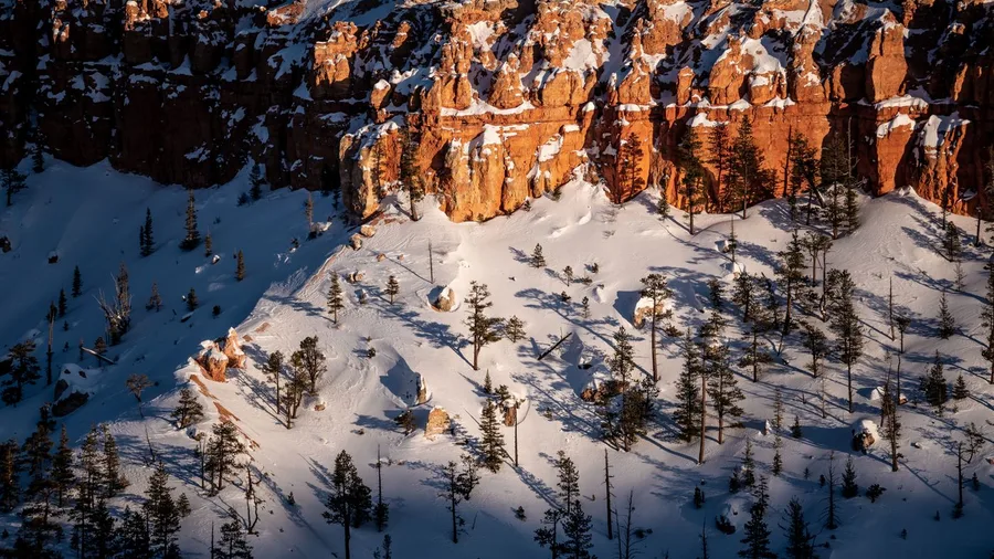
The cold hits your cheeks first at Sunrise Point, and the air smells of frost on juniper. Below you the amphitheater of hoodoos sits in blues and pinks, quiet, no snowshoes anywhere. This is the Bryce walk: 3.5 miles round trip with about 600 feet of gain on packed snow, and at first light the whole bowl turns pink before your hands warm up.
Get to Sunrise Point before 8 a.m. You want the pink light and the firmer footing that comes with a cold night's crust still holding. Carry microspikes for the shaded patches where ice survives, but leave the snowshoes in the car; the packed rim carries you fine. Park at Sunrise Point, and note the park entry fee or pass applies. Underfoot it is packed snow, the only ice is in shade, and the early start gets you both the light and the grip. Budget a quiet hour at the rail if you want it: this is a view to sit with, not walk past.
💡 Tip: Sunrise Point parking is closest to the amphitheater view; arrive by 7:45 a.m. to claim a spot before the first tour vans.
| Trail | Region | Round trip | Elevation gain | Traction to pack | Why no snowshoes |
|---|---|---|---|---|---|
| Sunrise Rim Trail | Bryce Canyon, UT | 3.5 mi | ~600 ft | Microspikes | Packed rim surface |
| Ooh Aah Point | Grand Canyon, AZ | 1.8 mi | ~600 ft | Microspikes | Exposed, usually dry |
| Pa'rus Trail | Zion, UT | 3.5 mi | ~50 ft | Microspikes | Paved |
| Airport Mesa Loop | Sedona, AZ | 3.3 mi | ~400 ft | Rarely needed | Dry red dirt |
| Lost Mine Trail | Big Bend, TX | 4.8 mi | ~1,100 ft | None | Dry desert ground |
| Alum Cave Trail | Great Smoky, TN | 2.6 mi | ~500 ft | Microspikes | Short, packed route |
| Stony Man Trail | Shenandoah, VA | 1.6 mi | ~340 ft | Microspikes | Packed by hikers |
| Ocean Path | Acadia, ME | 4.0 mi | ~150 ft | Microspikes | Pavement and gravel |
| Bear Mountain Loop | Hudson Highlands, NY | 3.8 mi | ~900 ft | Microspikes | Rocky, not snowbound |
| Steep Ravine Trail | Mt. Tamalpais, CA | 4.5 mi | ~1,000 ft (desc.) | Usually none | Snow-free redwoods |
| Benson Bridge Walk | Multnomah Falls, OR | 1.0 mi | ~200 ft | Microspikes | Paved |
| Central Trail | Garden of the Gods, CO | 1.5 mi | ~30 ft | Rarely needed | Flat pavement |
| Summit Trail | Enchanted Rock, TX | 1.4 mi | ~425 ft | Grippy shoes | Snow-free granite |
| Makapuu Lighthouse Trail | Oahu, HI | 2.0 mi | ~500 ft | None | Paved, no snow |
2. Grand Canyon's Ooh Aah Point
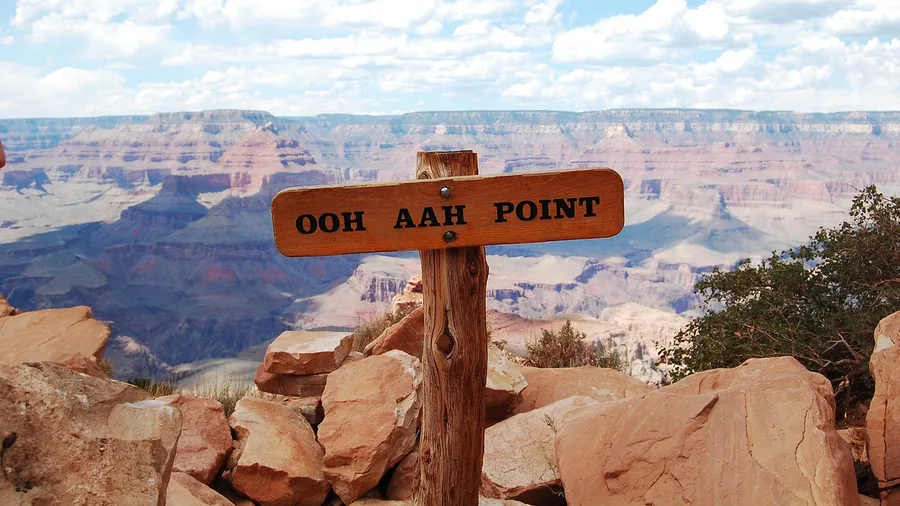
Take Ooh Aah Point seriously as a winter objective and it pays back far more than its length suggests. If a packed rim can deliver a signature view, a dry, exposed descent on the South Kaibab proves the same payoff comes shorter and sunnier. It is 1.8 miles round trip with roughly 600 feet of descent and climb, and the view is enormous.
The trail is exposed and usually dry, which is why snowshoes never come out of the pack here. The winter catch is shade: ice lingers in the shadowed switchbacks, so microspikes go in the bag and the start goes early, both for the light and for the parking lot, which fills by 9 a.m. Park entry fee or pass applies.
Part of the appeal is the name, earned by the view it names. The South Kaibab is an old pack route, cut along a ridge rather than down a side canyon, which is exactly why the ground stays open and dry in winter. There is no narrow gully holding cold air and old ice. You get the canyon spread out in front of you the whole way, which is why the descent feels shorter than it measures. Start early, carry the spikes, and the winter canyon is yours.
Ice Risk on These Trails
Where microspikes are essential and where they stay in the pack
- Lost Mine, Big Bend: Dry desert ground, no traction needed
- Central Trail, Garden of the Gods: Flat pavement, rare ice
- Pa'rus Trail, Zion: Pavement with riverside ice patches
- Alum Cave, Smokies: Shaded sections ice after rain or freeze
- Bear Mountain Loop: Rocky trail, microspikes essential
Ratings based on typical winter conditions in shaded sections; check local reports.
3. Zion's Paved Pa'rus Trail
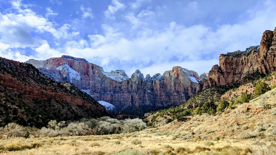
You hear the river before you see it, a steady rush under feet that barely climb. The Pa'rus Trail is 3.5 miles round trip with about 50 feet of gain, all of it on pavement, and it gives you Zion's canyon-floor scenery when the higher trails are holding ice. A short dry descent proved big views do not need distance; this is the opposite case, where the floor stays easy while the walls above freeze.
What earns it is the flatness and the pavement together. You walk beside the Virgin River, cottonwoods overhead, the canyon walls doing the drama above you. Watch for icy patches near the river where the shade holds, and let microspikes handle them; no snowshoes on pavement, ever. Where to stand: anywhere along the river bend gives you the shot, with the water leading up to the red wall behind.
Check the visitor center before you set out. Shuttle and parking status decide your access in winter, and that is the one thing that can change your day. Get there early, take the easy surface, and let the hours above you do the work.
4. Sedona's Airport Mesa Loop
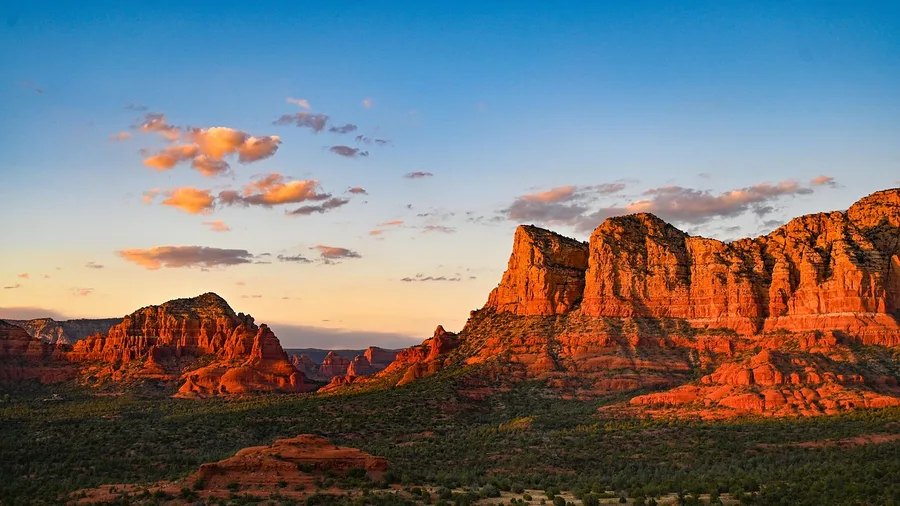
On the Airport Mesa Loop, yes, and you get a sunset out of it.
The 3.3-mile loop climbs roughly 400 feet on red dirt that stays mostly dry through December and February, so what you are solving for is not snow but light and time. Go late in the afternoon, when the low sun turns the rock formations warm and long, and bring a headlamp because you will be finishing the descent after the 4:30-to-5:15 sunset.
Microspikes are rarely needed here, but keep them in your pack for the shaded north slopes where a north-facing stretch can hold a thin crust.
Parking costs $5 at the trailhead lot, and you want to be there before 3 p.m. or you are circling.
5. Big Bend's Lost Mine Trail
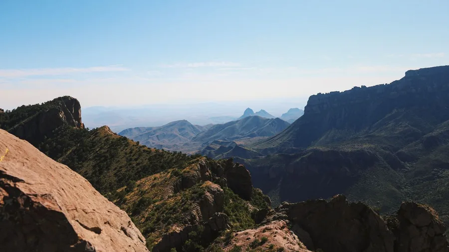
Do not plan this one for the afternoon. Lost Mine Trail is a morning walk, and the 8 a.m. start is not about beating crowds so much as securing a space in a lot that is small and fills fast.
It is 4.8 miles round trip with about 1,100 feet of gain, a genuine climb up a desert mountain path that opens onto big views across the Chisos. Winter here is dry far more often than not: this is a park where snow is the exception, so your footing is dirt and rock, and snowshoes stay home.
What replaces them is water and a wind layer. The trail is exposed the whole way, sun on one side and wind on the other, so carry more water than the mileage suggests and have something to pull on at the top.
A park entry fee or pass covers your access; check the official park page for current conditions before you drive.
💡 Tip: The lot holds maybe 25 cars; if it is full, park at the Basin trailhead and add 0.6 miles each way.
💡 PRO TIP
The 8 a.m. rule
On every trail here, the first two hours are the firmest, emptiest and best-lit. Ice is still frozen hard, parking lots are half empty, and the low sun does more for a canyon than any filter. Set the alarm.
6. Great Smoky's Alum Cave Trail
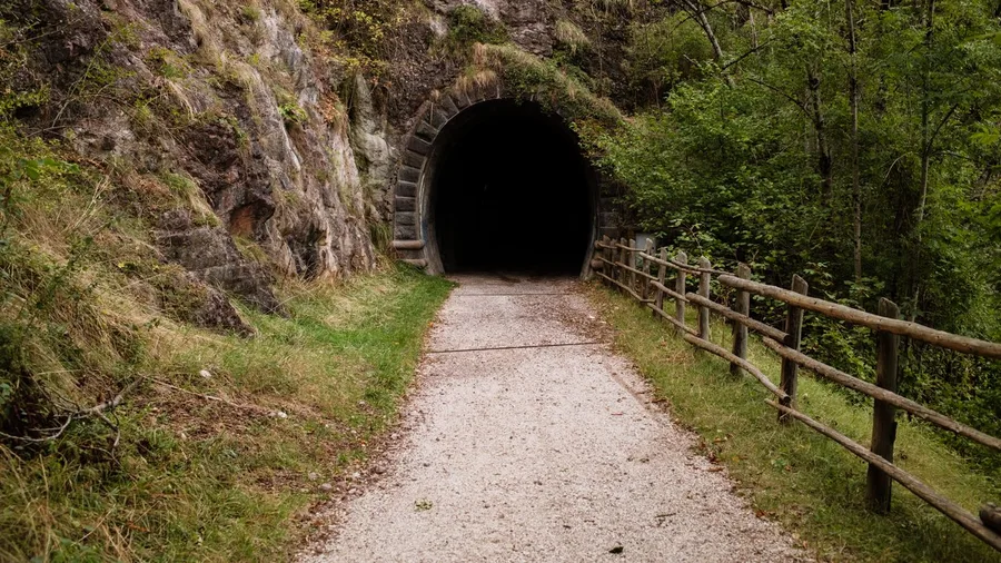
Alum Cave Trail is a 2.6-mile round trip with about 500 feet of gain to a rock arch, and it works in winter on ordinary shoes.
The catch is ice. After rain or a hard freeze, the shaded sections hold a slick glaze that the sunny stretches do not, so microspikes are the piece of gear that decides your day. Start early, before the melt refreezes and before the trail gets busy, and turn around if the ice is heavy rather than pushing for the arch.
Snowshoes are not needed. Parking is free at the trailhead, which keeps the cost of the outing at nothing but fuel and a little patience. What you might see along the way, honestly: bare rock, hemlock, and the arch itself, more reliably than any animal.
7. Shenandoah's Stony Man Trail
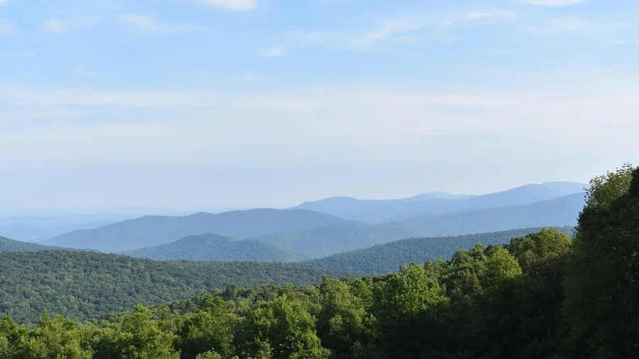
A Great Smoky climb earns its views with a few hundred feet of work and a rock arch at the top. Stony Man asks for less: 1.6 miles round trip and roughly 340 feet of gain, most of it in the first half mile.
This is a spur off the Appalachian Trail, which means the white blazes carry you most of the way and the footbed is already worn in by the people who came before you. On a clear winter morning you break out of the trees onto a rocky ledge and the Shenandoah Valley opens below you, ridgelines stacked in blue behind it, the whole thing a 40-minute walk from your car. No snowshoes, no route-finding, no epic.
The catch is ice, and the catch is small. The trail sits high enough and sees enough traffic that snow gets packed down rather than piling up, but wherever the path runs under hemlock or rock overhang the melt refreezes overnight into a slick glaze. Microspikes handle it in about thirty seconds of strap work. Without them you will manage, carefully, in a crouch, and you will not enjoy the descent.
Park at the Skyland area lot, which puts you at the trailhead without a road walk. A park entry fee or annual pass covers you. Go early on a clear day rather than a gray one, because the whole payoff here is the view, and a cloudy morning turns a big valley into a wall of white.
Winter Hiking Pack — At a Glance
🥾 Footwear
Waterproof hiking shoes
⛓️ Traction
Microspikes ($20–$40)
🧥 Layers
Base + windproof shell
💧 Water
1–2 liters per person
🔦 Light
Headlamp for early starts
Never needed
Snowshoes stay in the car on all 14 trails.
8. Acadia's Ocean Path
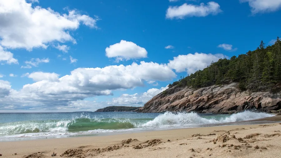
Count on $30 for a week-long Acadia pass and four flat miles from Sand Beach to Otter Point, with about 150 feet of gain spread so thin you will forget you are gaining anything. That is the whole price of the coast.
The path is pavement and packed gravel, easy ground in any season, and it runs along Ocean Drive where the surf hits granite below you and the cliffs at Otter Point stand out into open water. The wind is the winter variable here, not the snow, so bring a windproof shell over your layers. Ice forms where the road shade holds it, most often near the Ocean Drive stretch, and microspikes go on for those short patches and come off again. Park at Sand Beach, and know that the lot is smaller in winter than the summer crowds would suggest. Check the park's page for current closures before you drive out.
9. Hudson Highlands' Bear Mountain Loop
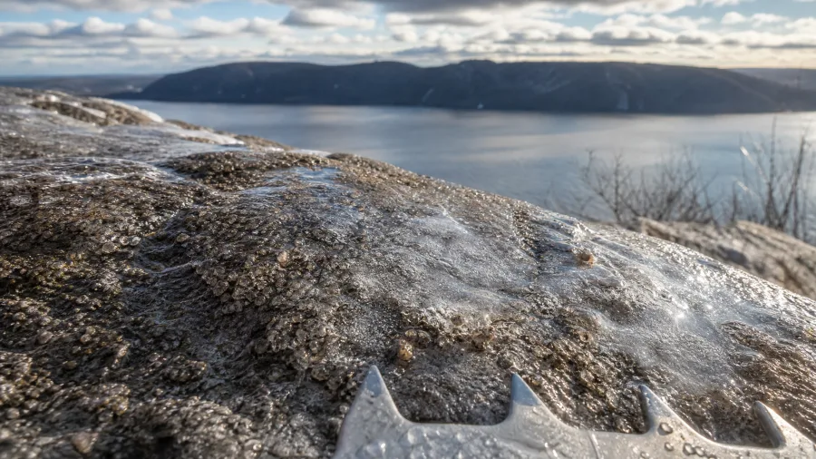
Skip the crowded lots that draw the summer crowds and take the Bear Mountain loop on a weekday morning instead. It is 3.8 miles with about 900 feet of gain, the closest real ridge walk to New York, and in winter it belongs to the people who live within an hour of it.
Rocky sections ice over, and this is the one place on the loop where winter stops being polite. Microspikes are not a nice-to-have here; they are the difference between a confident descent and a slow, gripping shuffle down wet rock. Start early to beat what crowds remain and to leave yourself daylight, because the loop is long enough that a late start in January means finishing in dusk. Parking runs $10 at the lot.
The reward is the Hudson from above, the river bending past Peekskill and the ridge line opening in both directions. Residents come for exactly this: a real climb, a real view, no snowshoes, half a day door to door, and the whole thing settled by gear, timing and the ten dollars at the gate.
10. Mt. Tamalpais' Steep Ravine Trail
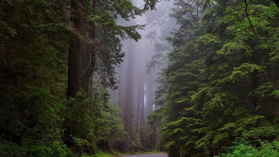
Can you walk 4.5 miles through redwoods to the sea in January without ever touching snow? On the West Coast the question flips: the trouble isn't ice underfoot, it's what the melt leaves behind. Steep Ravine runs one-way from Pantoll down to Stinson Beach, roughly 1,000 feet of descent through fern and redwood to open coast, and the ground stays clear of snow all winter — dramatic in the short daylight, when the light comes sideways through the trees.
The catch is the mud and the one-way shape. Slick roots and boggy stretches replace the Northeast's icy patches, so grip matters more than spikes, and traction devices usually stay in your bag. A shuttle or a car dropped at Stinson solves the point-to-point: park free at Pantoll, arrive early, and leave nothing to walk back to.
11. Multnomah Falls' Benson Bridge Walk
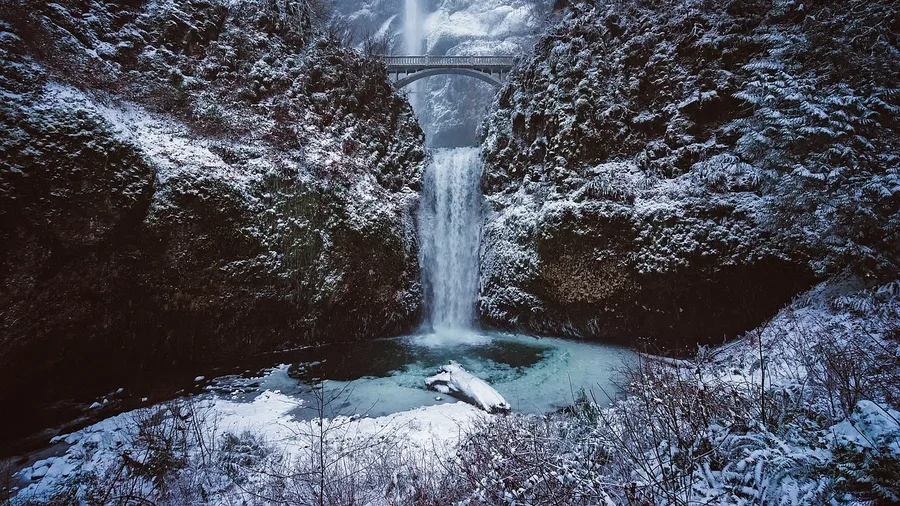
You hear it before you see it — a low roar of water hitting rock, felt as much as heard, and then the cold mist settles on your sleeves. The walk from the Multnomah Falls lot to Benson Bridge is a paved climb of about 200 feet, and the bridge sets you right in the spray zone, with the upper drop thundering overhead.
The whole round trip is one mile. No snowshoes, no route-finding, no long approach — just a short uphill on pavement that puts you under the second-highest year-round waterfall in the country, running full from winter rain.
The catch is that same pavement, wet or iced over in the cold snaps. Microspikes help on the slick stretches, and a handrail is your friend on the climb. Go early: the light is better and the crowd thins.
Then reward yourself properly. Order a hot blackberry cider from the lodge at the base — around $5 — and drink it where the mist can reach you. Free parking, but check the state park page for winter closures before you drive; the Historic Columbia River Highway has its own weather.
💡 Tip: The lower viewing platform is usually less crowded than the bridge itself — stop there first for the classic shot.
Snowshoes vs. Microspikes for These Trails
Microspikes (what you need)
- Slip over hiking shoes in seconds
- Handle short icy stretches on packed trails
- Cost $20–$40
- Fit in a daypack when not in use
- Work on pavement, gravel and packed snow
Snowshoes (what you don't)
- Designed for deep, unpacked snow
- Awkward on pavement and dry ground
- Cost $100+ to buy or $20+ to rent
- Overkill for 1–4.8 mile walks
- Not needed on any trail on this list
12. Garden of the Gods' Central Trail
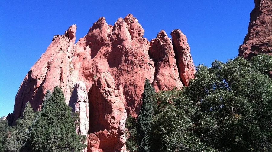
The sandstone glows at first light — a burnt orange that warms toward red as the sun climbs, and on a clear winter morning the air is cold enough that you can see your breath against the rock.
Garden of the Gods' Central Trail is a 1.5-mile paved loop with about 30 feet of gain, so flat you could push a stroller around it. That makes it the easy one on this list, and the famous one. On a mild weekend the main lot can sit full and the formations get a steady stream of photographers. Come at sunrise or late afternoon; the color is worth the timing, and the light keeps the crowd spread out.
Microspikes are rarely needed on dry pavement, though a shaded stretch can glaze after a freeze. Parking is free at the main lot. This is the stop for anyone traveling with kids or knees that want level ground — and the one to skip if you came for solitude.
13. Enchanted Rock's Summit Trail
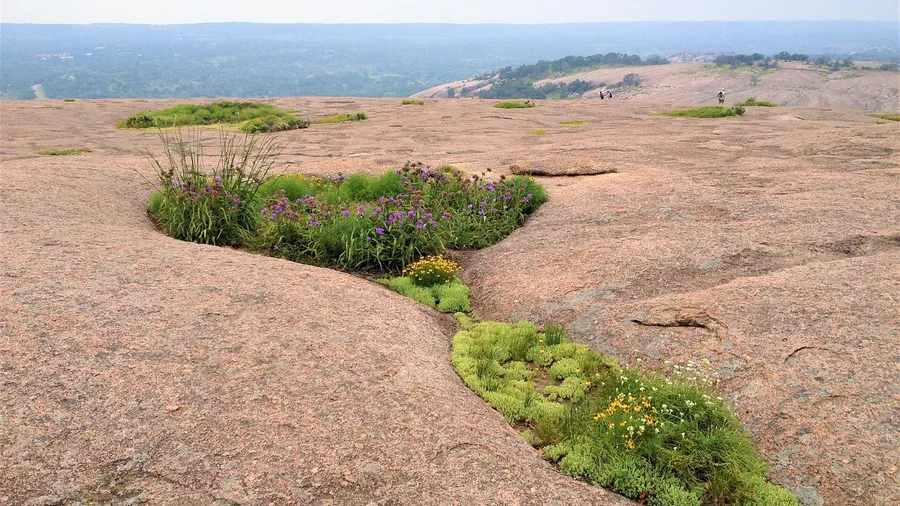
The flat loop delivers its red formations with almost no gain, yet the granite dome here keeps the mileage short while adding 425 feet of climbing underfoot. This 1.4-mile round trip stays entirely snow-free in winter, which is the good news. The catch is the surface itself: frost can turn the rock slick, so grippy shoes are the traction that matters, not microspikes and certainly not snowshoes.
You start on bare granite and work upward in short, steep stretches until the Hill Country opens around you. On a clear December morning the rock can glow warm while the hollows below hold cold air, and the summit rewards the climb with a view that runs a long way past the park boundary. On a frosted morning, treat the steeper slabs with care and take your time on the descent. Ordinary shoes with real tread handle it. Worn-out sneakers do not.
The access catch comes before you drive: this park runs a day-pass system, so check how it works online and sort your pass in advance rather than turning up and hoping. The park entry fee applies on top of that. No snowshoes needed on the walk, but the frost and the paperwork are the two things to plan around, and both are handled in a few minutes at home.
14. Oahu's Makapuu Lighthouse Trail
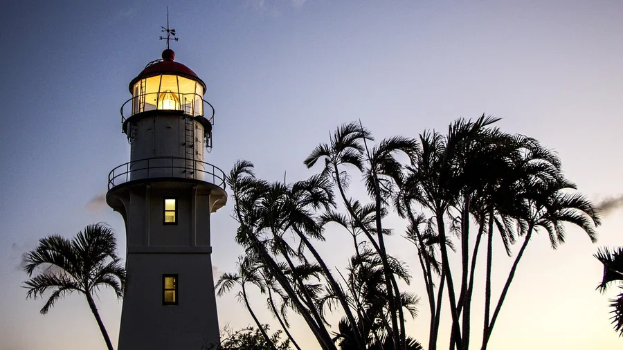
It is a paved ramp up a dry Hawaiian headland, the one walk on this list where the winter question of ice barely exists. The Makapuu Lighthouse Trail climbs 2.0 miles round trip with about 500 feet of gain, all of it on asphalt that stays bare in February.
What sells the stop is the payoff at the top: a wide view over the Makapuu coastline where, on a clear winter morning, humpback whales are often visible breaching offshore. Because the route is completely exposed, pack sun protection and two liters of water. Start by 7 a.m., before the sun gets hot and before the small free lot at the trailhead fills. Parking costs nothing, and nothing on the surface requires snowshoes. The winter variables here are heat and timing, not snow.
What a Winter Hike Day Actually Costs
Excludes travel to the region; national-park passes can cut entry costs.
Frequently Asked Questions
Do I really not need snowshoes on any of these trails?
Correct. Every trail on this list stays on packed, paved or dry ground where snowshoes are unnecessary. A few have short icy stretches, which is what microspikes are for.
What traction should I pack?
A pair of slip-on microspikes ($20–$40) covers the icy patches on most of these trails. For Big Bend, Garden of the Gods and Makapuu you can leave them in the car; for Bear Mountain and Alum Cave they are essential.
How cold does it get?
Expect 20–65°F depending on the region. Desert and coastal trails sit at the warmer end; Bryce, Shenandoah and Acadia can drop into the 20s. Layers and a windproof shell handle all of it.
Do I need reservations or passes?
National-park trails like Bryce, Grand Canyon, Zion and Acadia require an entry fee or annual pass. Enchanted Rock uses a day-pass system, and some parks require timed reservations in peak season; check the official page before driving.
What time should I start?
Between 8 and 10 a.m. is ideal. You get firmer footing, emptier parking and more daylight margin before the 4:30–5:15 p.m. sunset. On a few trails — Sedona's Airport Mesa, Garden of the Gods — late afternoon light is the reason to go, so bring a headlamp.
How do I check conditions before I go?
Check the official NPS, USFS or state-park trail page the night before for closures, ice reports and parking status. Winter conditions change fast, and a trail that is dry one day can be icy the next.
Pick Your Winter Trail by the Ground Underfoot
Pick by the ground you want underfoot. Dry footing and low ice: Lost Mine in Big Bend, Airport Mesa in Sedona, Garden of the Gods, Makapuu. Sunrise over a canyon rim: Bryce's Sunrise Rim and Grand Canyon's Ooh Aah Point. A packed Northeast path with microspikes in hand: Acadia's Ocean Path and Bear Mountain, with Stony Man and Alum Cave as the Appalachian versions.
Pull up the official park or forest trail page for current ice and closures before you commit. The beautiful winter trail that needs snowshoes turns out to be the exception, not the rule, on packed, paved, dry and packed-gravel ground.
Which leaves the numbers where they started: 1.0 mile at the short end, 4.8 at the long, 30 to 1,100 feet of gain, $0 to $15 to park. Match surface, ice, daylight and access to the shoes already in your closet and the hours already in your weekend, and the winter trip works.
Check the trail page before you drive
Open the official NPS, USFS or state-park page for your pick, confirm the ice report and parking status, then set your alarm for 8 a.m.