A grandmother grips a painted rail at the end of a granite wharf in Rockport, Massachusetts, and the harbor opens in front of her with no stair between her and the water. That is the whole point of the twelve routes below.
Flat is supposed to mean the paved loop behind the parking lot, the ocean you can hear but never quite reach. These walks are the exception: grades under 5%, surfaces of pavement, boardwalk or packed gravel, no sand walking anywhere on the route.
The flat path here is the one carrying the working harbor, the hauled-out seals, the lift bridge, the row of benches every 0.2 to 0.3 miles.
The easy walk is the one your whole company finishes, not the one the fastest of you summits. Every route below comes with distance, surface and access, so you can build a day around it instead of salvaging one from it.
No trail fees on any of them. Parking runs $0 to $15 a day, or $1 to $3 an hour, with some street spots free off-season; plan 45 to 90 minutes at a stroll, and aim for April through June or September through November.
Quick Tips Before You Start
Check the official page first
City and park sites post temporary closures, tide windows and accessible-route updates that no blog can keep current.
Arrive before 10 a.m.
On exposed Gulf and Pacific routes the shade is gone by mid-morning and the parking fills with it.
Budget $0–$15 to park
No route here charges a trail fee; meters run $1–$3 an hour, and street parking is often free off-season.
Pack one layer
Pacific routes run foggy and cool even in July; the Gulf runs hot and humid; the Great Lakes run cool all summer.
Look for the benches
Most of these paths place benches every 0.2 to 0.3 mile, so plan your turn-around point around a rest stop.
Read the local rules
Dog and bike rules vary walk to walk, and the boardwalk promenades are the strictest about both.
1. Rockport Harborwalk Loop, Massachusetts
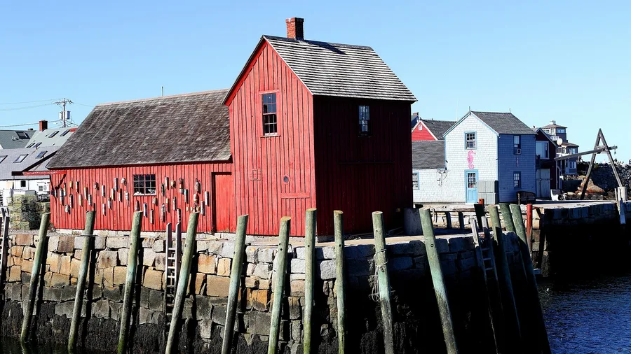
Walk the Rockport Harborwalk Loop if you want a New England harbor in front of you and nothing under your shoes that fights back. It is 1.8 miles of paved path and boardwalk around a working harbor, with grades under 3 percent. No hill. No stair. The granite piers and the galleries sit close enough to touch, and the water stays on your left for most of the loop.
Park at T-Wharf and leave the car there, because the restrooms are at the harbor lot and your vehicle becomes the base for the entire circuit. Benches come facing the breakwater and Motif No. 1, so the stop where you catch your breath is already aimed at the shot you came for. No trail fee, and parking falls inside the $0 to $15 a day range. Give it 45 minutes at a stroll, and the pavement takes a stroller or a wheelchair the whole way, which is why grandparents and a half-day with a lobster roll end up here together.
💡 Tip: Park at T-Wharf and walk counter-clockwise so the harbor is on your left and the photo stops come to you.
| Walk | Location | Distance | Surface | Best for |
|---|---|---|---|---|
| Rockport Harborwalk Loop | Rockport, MA | 1.8 mi | Paved + boardwalk | Harbor views, grandparents |
| Cape May Promenade | Cape May, NJ | 2.0 mi | Boardwalk | Strollers, bad knees |
| Virginia Beach Boardwalk | Virginia Beach, VA | 3.0 mi | Concrete boardwalk | Long strolls, food stops |
| Charleston Battery Sea Wall | Charleston, SC | 1.2 mi | Sidewalk | Shade, history, wheelchairs |
| Naples Pier Gulfshore Path | Naples, FL | 2.4 mi | Paved | Gulf sunsets |
| Galveston Seawall Promenade | Galveston, TX | 3.2 mi | Paved | Birding, open horizon |
| Santa Monica Beach Path | Santa Monica, CA | 3.0 mi | Paved | Palm trees, ocean panorama |
| Monterey Bay Coastal Trail | Monterey, CA | 2.6 mi | Paved | Seals and otters |
| Seaside Promenade | Seaside, OR | 1.5 mi | Paved | Cool-weather kites |
| Portland Harborwalk | Portland, ME | 1.2 mi | Brick + paved | Working harbor |
| Bellingham South Bay Trail | Bellingham, WA | 1.7 mi | Paved + boardwalk | Mt. Baker views |
| Duluth Lakewalk | Duluth, MN | 2.8 mi | Paved + boardwalk | Freshwater horizon |
2. Cape May Promenade, New Jersey
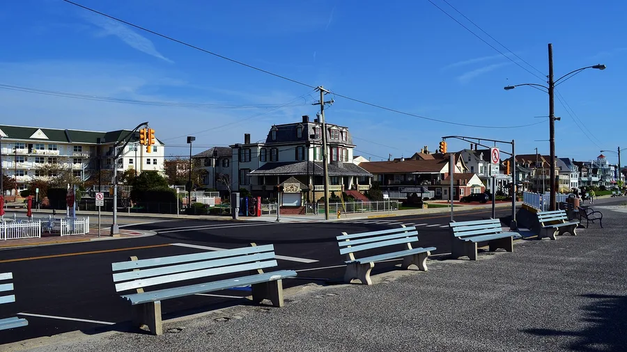
When the harbor view at ground level was settled, the next question is simply how far your knees will carry you past it. Is there a seaside boardwalk you can walk end to end without meeting a single step? Cape May answers that out loud: two miles of boardwalk pitched between dead flat and a two percent tilt, which is to say you will not notice the rise until you have already walked it.
The access points seal it. At either end of the promenade the path meets the street on a ramp, not a stair, so a wheelchair or a stroller rolls on without being lifted and a knee that objects to climbing never has to negotiate. On the beach side, wide sand stretches out past the rail and marked beach access points drop through to it for anyone who wants a few minutes on the water.
On the inland side the roof line does the entertaining: gabled Victorian inns in turrets and deep porches, close enough to study the paint. This is the splurge walk, and the money is easy to account for. There is no trail fee; parking runs $1 to $3 an hour or up to $15 for the day, and in the off-season you may find a free street space within a short walk of the boards. Figure a full two hours for the round trip at a slow pace, with time built in for the Victorian front porches, and budget roughly $15 for parking plus what you spend on a cone – close to the cheapest splurge of the trip.
Facilities keep the two miles within reach of anyone. Restrooms sit at each terminus, so the start and the turnaround are both comfortable. Between them a bench arrives about every fifth of a mile – often enough that you are never more than a couple of minutes' walk from sitting down and watching the water. In spring the birding crowd takes over the point and the beach edges during migration, and an ice cream window partway along breaks the walk neatly in half for anyone who needs the reward to come sooner.
A stroller or a wheelchair covers the whole distance here on a surface that never demands a lift, and there is no point on the two miles where anyone in the group has to wait at the bottom of a stair. The slow stroll is the plan, not the compromise. April through June and September through October are when the weather and the crowds are kindest.
Paved Path vs. Beach Walk
Flat paved route
- Strollers and wheelchairs cover the full distance
- Benches every 0.2–0.3 mile for rests
- No sand, so shoes stay on and pace stays even
- Restrooms and parking at the trailhead
- Grades under 5% the whole way
Walking the sand
- Soft footing tires hips and knees fast
- No benches, no shade structures, no rail
- Wheelchairs and strollers mostly cannot follow
- Access points can involve steps or a slope
- Half the distance feels twice as long
3. Virginia Beach Boardwalk, Virginia
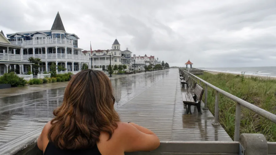
You hear the bikes before you see the water, a soft hiss passing behind your shoulder while the ocean stays out front. That is the design of the Virginia Beach boardwalk: a separate bike lane, walkers kept on the ocean side, riders routed behind you. Nobody has to dodge anybody.
It runs 3.0 miles of flat concrete, the longest stretch on this list, with benches and shelters spaced along it. Restrooms and parking sit at the oceanfront access points, and cafes line the way, so lunch is a stop on the walk rather than a detour off it. Give it 90 minutes at a stroll, or start at first light, when the sunrise over the water is the whole reason to be up. Families with strollers get the length without a grain of sand, and the surface plus the services are what make three miles feel easy instead of long.
4. Charleston Battery Sea Wall, South Carolina

A long oceanfront can be easy when the city attaches the services. Ask it to be cool and quiet as well, and the answers thin out. Charleston's answer is the Battery sea wall: 1.2 miles of sidewalk between White Point Garden and the seawall, with not a single step between either end.
Start at White Point Garden, where the live oaks meet overhead and the street parking and restrooms put the car behind you. The oaks run almost unbroken, throwing shade the whole way, and the benches face out toward the harbor and the mansions behind them. At a stroll the route asks maybe 45 minutes, and the shade does most of the work. That is the reason to start early on a hot day: the walk itself stays kind, but the pavement gives off heat by noon even with the canopy above you.
For the photograph, stop where the sidewalk bends in front of the water and frame the harbor beyond a live oak limb, the light best before the sun gets high. A carriage tour and this walk sit well in one morning: the carriage does the talking, the sidewalk shows you the buildings it names. It passes the history rather than explaining it, which is the trade you accept for a route that never leaves the pavement and takes a wheelchair from the garden to the water and back.
⚠️ COMMON MISTAKE
Do not start at noon on the Gulf
The Naples, Galveston and Santa Monica routes are fully exposed, and the pavement holds heat. Start before 10 a.m. or wait until the last two hours of daylight; the walk is the same, the experience is not.
5. Naples Pier Gulfshore Path, Florida
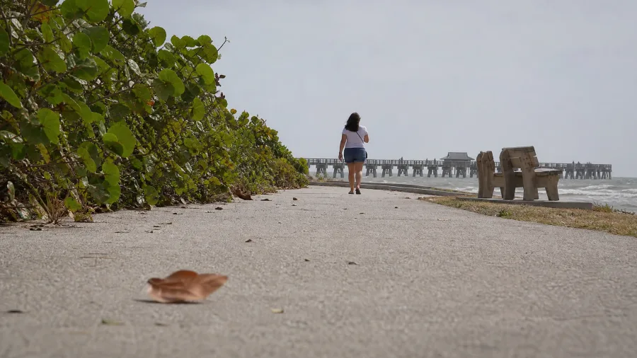
The catch on this Gulf route is exposure, not grade. The path runs 2.4 flat miles north from Naples Pier at a grade you will not notice, but there is very little between you and the sun, so start before 10 a.m. or plan on the late afternoon instead.
Parking runs about $3 an hour, and the pier has restrooms and showers at the start, which matters if the group includes anyone who wants to rinse off before the drive back. Sea grapes line the path and benches face west toward the sunset, so the evening version is the one to build a day around. Winter is the season that makes this work: warm water, low humidity, no afternoon storms rolling in off the Gulf.
No sand walking at any point, and that is the whole reason to bring the people who avoid beaches. The paved surface suits strollers, wheelchairs and anyone who has given up on soft footing. It is not the walk for a group that wants shade or a wild shoreline; it is a wide, open, sunset-facing promenade, and it does exactly that one thing well.
🚶 Before You Leave the Car
Check the official page
Confirm closures, tide windows and accessible-route notes for the specific walk.
Pick your turn-around bench
Decide the halfway point before you start so the group agrees on distance.
Locate the restrooms
They sit at or near every trailhead on this list, usually in the main lot.
Layer up or strip down
Pacific and Great Lakes routes need a jacket; Gulf routes need water and a hat.
Walk out, rest, walk back
Half the distance out is the whole distance back, and every bench is a valid finish line.
6. Galveston Seawall Promenade, Texas
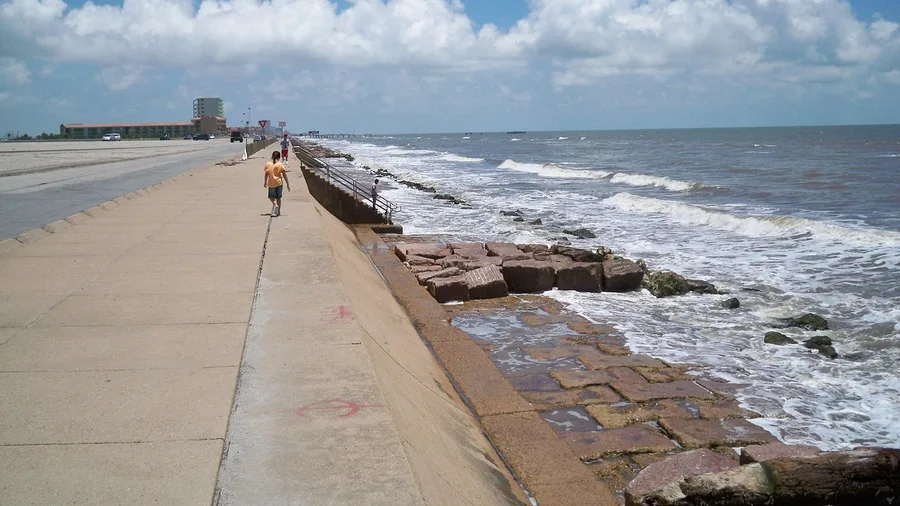
The Galveston Seawall is a 17-foot-high concrete wall built after the 1900 hurricane killed thousands, and the 3.2-mile promenade on top of it is the walk. Flat pavement the whole length, benches along it, and open Gulf views without a scrap of shade.
Start before 10 a.m. Restrooms and parking sit at the major beach access points, so the group can cut the walk short at any of them. The continuous flat surface means a stroller or wheelchair goes exactly as far as everyone wants and turns back anywhere. Winter is the season here, when the humidity drops and the birding and fishing piers come into their own.
💡 Tip: Use the numbered beach access points as bail-out markers — each one has parking and a restroom.
7. Santa Monica Beach Path, California
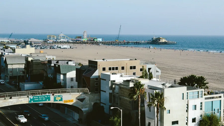
The light comes off the water first, a flat silver glare before the sun clears the mountains behind the city, and the palms along the path throw long thin shadows across the pavement. This is the Pacific coast with a city built right up to it, and the ocean is a short step off the concrete instead of the far side of a bluff.
Santa Monica holds 3.0 miles of paved path running from the pier north toward Will Rogers State Beach, and it holds a flat grade the entire way. That means no sand, no bluff climbing, and no moment where the group has to split between the ones who can scramble down and the ones who cannot. Benches and restrooms sit near the pier where the path begins, so the car is your base and the first rest stop is already inside the route.
What separates this stretch from the obvious tourist version is who treats it as their own back garden. Locals walk it at first light, before the parking lots fill and before the rental bikes and tour groups arrive, and the earlier you start the more the path is yours. On this exposed stretch, get moving before 10 a.m. or plan for the sun and the crowds to both be at full strength. The volleyball courts and palm trees are the postcard; the quiet, empty promenade at dawn is what the residents actually show up for.
Until about mid-morning you share it with cyclists, so keep to the ocean side of the path and let the bikes pass behind you. The pavement is the whole point here: it keeps the ocean within reach for anyone in the group who cannot manage a beach, and the flat route is what buys the panorama rather than the view that never quite arrives. If you want to see the California coast and nobody in the car wants to walk across sand to do it, this is the version that gets everyone to the rail.
8. Monterey Bay Coastal Trail, California

The trail is 2.6 flat miles from Monterey to Pacific Grove, and the wildlife comes to you at the rail rather than the other way around. Where the southern Pacific stretch is a paved promenade with a city at its back, this one keeps the same easy grade and trades the crowds for seals, otters and kelp beds a few feet off the pavement.
Benches and restrooms sit near Cannery Row, the busy end of the route, so start there and let the path carry you out. Harbor seals haul out below the rail and otters work the kelp in plain view, no scramble and no cliff descent required. Fog cools the trail most of the year, so bring a layer even when the forecast reads warm inland. Allow roughly an hour at a stroll, and go early: the seals are most active in the morning before the foot traffic builds.
For anyone who came for the animals, the flat path is not the lesser version of the coast, it is the better one, because the seals are within a few feet of the concrete. Check the tide before you set out; the rail is best when the water is up and the kelp is close.
💡 Tip: Bring a light jacket — Monterey fog does not consult the calendar.
Three Pacific Walks — At a Glance
🌴 Santa Monica
3.0 mi · promenade · parking $1–$3/hr
🦭 Monterey
2.6 mi · restrooms at Cannery Row end
🪁 Seaside
1.5 mi · packed gravel · 45 minutes
📅 Best months
April–June, September–November
🌫️ Skip if
You need sun — fog holds most of the year
Same coast, three moods
No trail fees on any of the three. Benches every 0.2–0.3 mile on the paved stretches, and a low tide puts the seals closest to the Monterey rail.
9. Seaside Promenade, Oregon
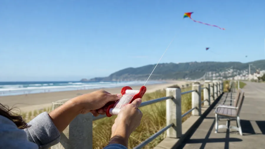
Not on this promenade. Seaside lays 1.5 flat miles of paved walk above the sand, and you get the wide beach and the Tillamook Head headland without a single switchback or root to trip over.
Restrooms and parking sit at the Turnaround, the heart of the route, so everything you need is at the start. Beach access points drop off the promenade without a climb if anyone wants the sand, but nobody has to. Come for the cool-weather walking and the kite flying; allow about 45 minutes at a stroll and bring a windbreak. This is a weather walk more than a wildlife walk, and the honest likelihood of seeing much beyond gulls and the occasional seal offshore is low.
The pavement sits above the beach, so the group stays together instead of scattering across sand at different speeds. Everyone sees the same water and the same headland from the same rail, and that is the reason to choose this over a trail that would leave half the car waiting at the trailhead.
10. Portland Harborwalk, Maine
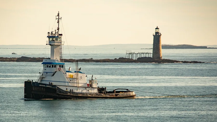
The first thing you hear is a diesel engine idling, and the first thing you smell is bait. That is the honest introduction to Commercial Street, where the Harborwalk runs 1.2 miles of flat brick and paving past boats that still go out and come back loaded.
It is the tightest route on this list and the most urban: ferries sound off from the terminal at one end, restaurants put tables on the wharf, and delivery trucks cross the working docks where the path meets them, so keep the group to one side at those crossings. Park and find restrooms at the ferry terminal, then walk it in about 45 minutes at a stroll. The brick is level enough for a stroller the whole way, and the city-and-sea day is built in rather than bolted on, which is the crowd worth having here.
11. Bellingham South Bay Trail, Washington
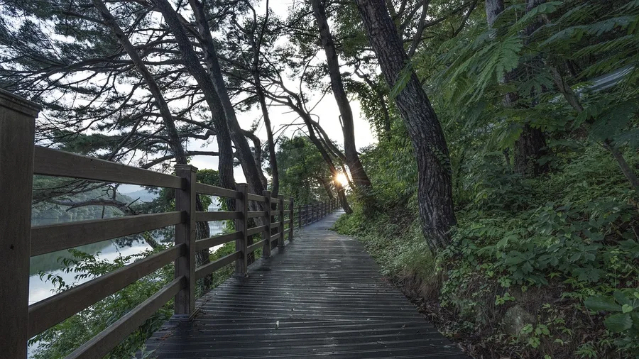
Know before you go that this is a rain-or-shine walk, and in Bellingham the rain usually wins. A jacket is the only gear the route asks for, and the trail holds up wet better than most.
South Bay is 1.7 miles of paving with boardwalk sections, grades under 3%, and no fee of any kind. Parking and restrooms sit at Boulevard Park, and a coffee shop waits mid-route for the turn back. On a clear day Mt. Baker stands over the bay the whole way, and you get the mountain without a single step of climb.
Where the harbor walk was hemmed in by streets, this one opens onto water with a peak behind it, and the flat grade and boardwalk take a stroller without complaint. The free part is not a catch. It is the whole walk.
💡 Tip: Go on a cloudy day — Mt. Baker often clears while the low cloud sits on the bay, which is the shot.
12. Duluth Lakewalk, Minnesota
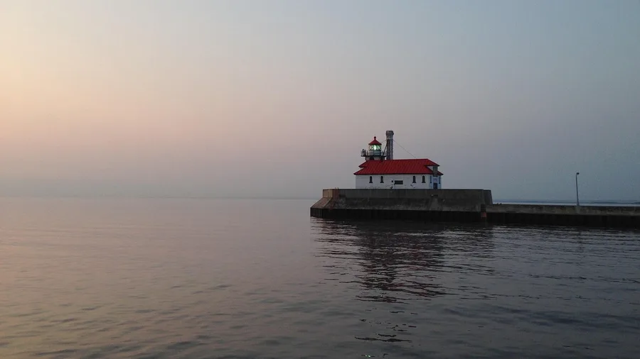
The Duluth Lakewalk is 2.8 flat miles of paved path and boardwalk out of Canal Park, and the freshwater horizon has no far shore in it, which is what makes people stop walking.
You start with parking and restrooms at Canal Park, and within a few minutes the lift bridge and an ore boat fill the view. Allow 90 minutes at a stroll and finish with a pasty, the handheld meat-and-potato pie the North Shore runs on, for around $8 to $12 from a Canal Park counter.
Check the city parks page before you set out, because the lift bridge goes up for traffic and boardwalk sections close for repairs. The flat boardwalk takes a wheelchair, and the cool summer air means the 90 minutes never feels long.
A Flat-Walk Day, Hour by Hour
Plan 45–90 minutes of actual walking; the rest is stopping.
Frequently Asked Questions
Are these walks really flat enough for someone with bad knees?
Every route on this list sits under a 5% grade, and several — Cape May, Charleston, Naples — run at 0–2%. None requires walking on sand. Cape May's boardwalk has ramps at both ends, so knees never meet a step.
How much does it cost to do one of these coastal walks?
No route here charges a trail fee. Parking runs $0–$15 a day or $1–$3 an hour, and some street parking is free off-season. Add whatever you spend on the food stop, which on most of these walks is within a block of the path.
When is the best time of year for a flat coastal walk?
April through June and September through November are the sweet spots almost everywhere on the list. Pacific routes can be foggy and cool even in summer; Gulf routes get hot and humid; the Great Lakes routes stay cool through July.
Can I do these with a stroller or a wheelchair?
Yes on all twelve, though the surface matters. Paved promenades and boardwalks are the easiest; packed gravel sections on a couple of routes are firmer going. Check the city or park page for accessible-route updates before you leave, since boardwalk repairs happen.
How far do I actually have to walk?
Distances run 1.2 to 3.2 miles, and you can turn around at any bench. Most of these paths place benches every 0.2–0.3 mile, so walking half the distance out and back is a complete, satisfying trip. Plan 45 to 90 minutes at a stroll.
Do I need to book anything ahead?
No permits and no reservations for the walks themselves. Parking is the only thing that fills, especially on summer weekends at Santa Monica and Virginia Beach — arrive before 10 a.m. Dogs and bikes have local rules that vary walk to walk, so read them first.
Which Flat Coastal Walk Fits Your Group?
Choose by who is walking. Families and strollers: Cape May, with ramps and restrooms at both ends, or Virginia Beach, three flat miles with a separate bike lane and services the whole way. Wildlife watchers: Monterey, where seals, otters and kelp sit within reach of the rail along 2.6 flat miles. City-and-sea walkers: Portland's wharves and ferries in 1.2 miles, or Bellingham, with Mt. Baker on a clear day and a coffee shop mid-route.
Before you leave, check the official park or city page: tide windows, temporary closures, restroom status, accessible parking, and the rules for dogs and bikes.
The flat path is the one that gets walked, the bench facing Motif No. 1, the seal at the rail. Pick the walk your slowest companion can finish end to end. That is the one everyone remembers.
Pick one walk and check its page tonight
Open the city or park site for the route closest to you, confirm parking, restrooms and any closure, and put the start time on your calendar before 10 a.m.