Most people drive past the Appalachian Trail and treat it as someone else's project, a five-month march that belongs to hikers with tents and stoves. That instinct is what keeps the best views on the map and off your weekend. The trail crosses roads constantly, and every hike here is a there-and-back from pavement, 20 to 90 minutes from towns like Catawba, Blowing Rock, Gatlinburg, Boonsboro, North Adams, Lincoln or Millinocket. McAfee Knob's ledge is the most photographed spot on the whole trail, and it is an 8.4-mile day, not a season. The range runs from Max Patch at 1.6 miles and 230 feet of gain to Katahdin at 10.4 miles and 4,200 feet, and none of it asks for a sleeping bag.
The view is the constant; miles, climb, hours and season are the price. Choose by the price you can pay today, not by which summit photographs best.
By the end you should know which trailhead matches your free hours, your legs and the month. Carry 2 liters of water, a rain shell, a fleece, an offline map and traction for wet roots. Cell service is patchy, so check the official trail club or park page for closures, parking rules and weather before you drive.
Quick Tips Before You Start
Match gain to your legs
230 feet (Max Patch) to 4,200 feet (Katahdin). Under 1,000 feet of gain suits a casual half-day; 2,000-plus means you should already be hiking regularly.
Check your month
Southern low-elevation hikes (McAfee, Max Patch, Siler Bald) run March-November. Franconia, Moosilauke and Katahdin are June-September only.
Beat the 8:30 fill
McAfee Knob, Franconia Ridge and Katahdin trailheads fill by 8:30 a.m. on spring and fall weekends. Dawn starts or a weekday solve it.
Budget by round-trip
1.6 miles (Max Patch) needs 1 hour; 4-5 miles needs 2-3; 8-plus miles needs 4-6. Pick the distance you can finish before dark.
Add 20-90 minutes
That is the drive from the nearest town-Catawba, Blowing Rock, Gatlinburg, Boonsboro, North Adams, Lincoln or Millinocket-to each trailhead.
Pack traction, not a pack
Wet roots and rock slabs are the main hazard; carry traction and a rain shell and fleece. No overnight gear is needed on any hike here.
1. McAfee Knob's Postcard Ledge in Virginia
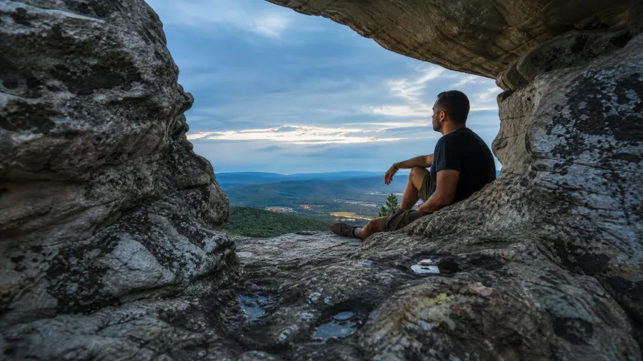
McAfee Knob is a rock shelf hanging over the Catawba Valley, and it is the most photographed single spot on the entire Appalachian Trail.
It costs 8.4 miles out and back from the Va. 311 trailhead, about 20 minutes from Catawba, VA, with 1,700 feet of climbing on the way up. Nothing opens up until you are nearly there; the walk in is all hardwood and green tunnel, which is exactly why the last few feet of rock feel like the floor dropped out. Budget 4 to 5 hours, start at dawn, and know that the lot off Va. 311 fills by 8:30 a.m. on spring and fall weekends, when you are either hiking or circling for a space. April through October is the window, fall color is the draw, and the price is a genuine half-day for steady legs, not a stroll from a car. Sit on the ledge an hour, do nothing, and it is the best hour you will spend all week.
💡 Tip: Arrive by 7 a.m. on an October Saturday; the lot is full by 8:30 and the ledge gets crowded by 10.
| Hike | State | Round trip | Elevation gain | Best season | Why go |
|---|---|---|---|---|---|
| Max Patch | NC | 1.6 mi | 230 ft | Apr–Nov | Easiest big payoff |
| Clingmans Dome | TN | 1.0 mi | 330 ft | May–Oct | Highest AT point |
| Grayson Highlands | VA | 4.0 mi | 700 ft | May–Oct | Pony balds, open views |
| Siler Bald | NC | 4.0 mi | 900 ft | Apr–Oct | Quiet grassy bald |
| Annapolis Rock | MD | 5.0 mi | 900 ft | Apr–Nov | Cliff view near D.C. |
| Mount Greylock | MA | 4.0 mi | 1,000 ft | May–Oct | Tower summit |
| Bear Mountain | NY | 3.8 mi | 1,100 ft | Apr–Nov | Hudson River view |
| Blood Mountain | GA | 4.4 mi | 1,300 ft | Mar–Nov | Stone summit |
| Dragon's Tooth | VA | 4.8 mi | 1,200 ft | Apr–Oct | Rock scramble finish |
| Charlies Bunion | TN | 8.0 mi | 1,600 ft | May–Oct | Smokies cliff edge |
| McAfee Knob | VA | 8.4 mi | 1,700 ft | Apr–Oct | Classic postcard ledge |
| Franconia Ridge | NH | 8.4 mi | 2,300 ft | Jun–Sep | Above-treeline traverse |
| Mount Moosilauke | NH | 7.6 mi | 2,800 ft | Jun–Sep | Quiet high summit |
| Katahdin | ME | 10.4 mi | 4,200 ft | Jul–Sep | Baxter Peak finish |
2. Dragon's Tooth's Rocky Spine
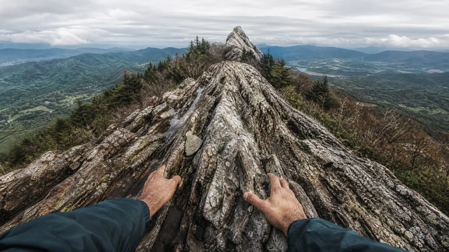
The rock goes grainy under your palms and wet where the last rain has pooled, and you are on hands and knees now, looking for somewhere to put a shoe.
This is Dragon's Tooth, and it trades distance for rock. From the same Va. 311 road that carries the crowds to the bigger view, it asks 4.8 miles and 1,200 feet of climbing, so the grade steepens with every step and the final approach is a genuine scramble up to a quartzite fin standing alone above the valley. Shoes with real grip are the only gear that matters here.
April through October is the season. After a rain, wait; the spine and the scramble both hold water, and the exposure is not decorative. It suits sure-footed hikers after an adventurous finish that stays short of technical, and it does not suit small children or anyone uneasy with a drop beside them.
3. Grayson Highlands' Pony Balds
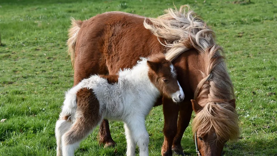
Where the rock spine next door demands a scramble and the same feet of ascent on a steeper grade, Grayson Highlands hands over open mountain country for 4.0 miles and 700 feet of gain, the first time on this list that both numbers drop at once.
You leave Massie Gap and the trees thin out fast. What follows is bald after bald: grass and outcrop with no canopy to block the view, so the long look begins within the first mile and never really stops. That is the reason to come.
The ponies are the other reason, and the story here is a practical one. They are wild, they graze the open ground the trail crosses, and the herd is managed to keep these balds open rather than growing back to forest. Keep your distance, never feed them, and step around rather than through a group. May through October is the window; June brings wildflowers across the grass.
Modest effort, large scenery. If you have children or you are hiking casually and want the openness without the climb, this is the stop that fits, and the price is low enough to repeat on a second morning.
⚠️ COMMON MISTAKE
Don't Feed the Ponies
Grayson Highlands' wild ponies are habituated to people and will approach your pack. Keep 10 feet back, never offer food, and step off the trail to let them pass. A fed pony becomes aggressive and gets relocated.
4. Max Patch's Grassy Summit
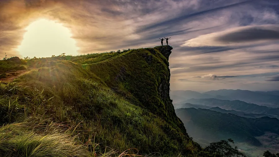
Max Patch is the one to pick if your day is mostly a drive. From Max Patch Road it's 1.6 miles round trip with 230 feet of gain, the least climbing anywhere on this list, and it puts you on a grassy dome with a 360-degree view. Grayson's balds cost four miles of walking for their open summit; this is the same kind of treeless top at a quarter of the price.
The catch is timing and exposure, both at once. Sunset is when the bald earns its reputation, the light going amber across the ridgelines in every direction, but the summit is wide open to wind, so a layer goes in the pack even on a warm afternoon. The season runs April through November, with leaf-off in late fall opening the longest sightlines, and the access road can turn rough after heavy rain, so ask locally before committing a low-clearance car to it.
For anyone short on hours, families with small legs, or a photographer chasing one frame of light, the arithmetic is simple: less time climbing means more time on top.
5. Charlies Bunion's Cliff Edge
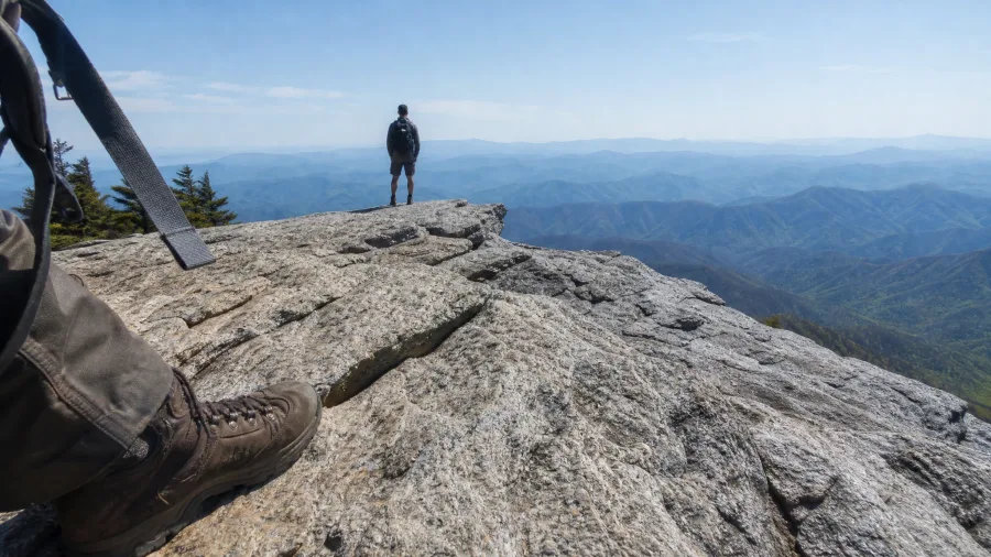
Yes, if you are willing to walk for it. The shortest path to a southern bald is a stroll; the Smokies answer costs more, and the bill comes due in miles. Charlies Bunion asks eight miles of round trip and 1,600 feet of climbing from Newfound Gap, with the trailhead about a half hour's drive from Gatlinburg, TN.
The crowd thins past the first mile, the forest gets quieter and the path turns rougher, and then the rock outcrop opens over a drop you should not stand near. Stand back a body length, face the ridge, and shoot in the softer light of morning; May through October is the window, and Newfound Gap's lot is full early on weekends, so a dawn start is the difference between hiking and hunting for a space. This is the same mileage as the classic Virginia ledge but delivered as cliff, not shelf: a fit hiker's half-day with a dramatic finish.
6. Clingmans Dome's Highest-Point Walk
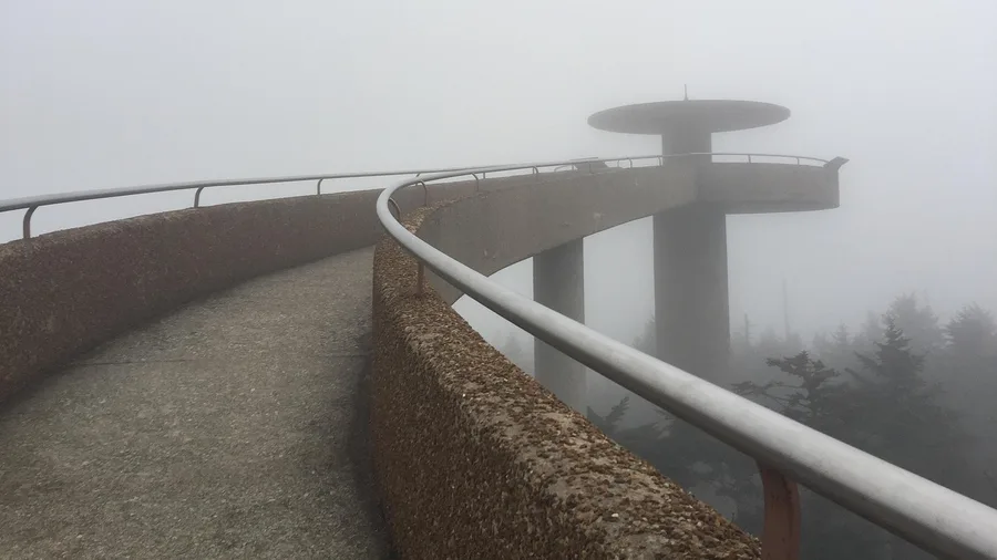
One mile, 330 feet of climb, and a steep paved path from the parking area off Newfound Gap Road — the shortest summit walk on the entire trail, and the highest ground it reaches at 6,643 feet. If you have an hour and a car, the bragging rights are yours, and you can share them with a crowd. The same road that serves the cliff edge a few trail miles away serves this summit in a fraction of the effort.
Go early or late to dodge the worst of the crowd, and pack a fleece even in July: the top runs cooler and cloudier than the valley, and a clear valley morning can be a fogged-in summit. May through October is the season. It is not a wilderness escape — pavement, railings and people — but as a quick, honest check on the AT's high point, it earns its mile.
Southern Appalachian Day Hikes — At a Glance
📏 Shortest round trip
1.0 mi (Clingmans Dome)
⛰️ Biggest climb
1,700 ft (McAfee Knob)
🌿 Gentlest grade
230 ft (Max Patch)
📅 Best window
April–October
🅿️ Lots fill by
8:30 a.m. weekends
Price check
Every southern hike on this list is a half day or less from a paved trailhead.
7. Blood Mountain's Stone Summit
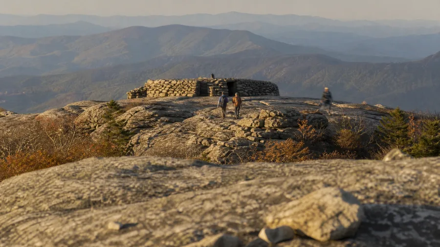
Wind hits the rock before you do, and the last quarter mile gives you nowhere to hide from it. Blood Mountain's top is a stone shelter and bare slabs of granite, the rawest finish on the southern stretch of the AT, and on a gray afternoon the gusts will push at your jacket while the valley stays silent below. Bring a shell, even in October.
You start at Neels Gap, where the trail crosses the highway and a hostel sits at the trailhead, so the walk in is 2.2 miles up and 2.2 back with 1,300 feet of climbing packed into that short run. Do the arithmetic: it's a workout, not a stroll, and the grade keeps your heart up most of the way. Free to park, no fee at the gap, and March through November is the window – go late in the season and the hardwoods turn copper and gold on the climb.
8. Siler Bald's Southern Grass Bald
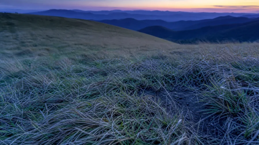
The forest climb is what you hear first: boots on dry leaves, a woodpecker somewhere uphill, the air cooling as the canopy closes over your head.
Then the trees open and there is grass to the horizon. Siler Bald is a grassy dome reached by 2 miles of steady uphill from Wayah Gap, 900 feet of gain, and the top is broad and sunlit with a fraction of the weekend crowd that finds the better-known balds. There is no shade up there and no water source, so carry more than you think you need.
The hour to come is the last one before dark. April to October is the season, but the longest sightlines arrive after the leaves drop in late fall, when the ridges stack up clear to the Blue Ridge. It is a leg-burning hour either way – the trail is dirt and rock the whole way, with nothing paved about the approach.
The Appalachian Trail in Four Numbers
Before you pick a day hike, know the scale of the trail you're stepping onto.
9. Annapolis Rock's Cliff Overlook
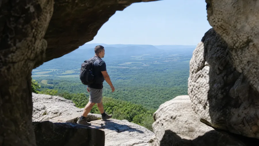
Southern balds demand a long drive; this one asks for about 5 miles and 900 feet, and you can leave Washington after an early lunch and still be standing on the ledge by four.
The route climbs from the US 40 lot at South Mountain – a trailhead roughly 20 to 90 minutes from Boonsboro and well under two hours from D.C. or Frederick – on a steady, unremarkable grade through oak and locust. You are walking, breathing, gaining ground the whole way, and the reward is a west-facing rock shelf that hangs over the valley like a balcony seat.
Time the climb for late afternoon on purpose. The sun drops toward the ridge line and the valley floor turns gold, and that light is why the ledge is worth the walk rather than the walk being worth the ledge. April through November works; the US 40 parking area is small and fills on weekends, so arrive by mid-morning or come on a weekday. It is a half-day close to roads and other hikers, not a remote escape.
10. Bear Mountain's Hudson View
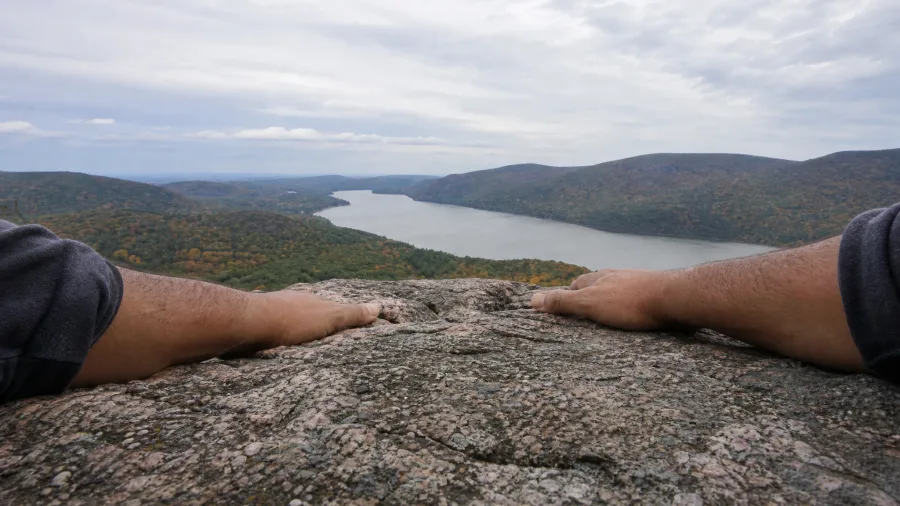
The lot at Hessian Lake is small and it fills, so on a fall weekend you want to be walking before nine or you are circling while everyone else climbs.
Bear Mountain is the New York answer to a mid-Atlantic cliff hike: 3.8 miles round trip and 1,100 feet of gain, straight up from the lake in Bear Mountain State Park. Nothing about the distance is hard. The grade is. That 1,100 feet is packed into less than two miles of switchback, so your heart rate climbs faster than your odometer and the trail gives you no easy warmup. It is rocky most of the way and shared with a lot of people, and the payoff at the top opens the whole Hudson below you, river bending north past the highlands.
Best April through November; fall weekends are the busiest of its season, when the river bends go orange and every car within an hour of the city seems to have found the same trailhead.
Now the food stop, because you will have earned it. Somewhere within a short drive you want a New York deli plate or a proper Hudson Valley cider and a hot sandwich, and you should budget about $15 to $25 per person for a casual counter lunch. The point is not the restaurant. The point is that a steep three-and-a-half miles deserves a real sit-down, and a half-day here has time for both.
Price check: this is the steep short half-day for a hiker based in or near the city, close enough that you can leave after breakfast and be back for dinner. What it is not is a quiet wilderness route. If you came for solitude, this trail will not give it to you on any weekend, and on the busiest ones you should pick another.
Southern Balds vs. New England Summits
Southern balds (NC, VA, TN)
- Warmer season: March–November
- Less climbing for the view
- Open grass, ponies, wide valleys
New England summits (NH, ME)
- Shorter season: June–September
- More elevation gain per mile
- Above-treeline exposure, longer days
- Parking and park rules to check
11. Mount Greylock's Tower Summit
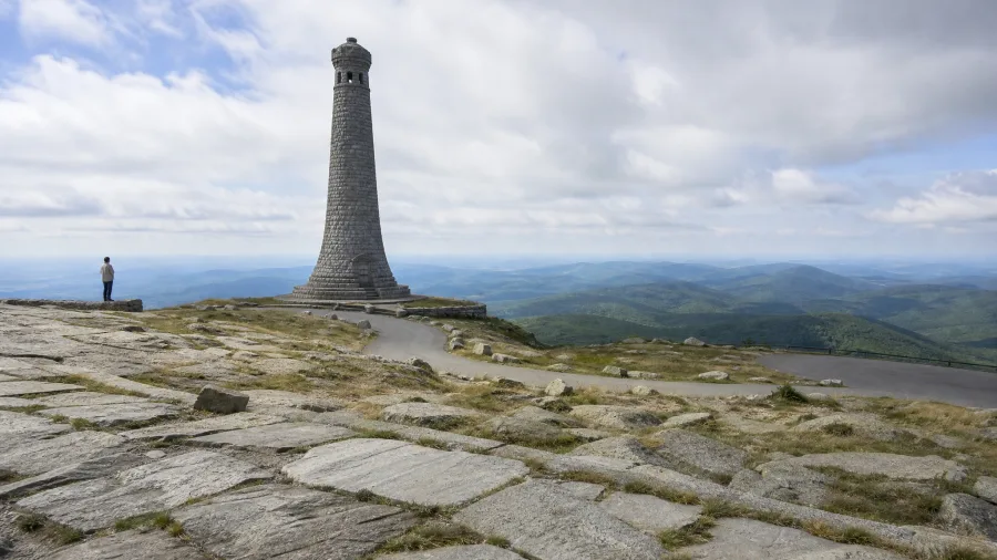
You come over the last rise, the trees break, and the first thing that reaches you is cold, wind moving across the open rock even on a soft valley afternoon. Massachusetts asks a little more commitment than the New York section: 4.0 miles round trip and 1,000 feet of gain from the AT crossing near Rockwell Road, 20 to 90 minutes from North Adams. The summit holds a stone war memorial tower and views spreading in every direction, and a paved summit road brings the view within reach of anyone who cannot or will not walk it.
That road decides the character of the place. It suits families, mixed-ability groups and travelers with an afternoon, since part of the group can drive to the top while the rest hike up to meet them. It does not suit anyone chasing a quiet backcountry summit, because you will share the tower. Best May through October, and the top is cooler and more exposed than the valley, so pack a layer even in July.
12. Franconia Ridge's Above-Treeline Traverse

Yes, and the walk starts at Lafayette Place, just off the highway a short drive from Lincoln, NH.
The number is 8.4 miles out and back and 2,300 feet of climbing. That is a full morning for a steady hiker and not an afternoon errand, and the last stretch puts you on open rock with nothing above you but sky.
What makes it the most dramatic day in this direction is the exposure. The trees drop away and stay away for the length of the ridge, so the views run end to end without interruption, and the same openness that gives you those views gives you nowhere to hide from wind, rain or lightning. If the clouds are building or the wind is pushing you sideways, turn around. That is not a defeat; it is the correct decision on a ridge this bare.
A day well inside June to September is the season for it. A layer in the pack matters even in July, because the ridge runs cooler and windier than the parking lot. On a busy weekend the lot at Lafayette Place is full by around 8:30 in the morning. A dawn start gets you a space and puts you on the ridge before the afternoon storms arrive.
As for wildlife: the odds of a solid sighting are low, and you should go in expecting the scenery rather than the animals. What you will probably get, on a clear morning, is a raven or two riding the wind along the edge of the drop-off, and if the day is going your way, a hawk working the same updrafts below eye level, seen from above. That is the honest likelihood on open rock, and it is a good one. This is a route for strong legs and an early alarm, not for anyone who is unsure on exposed ground.
Matching the Hike to Your Day
Work down from the view you want to the day you can actually give it.
13. Mount Moosilauke's Open Summit
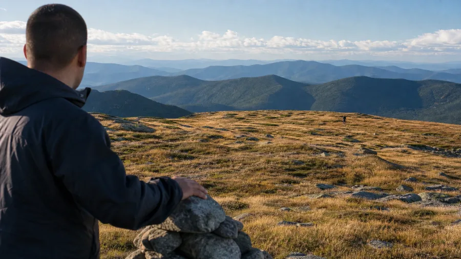
7.6 miles round trip, 2,800 feet of gain, and the quiet the more famous ridge across the state does not give you. The Beaver Brook trailhead puts the climb into fewer miles than the big-name traverse, which means the grade carries the trade: steeper, unrelenting in the middle stretch, and honest about what it is asking of your legs before you ever hit the open rock up top.
The summit itself is broad, grassy and fully exposed, and wind is the default condition rather than an exception. Bring a shell even in August, and carry a paper map or a downloaded one, because the ridge is open in every direction and the trail down can look like several of the others. Best June through September, though crisp late-September and early-October days rank as the bonus the crowds never figure out — cold enough to thin the trailhead, warm enough to linger.
Price check: a big summit for fit hikers who want the high point without the famous ridge's noise, its full lot and its procession of boots. Locals make this one midweek. If your knees are reliable and 2,800 feet over 3.8 miles sounds like a fair deal, it is.
14. Katahdin's Baxter Peak Finish
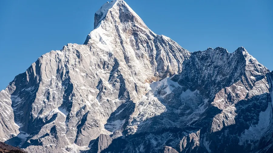
Katahdin is the last mile of a 2,190-mile trail, and it costs a day. From Katahdin Stream Campground the Hunt Trail runs 10.4 miles round trip with 4,200 feet of gain – more than double any other climb here – up to Baxter Peak at 5,269 feet in Baxter State Park, roughly 20 to 90 minutes from Millinocket, ME. Above treeline the rock is bare, slabby and strewn, with iron rungs bolted into the steepest pitches; on a clear morning the ridge ahead of you is where the mountain stops being forest and starts being weather. A Baxter State Park vehicle pass is around $15 for a day, plus a few dollars per person, and it buys the only summit here that is the literal end of the trail. Park at the campground, start very early – the lots fill by 8:30 a.m. on the busiest mornings – and check the park's current rules and trail conditions before you drive, since the Hunt Trail and the summit can close on short notice.
The window is tight: July through September for dependable weather, and the mountain makes its own clouds even then. This is a full-day mountain outing for very fit hikers, not a walk – not beginners, not a rainy or windy forecast, not anyone who wants to be back at the car by lunch. If your day is eight hours and your legs have 4,200 feet in them, the summit is the version of the AT you came for; if either is missing, save it for when you can pay the full price.
🥾 From Trailhead to Summit: A Day-Hike Sequence
Check conditions
Look at the official trail club or park page for closures and weather.
Pack the day pack
2 liters of water, rain shell, fleece, offline map, traction for wet roots.
Arrive early
Aim for the trailhead before 8 a.m.; lots at busy hikes fill by 8:30.
Climb steady
Set an easy pace on the steep sections; most of these gain is front-loaded.
Turn back if needed
On exposed ridges and summits, wind, rain or lightning means turn around.
Summit and descend
Spend 20–30 minutes at the top, then head down before afternoon storms.
Frequently Asked Questions
Do I need a permit to day-hike these Appalachian Trail sections?
Most trailheads on this list don't require a permit for day use. Baxter State Park, where Katahdin sits, has its own rules and parking limits — check the park page before you drive. Some state parks charge a small parking fee.
What's the easiest big view on the list?
Max Patch: 1.6 miles round trip with 230 feet of gain. It's a grassy dome with a 360-degree view, and you can be back at the car in under two hours. It's the one to pick if you're short on time or hiking with kids.
Can I hike McAfee Knob without backpacking?
Yes. It's 8.4 miles round trip with 1,700 feet of gain from Va. 311 — a half-day walk for steady legs. Start early; the lot fills by 8:30 a.m. on spring and fall weekends.
When is the best time to hike the New England sections?
June through September for Franconia Ridge, Moosilauke and Katahdin. Above treeline, summer weather can still turn cold and windy, so carry a shell and fleece even in July.
How much climbing is too much for a day hike?
If you're new to hiking, stay under 1,500 feet of gain and 5 miles round trip. That covers Grayson Highlands, Max Patch, Siler Bald, Annapolis Rock and Bear Mountain. Franconia and Katahdin are for fit hikers with early starts.
Is cell service available on these trails?
Patchy at best. Download an offline map before you drive, and tell someone your route and expected return time. Trail club and park pages are the best source for current closures.
Pick the Hike That Fits the Day You Have
So the verdict, by situation: Max Patch for the easiest first view at 1.6 miles and 230 feet. McAfee Knob for the classic postcard ledge at 8.4 miles and 1,700 feet. Franconia Ridge for the biggest high-mountain day, 8.4 miles and 2,300 feet above treeline. Katahdin only for very fit hikers with a full day and checked park conditions, at 10.4 miles and 4,200 feet.
That ledge over the Catawba Valley costs four to five hours and a dawn alarm. Not five months and a tent.
Every view on this list is entered from a road, and the only permit you need is a checked forecast, an early start and the official page for closures and rules. The trail was never someone else's project. Pick the price you can pay, set the alarm, and drive to the trailhead instead of past it.
Check the Trailhead Before You Drive
Pick your hike from the table above, then confirm current closures and parking rules on the official trail club or park page. Ten minutes of checking saves a wasted morning.