The mistake is planning the Pacific Northwest around the famous stops and assuming the quiet ones are being kept quiet by someone. You have already done Multnomah Falls, Pike Place and Crater Lake. You have five to ten days. Nothing on this list is hidden. Each stop is empty because it charges an entry fee in gravel, tide, season or a hull, and every fee is knowable before the car starts. Ten named places, four in Oregon, four in Washington, two in Idaho, each with the road, the cost, the month and the catch attached. That way you compare them against each other instead of bookmarking them against nothing.
Pick the state for the week. Name the first stop. Drop two if the calendar shrinks to three days, and know the four things to reserve before you leave.
The quiet places are conditional, not secret. You pay in washboard, in a tide window, in a July-to-October opening, in twenty miles of water. Once you know the toll, you can book tonight.
Quick Tips Before You Start
Match the stop to the car
Steens and Leslie Gulch need high clearance; a sedan loses its oil pan on the washboard.
Top off before the dirt
No gas between Burns and Frenchglen or on Ore. 201 past Adrian — fill up when you see a pump.
Check the tide table first
Bob Creek and Tongue Point only work at low tide; the table gets checked before the drive, not at the rail.
Carry more water than you think
A gallon per person per day for any desert stop, and two liters for a four-mile walk.
Book the boat or the buoy early
Sucia campsites and moorings go through Washington State Parks and fill before the weather window.
1. A 30-Mile Gravel Loop Over Steens Mountain
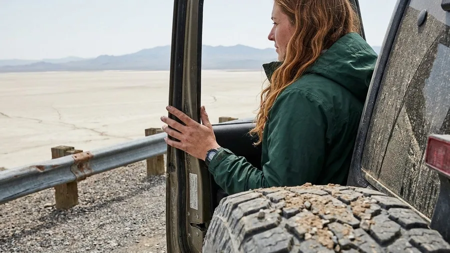
Oregon's largest mountain is approached by exactly one road, and that road is a 30-mile loop of gravel out of Frenchglen. The gate swings open around the Fourth of July and shuts at the first real snow in October, and nothing about the circuit costs a dollar.
There is no gas, no water, and no cell signal anywhere past Frenchglen, so you fill the tank in Burns first, load a full spare and a gallon of water per person, and plan to run the loop and the highway home on a single fill, because a breakdown up here is a walk. The road climbs to 9,734 ft and then falls 4,000 ft off the east face straight into the Alvord Desert, and the far wall of that basin is Nevada with open ground the whole way. The catch is the car, since a sedan will lose its oil pan on the washboard inside the first few miles, and the October closure is a date rather than a suggestion.
💡 Tip: If you only have one day in eastern Oregon, do this loop and skip the Alvord Hot Springs soak — the drive is the point.
| Place | State | Time to allow | Cost | Best months | Who it suits |
|---|---|---|---|---|---|
| Steens Mountain loop | OR | Half day from Frenchglen | Free | Jul-Oct | High-clearance drivers |
| Leslie Gulch camp | OR | Overnight | Free | Apr-Jun, Sep | Self-sufficient campers |
| Mirror Lake via East Fork | OR | Half day | Free | Jul-Sep | Hikers with knees |
| Bob Creek Wayside | OR | 30 minutes | Free | Low tide, year-round | Beachcombers on US-101 |
| Ancient Lakes | WA | 2 hours | Free | Apr-May | Easy desert hikers |
| Salt Creek Recreation Area | WA | 2 nights | Free day use; about $37/night camp | May-Sep | Olympic Peninsula base campers |
| Lake Ozette / Cape Alava | WA | Half day | $30 per vehicle Olympic entry | May-Sep | Rainforest walkers |
| Sucia Island | WA | Full day or overnight | Boat + campsite or buoy fee | May-Sep | Kayakers and boat owners |
| Bruneau Dunes | ID | 2 hours | $7 per vehicle | Apr-Jun, Sep | Sand climbers and stargazers |
| Bayhorse ghost town | ID | 45 minutes | Free | May-Sep | US-93 road-trippers |
2. Pink Spires and a Free Camp at Leslie Gulch
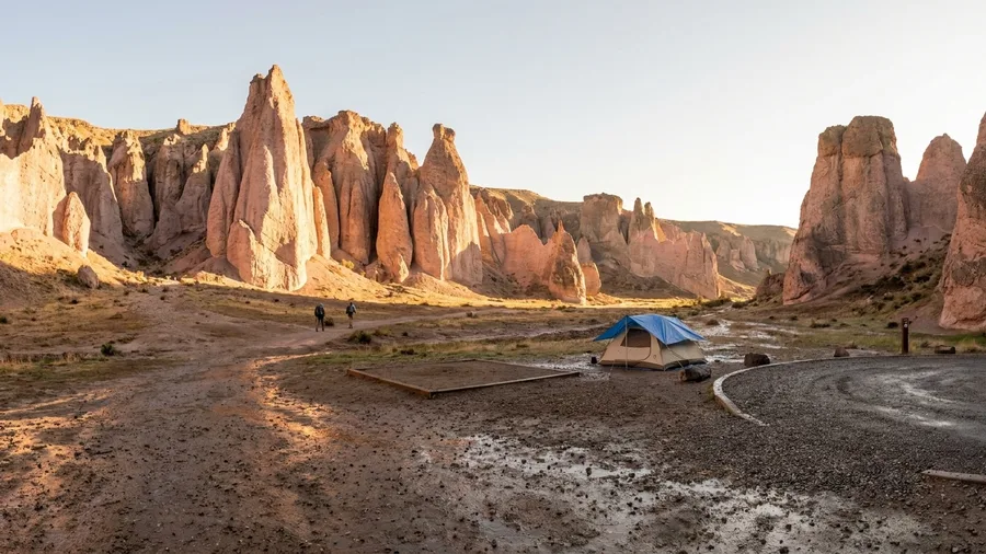
Twelve miles of gravel separate a free bed from the tarmac at Ore. 201, and those twelve miles are the fee. Nobody at a gate collects anything at the end of them. The desert does the collecting on the way in, and the reward sits behind it in the form of pink rock.
From Boise the drive runs about two hours southeast, past the Snake and out onto open tableland where the last paved turn hands you over to washboard and dust. What rises at the end of the gravel is a wall of pale pink volcanic tuff — pillars and fins and blunt towers stacked like something poured and never cooled, lit amber on the faces turned to the sun. The rock is soft enough that the whole canyon reads as carved rather than built, and in late afternoon the pink goes deep orange at the ridgelines while the floor already sits in shadow.
The campground at the cul-de-sac is free and it is six sites, no more. Nothing can be reserved, so the sixth party down the road turns around and drives the twelve miles back out — which means arriving on a Friday at dusk is a gamble with an empty tank of options. There is no water spigot and no shade at any of the six pads. Bring drinking water, bring a shade tarp, and rig it before the sun starts working on you, because the ground is bare and the tent is the only shade you brought.
April through June and again in September are the months that work. July afternoons push past 100 degrees in the canyon and the tuff holds the heat through the night, so a midsummer attempt turns into a vigil beside an idling truck. This is not a first night in a tent. It suits someone who has already solved water and shade and knows how to leave a site clean with no trash can in sight.
Stay for the light. The towers flare orange around sunset, and with maybe one other vehicle in the lot, the only sound is the rock giving off the day's warmth. That is the whole transaction: twelve miles of gravel for a campsite that costs nothing and a canyon that looks like it landed here by mistake.
🏔️ Steens Mountain Loop: Start to Finish
Fill up in Burns
Last gas before the loop; top off the tank and buy water here.
Check the gate
The road typically opens around July 4 and closes at first snow in October — confirm the date before driving out.
Start the loop at Frenchglen
Head up the gravel road, watching for washboard and sharp rocks.
Reach the 9,734-ft summit
Stop at the top for the view east into the Alvord Desert.
Drop into the Alvord
The road descends 4,000 feet to the desert floor — the far wall is Nevada.
Return to Frenchglen
Complete the loop and refuel at Burns on the way home.
3. Mirror Lake on the East Fork Wallowa Trail
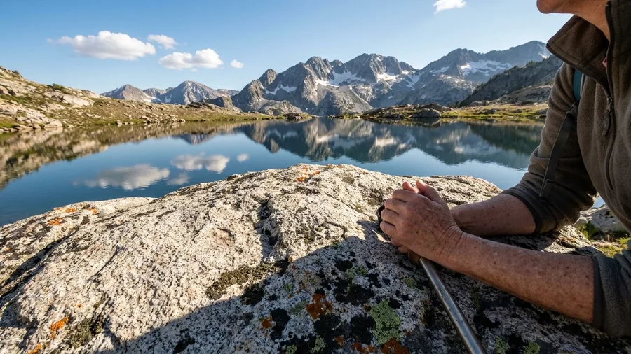
Is a 5.6-mile round trip worth 1,700 feet of climb? If you want a lake under the Eagle Cap peaks and you have a morning, yes — and the price is legwork, not admission. No fee, no permit, no gate. The East Fork Wallowa Trail starts at the Wallowa Lake trailhead and gains that 1,700 feet over 2.8 miles to Mirror Lake, where the water sits in a bowl of granite and the peaks stand behind it in a row.
Start before 8am or the trailhead lot is full, and the overflow down the road adds distance to a grade that is already stacking up. Six hours east of Portland means this is an overnight, not a day trip: sleep at Wallowa Lake and walk in on the cool morning while the trail is still shaded. If knees, altitude or a short clock rule out the climb, the Wallowa Lake Tramway costs $35 and buys the same peaks without the gain — worth it for the view, skippable if the lake itself is what you came for.
⚠️ COMMON MISTAKE
The 8am rule is not optional
At the Wallowa Lake trailhead the lot is full by mid-morning in summer, and the overflow adds a mile each way to a hike that already climbs 1,700 feet. Walk in early or take the tramway.
4. An Agate Beach at Bob Creek Wayside
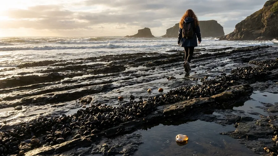
Skip it at high water. Bob Creek Wayside, 12 miles south of Yachats on US-101, is worth exactly one thing and that thing is a low tide, which is why the stop belongs on the calendar and not on the whim.
The pull-off is easy to overshoot: no gate, no restroom building, no interpretive sign that tells you it is anything but a wide shoulder above the guardrail. Check the tide table at breakfast in Yachats, because by the time you are standing at the rail with the engine off it is too late to find out the shelves are drowned. At the right hour the rock runs out flat and black and wet under the surf line, studded with agate and stacked with mussel beds, and the easiest way to think about it after a mountain that cost a climb and six hours of driving is that this costs a glance at a table and a hard right. Oregon State Parks sets the rules on what may legally leave the beach, so look that up before anything goes in a pocket.
Give it 30 minutes and treat it as a leg stretch on the run south, not a place you build a day around: the shelves are slick, so wear something with bite on the sole, and if the water is up, drive on and come back on the other side of the cycle.
💡 Tip: Park facing south so you can pull out easily — the shoulder is narrow and traffic on US-101 does not slow down.
High-Clearance vs. Sedan: Which Stops Work
High-clearance vehicle
- Steens Mountain loop
- Leslie Gulch road
- Ancient Lakes access road
- Bruneau Dunes (paved, but rough)
- Lake Ozette road (narrow, slow)
Sedan
- Skip Steens — washboard kills oil pans
- Skip Leslie Gulch — last 12 miles gravel
- Bob Creek fine if tide is low
- Salt Creek and Mirror Lake trailhead fine
- Sucia requires a boat, not a car
5. Three Lakes in a Coulee at Ancient Lakes
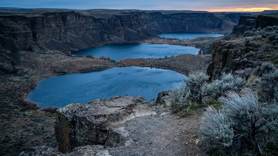
The first thing that hits you at Ancient Lakes is the quiet – no engine, no windbreak, just sage smell and the click of your own boots on gravel as you drop into the coulee. Four miles round trip, 400 ft of gain, free, and three desert lakes laid out below basalt cliffs off Ancient Lakes Road near Quincy.
Pack a lunch you actually want, because there is nowhere to buy one: the move is bread, good cheese and a cold drink in the shade of a basalt block at the water's edge, which runs you maybe $10 at a Quincy grocery and beats anything within an hour of the trailhead. Fill every bottle before you leave town, since two liters covers the four-mile walk and a gallon a day covers a night out here. Stay on the trail through the sage and look at the far side of a rock before your foot goes over it – rattlesnakes are up from April through September and this is their address.
The season picks the place for you. In April and May the melt runs off the cliff in thin white threads and the coulee is a green thing with water in it; by July the threads are gone and you are walking to three blue pools in bare rock, which is the same four miles and a completely different hike. Camping is first-come, so the site is whoever gets there.
The Desert Stop Priority Pyramid
What actually matters when you have one day
6. Tide Pools and WWII Bunkers at Salt Creek
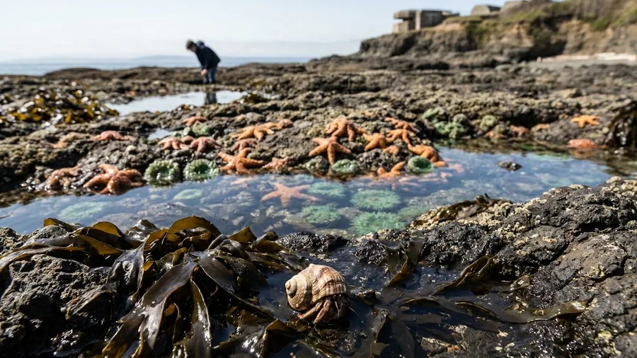
Ancient Lakes is a tent you carry in; Salt Creek is a tent you drive to, and the difference is about $37 a night – day use free, 15 minutes west of Port Angeles, county park rates instead of park-lodge ones.
The $37 buys a base for two nights, with Hurricane Ridge and Cape Flattery as day drives, and it is the reason the loop fills: sort the site before the ferry, not after. Time Tongue Point to the low tide and go early, because everyone is reading the same table – ochre sea stars, anemones and hermit crabs packed into the rock below the campground. Above you, unstaffed concrete from the Second World War sits on the bluff, walkable and unsigned, and nothing from the road tells you it is there.
💡 PRO TIP
Book the Salt Creek loop early
The $37 campsites fill before the summer weather window opens. Reserve through Clallam County Parks the day the window opens, and plan the tide pool walk for the first low tide after you arrive.
7. The Boardwalk to Cape Alava at Lake Ozette
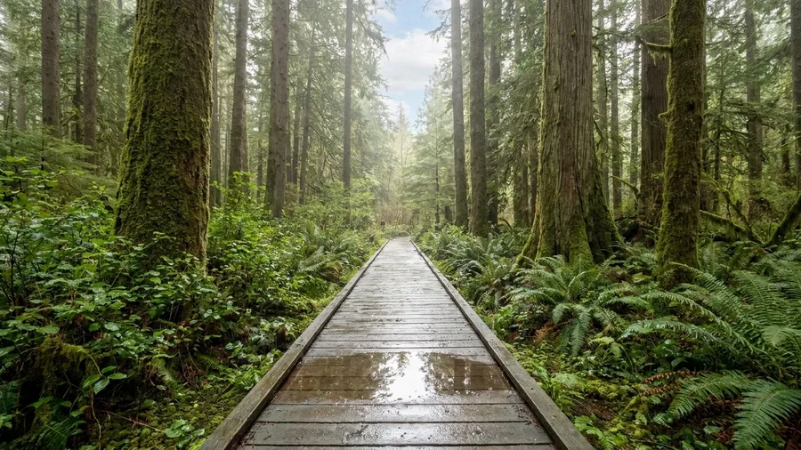
The cedars swallow the sound first. Ten steps past the ranger station the highway noise is gone and what's left is drip – water off moss, off salal, off the planks under your boots – and the air sits about ten degrees cooler than the parking lot you just left. The boardwalk runs ahead of you in wet grey cedar, three feet wide, and it does not stop for three miles.
That is the Ozette walk: a plank path laid through rainforest out to Cape Alava, with a 9.4-mile Ozette Triangle for anyone who wants the beach leg and the second forest leg as well. Olympic charges $30 per vehicle at the entrance, and getting here is roughly two hours of driving out of Port Angeles – past the Neah Bay turn-off, which comes before the Ozette road and is not yours. Stay on 112 to the end; the last miles are slow and narrow, and you will not be passing anyone.
Boots on and walking by 8, because the lot at the ranger station is full by 10 in summer. The planks are slick most of the year and the mud between them is real mud, so a slow hour sitting on the beach at the end is earned rather than lazy – driftwood stacked into silver piles, the short wet drop off the boardwalk to get down to it, and nothing to do but listen to the surf turn over. Bring a shell and shoes with tread. Leave the trail runners in the car.
Lake Ozette at a Glance
🕖 Best hours
Park by 7:45am; lot fills by 10 in summer
🌊 Plank vs beach
Dry planks out, tide-dependent beach return on the Triangle
👟 Footwear
Boots with tread; trail runners stay in the car
🚻 Bathrooms and water
Ranger station has toilets; no water on the trail
💵 Extra cost
$30 Olympic entry covers the whole vehicle, all week
⏳ Skip the Triangle if
Tide is in, or you have under 4 hours of daylight
The 8am rule
Arrive before 8am or you will walk the boardwalk behind a guided group and park on the road.
8. Sucia Island, a State Park With No Ferry
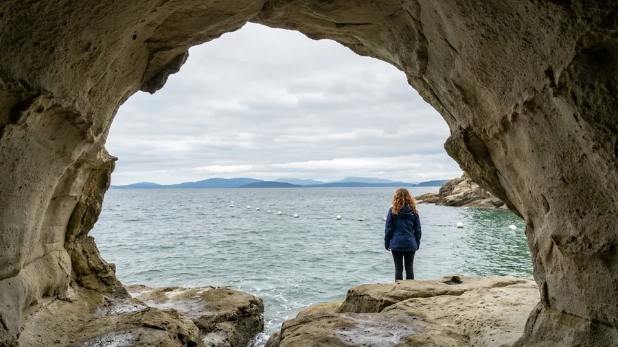
There is no ferry to Sucia, and no bridge either – a 564-acre horseshoe of sandstone coves sitting 20 miles by water from Bellingham, reachable only by your own boat or kayak. That hull is the whole trip, and it's the fact to sit with before you plan anything. Campsites and mooring buoys – more than 60 of them – reserve through Washington State Parks, and that reservation comes before the weather window, not after. Sort it, then watch the forecast.
Land at Fossil Bay, walk out to Ewing Cove, and the sandstone shelves open on the quiet side of the island, pale rock dropping into green water with the San Juans strung out behind. Stand on the shelf at Ewing at low evening light and the whole cove goes gold – that's the frame you'll keep. Kayakers and boat owners get this on a normal weekend; anyone without a hull puts it on the year they finally charter.
9. Climbing Idaho's 470-Foot Bruneau Dune
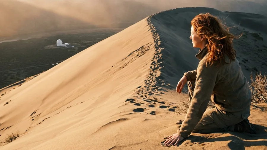
Seven dollars per vehicle, one hour from Boise off I-84, and 470 feet of loose sand: that is the whole transaction at Bruneau Dunes, and it is the opposite bargain from a boat-only island – no hull, no mooring reservation, no weather window. You pay at the gate, you park, and North America's tallest single-structured dune is standing over the lot waiting for you.
Which is where the story gets good, because this sand has been moving for a very long time. The dune sits in a basin where prevailing winds from two directions meet and cancel each other out, so the sand piles into one blunt peak instead of drifting away – a shape the wind holds in place and has held for thousands of years. People have crossed this stretch of the Snake River plain for centuries and the dune has been the landmark the whole time: visible from the interstate, visible from the river, a white shape on the horizon that tells you where the water is.
Start at dawn anyway. The face has no shade on it at any hour, and 470 feet of sand gives under every step – carry water, and turn around when your legs tell you to rather than when the summit does. Coming down is the reward: a sled or a board turns the face into a two-minute slide, and the first bench up already carries the view, so nobody has to reach the top to have had the day.
Then stay. The observatory next door runs evening programming, and the dark sky out here is the second reason to sleep in Bruneau rather than point the car back at Boise – the drive home is an hour you don't have to spend.
💡 Tip: Bring a piece of cardboard or a waxed sled for the descent — the park does not rent them.
10. Walking the Ghost Town of Bayhorse
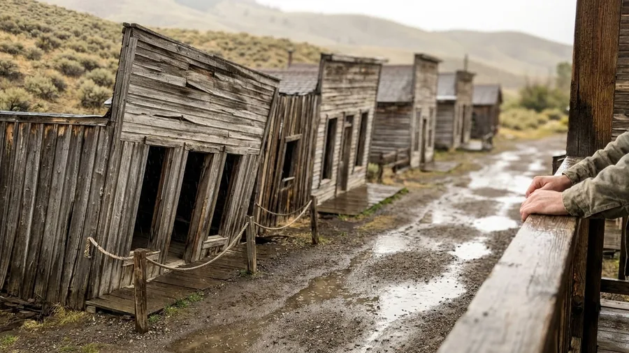
You won't need a vehicle with clearance, a tide chart or a reservation to get into Bayhorse – just 20 miles of two-lane US-93 west of Challis, and a gravel pull-off where nobody collects a fee. After a morning that asks you to haul yourself up loose sand, a flat walk between wooden buildings at no cost is the softest entry on the route. But free has its own catch here, and it isn't money.
The buildings lean because the ground under them has been giving way for a century, which is why the unstable ones are roped off – the doorway stays a photograph, and you keep your feet on the outside of the rope. Give it 45 minutes on foot, then pair it with Custer and the Challis hot springs for a half-day loop back into town. Alone, it's a break in the drive rather than the reason for it.
This suits US-93 road-trippers with a tank of gas and an hour to spare, not anyone building a trip around it. There's no gate, no entry booth and no one to ask questions, so read the signs at the buildings and leave the roped ones alone. Pull in, walk it in three-quarters of an hour, and you're back on the highway pointed at Challis.
Frequently Asked Questions
Do I need a high-clearance vehicle for all ten stops?
No. Steens Mountain and Leslie Gulch are the two that demand it — the washboard and gravel will damage a sedan. The rest (Bob Creek, Mirror Lake trailhead, Salt Creek, Bruneau Dunes, Bayhorse) are fine in a normal car. Sucia requires a boat, not a car.
What is the best month to do this loop?
July through September covers the most ground: Steens opens around July 4, the Wallowas are snow-free, and the Olympic Peninsula is at its driest. April-June and September are better for Leslie Gulch and Ancient Lakes, which get too hot in midsummer.
How much does the whole trip cost?
Most stops are free. The paid ones are Salt Creek campsites (about $37 a night), Olympic entry ($30 per vehicle), Bruneau Dunes ($7 per vehicle), the Wallowa Lake Tramway ($35) and Sucia campsites or mooring buoys (reserved through Washington State Parks). Budget roughly $150-$200 in fees for the whole loop, plus fuel.
Can I do this loop in one week?
Barely. The full loop is about 1,900 miles. One state per week is realistic — Oregon in week one, Washington in week two, Idaho in week three. If you have only three days, pick two stops and skip the rest.
Are these places safe for solo travelers?
Yes, with preparation. The desert stops (Steens, Leslie Gulch, Ancient Lakes) have no cell service and no water — carry a gallon per person per day, a full spare and a paper map. Rattlesnakes are out April-September at Ancient Lakes. The coastal and forest stops are well-traveled enough that you will see other people.
Do I need to book ahead?
For Sucia and Salt Creek, yes — Sucia campsites and buoys go through Washington State Parks, and Salt Creek fills fast in summer. Leslie Gulch and Ancient Lakes are first-come, so arrive early. Lake Ozette needs an early start, not a reservation.
Which Trip Are You Taking? Pick the First Stop
Start with the trip you are actually taking. From Boise for a long weekend, climb Bruneau Dunes at dawn, stay for the observatory after dark, then take Leslie Gulch for the second night's free camp. A week on the Olympic Peninsula starts at Salt Creek, two nights at about $37, Tongue Point at the first low tide, Hurricane Ridge and Cape Flattery as day drives. Looping out of Portland, go to Wallowa Lake first: at the East Fork trailhead before 8am, Mirror Lake by noon, the $35 Tramway for whoever skipped the climb.
Three days means dropping two. Sucia goes, because a hull and a mooring reservation is a trip of its own. Bayhorse goes, because 45 minutes 20 miles west of Challis does not repay the detour.
Multnomah Falls, Pike Place and Crater Lake are on the postcard because they survive being visited by everyone. These ten are quiet because each charges a toll, and the toll is published. Before the car starts: a Sucia mooring or campsite through Washington State Parks, an Ozette trailhead arrival ahead of 10am, a high-clearance vehicle for Steens and the last 12 gravel miles into Leslie Gulch, and the tide table open for Bob Creek. Pick the first stop, check the toll, drive.
Book the Sucia Reservation First
The campsites and mooring buoys go through Washington State Parks — reserve before the weather window opens, then build the rest of the trip around it.