At 7 a.m. on the South Rim of Canyon de Chelly, the air is still cool and the only sound is a raven somewhere below the rim.
You have been told that Sedona is the only base that hands you red-rock scenery and real hiking in a single trip. That is a convenient belief, and it costs you an hour in traffic before your first trail.
The ten places ahead each reproduce one Sedona element at a smaller scale: a 3,000-foot escarpment, slot canyons, cliff dwellings, hoodoos, a 2,000-foot gorge. What they trade away is the resort strip, and what they charge back is a permit, a dirt road, or a road check.
So plan scenery first, base town second, season and permits third. Three to five days is enough to feel like Sedona without the scene, if you match the walls or slots or ruins to the right small town and check its access rule before you book.
By the end you can pick by trip type, first-timer or ruins or dark sky or remote road, and know the first official check each one needs.
Quick Tips Before You Start
Check road conditions first
Many of these spots sit at the end of dirt or gravel roads that turn to soup after rain. Call the local BLM or NPS office the morning you leave.
Permits are not optional
The Wave, Coyote Buttes, and some tribal sites require advance lotteries or permits. Apply weeks or months ahead, not the night before.
Carry more water than feels reasonable
Dry air and exposed rock drain you fast. One gallon per person per day is the minimum for any hike over two hours.
Fill up before the dirt
Gas stations are scarce once you leave the highway. Top off in the last town before any remote access road.
Spring and fall beat summer
April–May and September–October give cool mornings and manageable heat. July and August bring monsoon storms and 100-degree afternoons.
1. Vermilion Cliffs: Marble Canyon's Quiet Red Wall
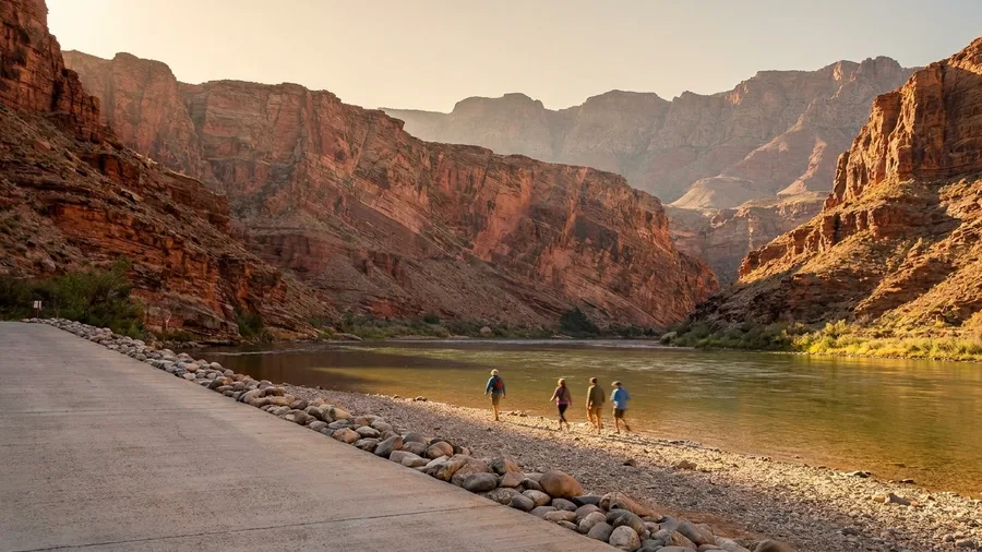
Lees Ferry, and the escarpment that towers above it, is the closest thing the Southwest has to a Sedona backdrop without a resort strip selling crystals at the trailhead.
The Vermilion Cliffs rise about 3,000 feet from the Colorado River corridor, and Lees Ferry sits at the bottom of them, a scatter of river access, a historic crossing, and not much else. What that buys you is a base with almost no commercial layer between you and the rock. The Marble Canyon overlooks north along the drive deliver the river-and-wall pairing in a single stop, and spring and fall give you cool air for Arizona desert trails; summer here bakes, and the shade is wherever you make it.
The quirky part is that the trip's real gatekeeper is paperwork, not a fee booth. Wire Pass starts from a trailhead 42 miles east of Kanab, a sandy wash that threads into a slot and opens the slickrock beyond, and the road in takes whatever the last storm left. Coyote Buttes and the Wave are the names that draw the permits, and the BLM lottery for those decides your day well before boots hit dirt. Check the BLM pages first, then build the itinerary around the date you win, not the other way around.
The honest trade-off: fewer services means you carry your own plan. Gas, food, and cell coverage thin out fast, and the drive between the trailheads and the overlooks is a big chunk of the day. That is the cost of the quiet.
What you get in return replaces Sedona's red walls with a river corridor, the wall above it, and almost nobody between you and both. The overlooks and the drive do the heavy lifting; the permit and the road check decide the rest.
💡 Tip: The Lees Ferry campground is first-come, first-served and rarely full outside spring break. Bring shade; there's little natural cover.
Vermilion Cliffs by the Numbers
2. Grand Staircase-Escalante's Slot-Canyon Backroads
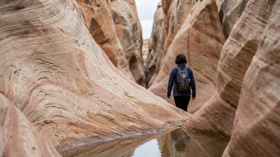
Go to Grand Staircase-Escalante for the solitude, but plan it as a road trip, not a hike schedule. The slickrock and slots are real, and so is the fact that you spend more of the day in the truck than on your feet.
Escalante is the base town, barely more than a couple of blocks of gas and motels, and spring and fall are the seasons that work. Allow five to seven days. Hole-in-the-Rock Road is the dirt artery south toward Peekaboo and Spooky slots, and the condition of that road on the morning you drive it decides whether the day happens at all. Start early, confirm conditions with the visitor center before committing, and treat the forecast the night before as a vote.
This is the move from overlooks to the inside of the rock. Where a red-wall drive keeps you above the scenery, these canyons put you in the corridor, and the wrong road day turns a slot hike into a tow-truck story. The quiet is genuine, and so is the check.
💡 Tip: The visitor center posts current road conditions daily. Ask about the last mile to any trailhead—that's where the trouble usually is.
⚠️ COMMON MISTAKE
Don't trust a dry forecast alone
A storm 20 miles away can send water through a slot canyon you're standing in. Check the radar, not just the sky above you, and never enter a slot if rain is in the forecast anywhere upstream.
3. Cedar Mesa: Cliff Dwellings and Muley Point
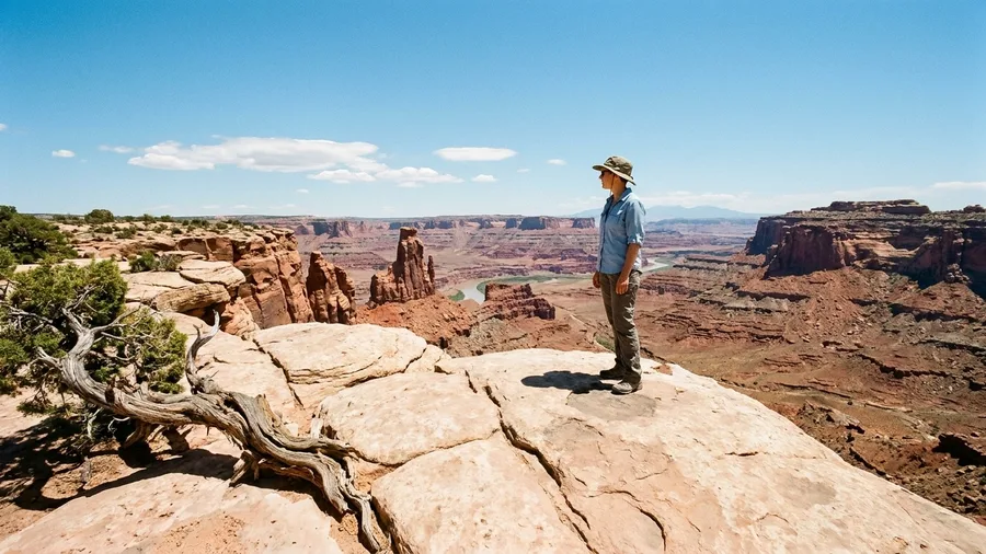
Four dollars is roughly what a diner breakfast costs in Blanding, and it is the refueling stop for the kind of day that starts with a mesa-top overlook and ends at a thousand-year-old room block. The town is your base, spring and fall are your seasons, and the cliff dwellings and Muley Point pair archaeology with red-rock views and far thinner crowds than Sedona's trails.
Muley Point is the walk that earns the morning: a short mesa-edge stroll to the open view over the San Juan country, sandstone spires and canyon floor unrolling to the horizon. The cliff dwellings on Cedar Mesa are the second act, and they are archaeological sites with access rules, not roadside attractions. Check BLM and tribal access before you build the day, because a locked gate or a closure notice decides the itinerary faster than any weather forecast.
The shift from canyon corridors to mesa tops is the point. Same red rock, different angle, plus stone rooms you can stand near and think about. The quiet depends on that access check happening before you drive, not at the trailhead.
💡 Tip: Muley Point's edge is unfenced. Keep kids and dogs close, especially when the wind picks up.
Cliff Dwellings: What to Expect vs. What to Skip
Worth the effort
- Checking BLM or tribal websites for current access rules
- Bringing binoculars for rim viewing
- Planning a half-day for Muley Point and a short mesa walk
- Carrying extra water and sun protection
Not worth it
- Assuming every ruin is open to the public
- Trespassing on tribal land without a permit
- Trying to see everything in one day
- Driving a low-clearance car on the last mile of dirt
4. Chiricahua's Hoodoo Forest in Southeast Arizona
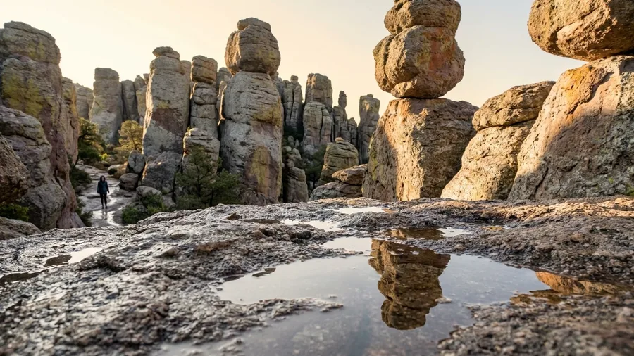
Chiricahua is a stone garden, and nothing in it is red. Instead of walls, you get hoodoos – tall weathered spires and balanced boulders stacked on narrow stems – packed into one small monument in southeast Arizona. Sedona's palette is the appeal there; here the appeal is shape.
Willcox is your base, 37 miles away, so the day is car-dependent and services are thin once you leave town. Spring and fall bring cooler hiking on the exposed rock. Drive the 8-mile scenic route to Massai Point first for the overview, then walk the Heart of Rocks loop, where the strange formations carry the drama. The viewpoint crowds thin by mid-morning; arrive early and the hoodoos feel like yours.
💡 PRO TIP
Start at Massai Point
Drive to the top first, then hike down. The Heart of Rocks loop starts near the top and drops into the formations—doing it in reverse means a long climb at the end.
5. Canyon de Chelly: Rim Drives and Ruins
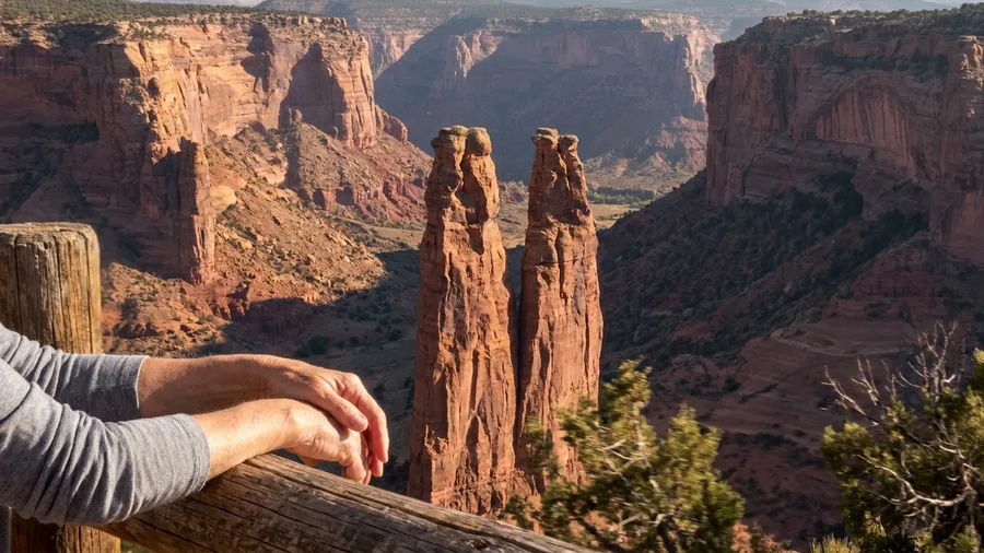
Chiricahua asks you to walk to the rocks. Canyon de Chelly lets the rim do the work: South Rim Drive delivers a sequence of overlooks along red cliffs and ruins with no long hike and no entrance fee, and Chinle is the base. Spring and fall are the kind seasons.
Come for the last hour of light. Spider Rock and White House Overlook are the anchors, and the low sun turns the sandstone the color the photographs promise – at midday it goes flat and pale. The White House Trail down to the canyon floor is a real option only if Navajo Nation access rules allow it; check before planning on it, and treat the rim as the trip if they don't.
🚙 Plan Your Canyon de Chelly Rim Day
Start at the visitor center
Check current Navajo Nation rules and pick up a map before driving the rim.
Drive South Rim to White House Overlook
The first major stop gives you a classic ruin view and a short trail option.
Continue to Spider Rock
The 800-foot spire is the canyon's signature view—best in morning or late afternoon light.
Loop back on the North Rim
The north side offers different angles and fewer cars if you have time.
Check canyon-floor access
If a ranger-led tour or permit is available, book it; otherwise the rim is the trip.
6. El Malpais: Lava Country With Sandstone Skylines
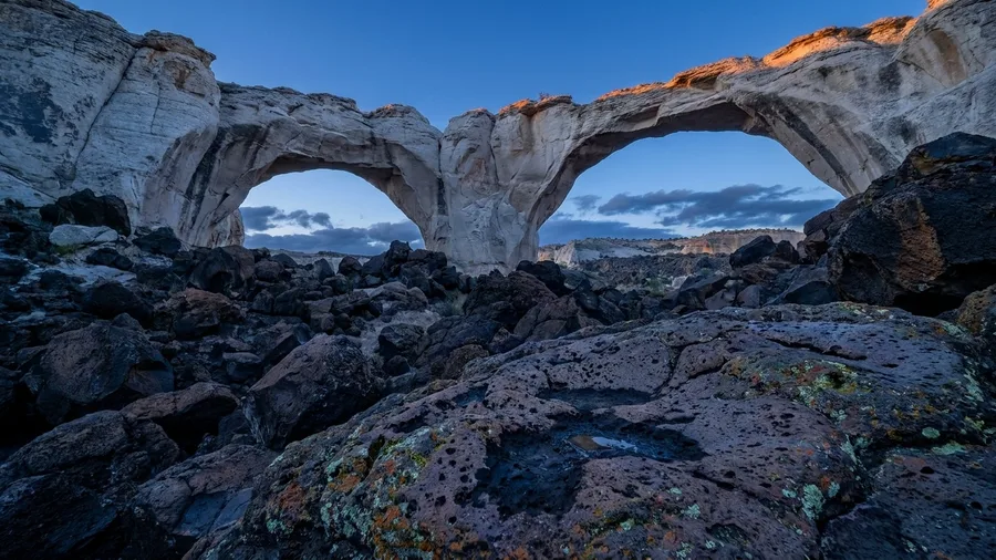
The wind out at La Ventana is the first thing you notice, dry and constant, carrying the smell of dust off black rock. You come around the bend on Highway 117 and the arch suddenly opens against a sky so bright the sandstone glows white. Nothing here is red.
El Malpais turns the Sedona palette inside out. The lava flows are coal-black, some of them hundreds of years old and still bare, and they sit against white sandstone bluffs that catch the afternoon light like chalk. Highway 117 runs along the eastern edge with pullouts for the lava country and the bluffs beyond it, and La Ventana Arch, just off the access road, is the single best frame of the contrast. Allow an easy half-day for the arch trail and a couple of overlook stops; it is not a long hike, but the openness means you will linger.
Grants is your base, twenty-some miles east, and the town has the motels and gas you will not find closer. Spring and fall are the months to come, both because the exposed rock gets punishing by noon in summer and because the light is lower and the shadows longer. If you want the lava tubes, check the BLM before you plan the cave day, since access is not always open and the wrong assumption wastes a morning. The drama here is scale and color, not a strip of galleries and boutiques, and on most pullouts you will share the view with one other car.
El Malpais — At a Glance
🥾 Arch trail
Paved, short, under a mile to the arch
⛽ Closest services
None between Grants and the arch turnoff
🚫 Skip if
You came for red rock and galleries
📍 Pair with
Gila Cliff Dwellings, 44 mi from Silver City
🦇 Cave day caveat
Confirm BLM status before driving out
Two bases, one trip
Grants for El Malpais; Silver City for Gila Cliff Dwellings. The 44-mile gap makes a day of it, not a single stop.
7. Gila Cliff Dwellings' Forested Canyon Detour
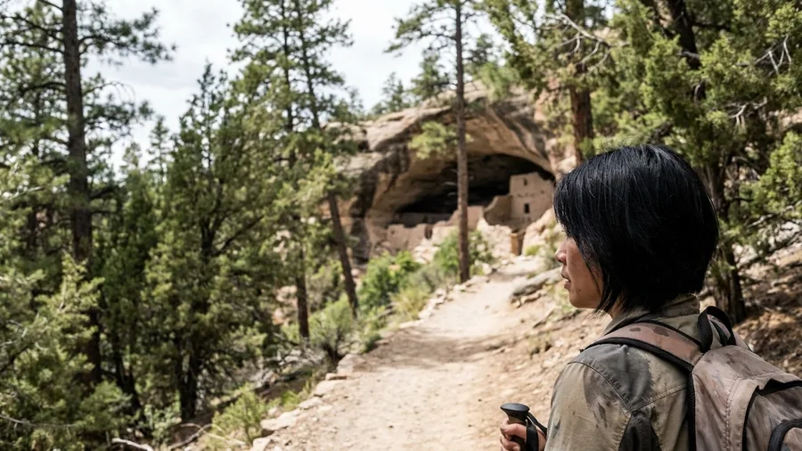
The shade hits you before the ruins do, cool air off the canyon floor and pine overhead while the rock walls around you sit in shadow. That is the trade the Gila makes: you give up Sedona's baked red slickrock and get a forested canyon instead, cliff dwellings tucked into a south-facing alcove a one-mile trail from the parking area. Silver City sits 44 miles back down the road, the nearest town with beds and gas, and the drive between is the part people underestimate.
The access road into the Gila Wilderness is narrow and winding, and it climbs and drops enough that a trailer or a nervous driver will feel it. Check weather and road status before you leave Silver City, because a storm up high can change the surface and your return timing in the same afternoon. Once you are on the trail, the payoff is five cliff dwellings built into the overhang, rooms still intact under the rock. Give it your whole slow afternoon. Sit on the bench below the alcove for an hour and let the canyon do nothing at you.
💡 Tip: The trail is paved but uneven, with a few steep sections. Wear shoes with grip.
8. Chaco Culture: Ruins Under Dark Skies
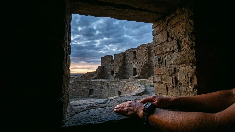
The 9-mile dirt access road is the first thing to know, and it decides who this trip suits. Graded but rough after rain, it sets the pace in and out, and if you are driving a low-clearance car or towing anything, check conditions with the park before you commit. Families with patient kids and anyone willing to go slow will find the reward worth the washboard; travelers who want a paved loop and a quick overlook should pick a different canyon.
Nageezi is the base, spring and fall are the seasons, and the room blocks at Pueblo Bonito and Chetro Ketl are what you came for. Pueblo Bonito is the monumental one, a curved stack of stone rooms four stories high in places, built with a precision that holds up when you are standing inside it. Chetro Ketl sits a short walk away and gives you the same craft with fewer people around the walls.
Stay for dark. Chaco is a dark-sky destination, and after the day visitors clear out the Milky Way comes up over the ruins in a way Sedona's town glow never allows. Confirm road conditions and the return drive before you settle in, and carry a headlamp. The wonder here is archaeology and darkness together, and the rough road is the filter that keeps the crowd away.
💡 Tip: Bring a red-light flashlight for night-sky viewing. White light ruins your night vision and others'.
A Chaco Day: What It Costs
9. Black Canyon of the Gunnison's Sheer Gorge
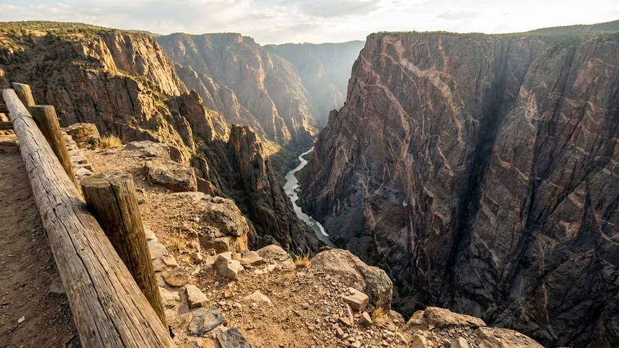
A 2,000-foot drop, a 7-mile rim road, and a fraction of the traffic you fight in red-rock country. Montrose is your base, spring and fall are the seasons, and the South Rim Road is the spine of the whole visit, a string of overlooks perched above the Gunnison River where it cuts through dark, steep rock.
The scale is the attraction, but the honest wildlife likelihood is modest: you may spot ravens riding the updrafts and the occasional mule deer on the rim, and that is about it, so come for the vertical exposure rather than a safari. Take a rim trail off the South Rim Road in the cooler months and the gorge opens below you in a way no red wall quite does. It trades archaeology and darkness for sheer stone, and the quiet on the rim is the point.
10. Big Bend Ranch's Remote River Canyons
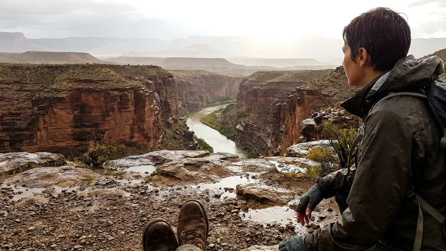
Skip Terlingua and book the room in Presidio. The old border town on the Rio Grande is the base for Big Bend Ranch State Park, and it is where the locals go when they want red rock without the line at a trailhead. Where Black Canyon packs its drama into a rim road you can drive in an afternoon, this park stretches the same idea across a remote Texas map, and the planning shifts from viewpoints to the road and the water.
The drive in is 27 miles of gravel to Sauceda, the park's hub, and it sets the tone before you see a single canyon. Washouts, caliche dust, and slow going make it a low-gear morning, not a shortcut. Ask at the ranger station in Presidio about road and water conditions before you commit, because the answer changes week to week.
Sauceda is the old ranch headquarters that the park runs from, and it is where you sort out water, permits, and the day's route. The Colorado Canyon overlook trail from there is the first hike: short, exposed, and framed by the Rio Grande cut below and the desert rolling out past it. Carry more water than you think you need. There is none on the trail, and the nearest reliable supply is back in Presidio.
Fall through spring is the window. Summer heat on this ground is not a challenge to push through, it is a reason to stay home, and the shoulder months give you cool mornings and clear light on the red walls. Self-reliance is the price of the solitude here. Cell service drops, the drive is the destination as much as the overlook, and the park rewards people who check conditions rather than assume them.
This is the entry for the traveler who has already done the red-rock day hike and wants the same rock with the crowd subtracted. Presidio is the base, but the park and its gravel road are the trip, and the quiet is what you drove out here for.
💡 Tip: Cell service is spotty to nonexistent. Download offline maps and tell someone your itinerary before you leave Presidio.
Frequently Asked Questions
Do I need a permit for any of these places?
Yes for some. The Wave and Coyote Buttes in Vermilion Cliffs require a BLM lottery permit. Canyon de Chelly's canyon floor is Navajo Nation land with its own access rules. Always check the official BLM, NPS, or tribal website before you go.
What's the best season for a Southwest road trip to these spots?
Spring (April–May) and fall (September–October) give you cool mornings, manageable heat, and fewer crowds. Summer brings monsoon storms and 100-degree afternoons; winter can close higher roads and bring snow to the rim country.
Can I visit these places in a standard rental car?
Some, yes. Chiricahua's scenic drive and Canyon de Chelly's rim roads are paved. But Grand Staircase-Escalante's Hole-in-the-Rock Road, Chaco's 9-mile access road, and Big Bend Ranch's 27-mile gravel road are rough—check conditions and consider a high-clearance vehicle.
How far in advance should I book?
For permits like the Wave, apply months ahead—the lottery is competitive. For campgrounds and motels in base towns like Escalante or Blanding, book a few weeks out in spring and fall. Remote areas have limited services, so plan your fuel and food stops.
Are these places safe for solo travelers?
Yes, with preparation. Cell service is unreliable, so carry a paper map, tell someone your plans, and bring extra water. The main risks are heat, dehydration, and rough roads—not crime.
Book Your Next Southwest Base Camp
Match the landscape and the verdict is easy. A first-timer goes to Vermilion Cliffs and Lees Ferry, a ruins buff to Cedar Mesa and Blanding, a dark-sky chaser to Chaco Culture and Nageezi, and a remote-road camper to Big Bend Ranch and Presidio.
Then do one thing before you book anything: check the official BLM, NPS and tribal pages for permits, road conditions and seasonal closures. Sedona is not the only red-rock base, but the ten alternatives hand you the scenery with access rules attached, and that trade is the whole point.
Pick the scenery and the official check before the hotel. The quiet Southwest is not plug-and-play, but it is Sedona-scale, and it starts the way Canyon de Chelly does at 7 a.m., with cool air, one raven, and nobody between you and the rim.
Check the road before you book the room
Pick your base, then call the local BLM or NPS office for current road and permit conditions. That five-minute call saves a wasted day.