Sixty-three miles, three hundred lakes, and a summit over 10,800 feet: that is Grand Mesa, and the name that pulls the crowds is not the road that earns the day. You default to the famous byway because it feels safe – Acadia means the Park Loop Road, and the known road means the scenery. Half the time it also means a queue.
These twelve run 14 to 80 miles, and each has a gate that decides it: Ebbetts Pass closed roughly November through May, Grand Mesa open June to October, Smugglers' Notch shut in winter. Service gaps decide the rest – no fuel on the Cherohala ridge.
So choose by the calendar, not the reputation. The road worth a day is the one whose season, drive time, and fuel stops line up with your month and your half- or full day; being unknown on this list is a side effect, never the qualification. By the end you should have one byway picked, a plan sized to the hours you actually have, and the closure, gas, and booking checks that stop a good day going wrong.
Quick Tips Before You Start
Fill up before the ridge
The Cherohala and the Highland Scenic Highway have no gas for 43 miles — top off in Robbinsville, Tellico Plains or Marlinton.
Check the pass opening
Ebbetts Pass closes roughly November to May and Smugglers' Notch closes in winter; a phone call or a quick web check saves the day.
Book Fallingwater ahead
Tours run $20–35 and sell out; reserve before you plan the Laurel Highlands drive around it.
Pack for 20 degrees colder
Grand Mesa tops 10,800 feet — a valley day in the 80s can be a 60-degree mesa with wind.
Start early for color
Mid-October on the Cherohala means leaf-peeper traffic; the first cars on the ridge get the views.
1. Chuckanut Drive, Washington's 21-Mile Cliff Road
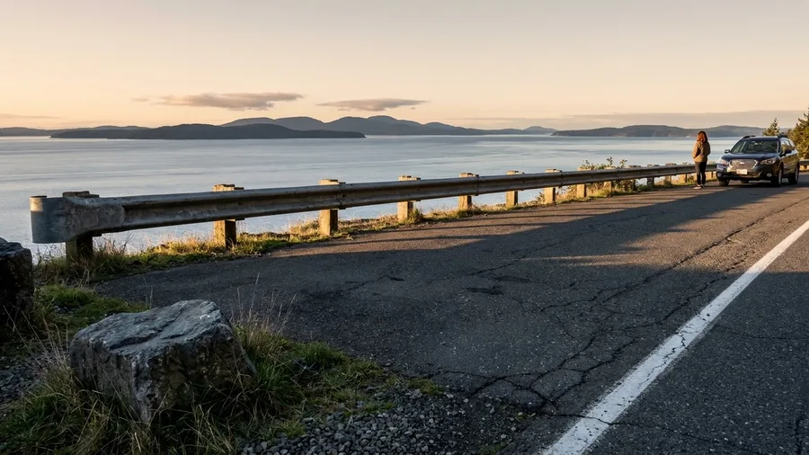
Take Chuckanut Drive if you want the biggest view on this list for the smallest commitment. WA-11 runs 21 miles from Burlington to Bellingham, and you can cover it in 45 minutes flat with the windows down. That is the whole pitch: Puget Sound water below a cliff edge, the San Juan Islands stacked out past the rail, and you back at your car before lunch.
The problem is you will not drive it in 45 minutes, because every pullout asks you to stop. Larrabee State Park is the shoreline stop, and a $10 day pass gets you out of the car and onto the rocks where the water slaps the sandstone. Do it on a clear spring or fall afternoon, when the light is low and the islands go blue, and finish with oysters at a bar in Bow or Edison. Nothing to book, nothing to reserve. Just daylight and ten dollars.
💡 Tip: The park pass is self-serve at the entrance — bring cash or check if the kiosk is unmanned.
| Byway (route) | State | Length | Drive time | Best season |
|---|---|---|---|---|
| Chuckanut Drive (WA-11) | Washington | 21 mi | 45 min | Spring–fall |
| Cascade Lakes (OR-46) | Oregon | 66 mi | 2 hrs | July–October |
| Ebbetts Pass (CA-4) | California | 61 mi | 1 hr 45 min | June–October |
| Grand Mesa (CO-65) | Colorado | 63 mi | 2 hrs | June–October |
| Wind River Canyon (US-20/26) | Wyoming | 34 mi | 40 min | Year-round |
| Davis Mountains Loop (TX 118/166) | Texas | 75 mi | 1 hr 45 min | Mar–May, Sep–Oct |
| Pig Trail (AR-23) | Arkansas | 80 mi | 2.5 hrs | Spring–fall |
| Cherohala Skyway (NC-143/TN-165) | NC/TN | 43 mi | 1.5 hrs | Mid-October |
| Highland Scenic (WV-150) | West Virginia | 43 mi | 1 hr | First 2 weeks Oct |
| Laurel Highlands (PA-381) | Pennsylvania | 68 mi | 2 hrs | Spring–fall |
| Smugglers' Notch (VT-108) | Vermont | 14 mi | 30 min | Warm season |
| Schoodic (ME-186) | Maine | 29 mi | 1.5 hrs | September |
2. Cascade Lakes Scenic Byway: 66 Miles Past Mount Bachelor
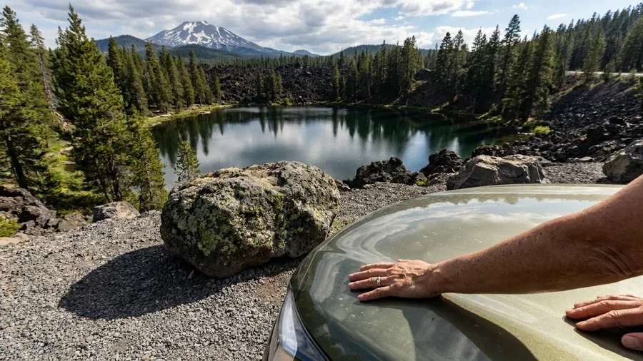
Know before you go: OR-46 is a summer road. The Cascade Lakes Scenic Byway runs 66 miles from Bend out to OR-58, and it is not the plan outside July through October, when snow closes the high section. Check the gate before you set the day aside, because the mountain does not negotiate.
Two hours of driving before you stop even once, so this is a full-day shape, not the half-day escape you might have been picturing. Mount Bachelor rises on one side and a chain of high lakes threads the other, and the whole day is really a series of small stops, each lake colder and quieter than the last. The road is the spine. The lakes are the day.
Build it as a Bend loop, not a through-route. You leave Bend, climb past Bachelor, loop the lakes, and come back the same way you came. The odd highlight that breaks up the driving is the lava country around the upper lakes, black rock and pines growing straight out of it, worth pulling over for. If you want it without the crowd, go on a weekday, because every Bend local with a kayak is out there on a Saturday.
3. Ebbetts Pass: A California Pass With No Shoulders
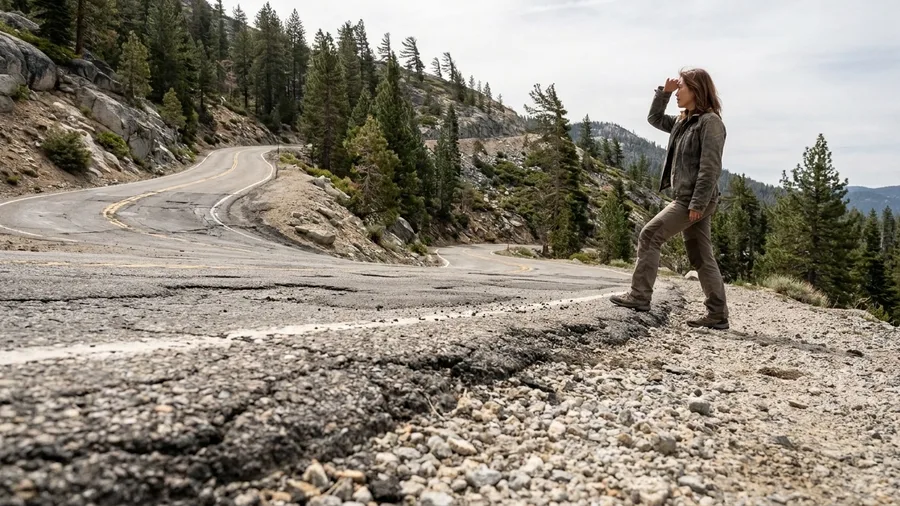
The first thing that registers on Ebbetts Pass is the sound of your own tires on gravel at the edge, because for long stretches there is no shoulder at all, just a white line and then the drop. CA-4 runs 61 miles from Arnold up to Markleeville, about 1 hour 45 minutes, and crosses an 8,730 ft pass on the way.
That narrow surface is the point, and it is also the reason to skip the drive if tight mountain road makes you grip the wheel. The switchbacks have no guardrail in places, and oncoming traffic sometimes has to back up to let you by. Rewarding for a confident driver. A white-knuckle experience for anyone else.
The season comes before the driver, though. Ebbetts is closed roughly November through May, and the pass does not open on a whim. What you get for waiting is a Sierra crossing with none of the famous-pass circus, no queue at a gate, no shuttle, just you and the granite. Check the closure before you plan the day, then go when the road says yes.
💡 Tip: Check Caltrans road status the morning you go — the opening date varies by snowpack.
⚠️ COMMON MISTAKE
Do not trust the pass calendar blindly
Ebbetts Pass and Smugglers' Notch both close for winter, but the exact dates shift with snowpack and maintenance schedules. A quick call to the state DOT or a look at the road-status page the morning you leave is the difference between a scenic drive and a wasted detour.
4. Grand Mesa Scenic Byway: 63 Miles Above 10,000 Feet
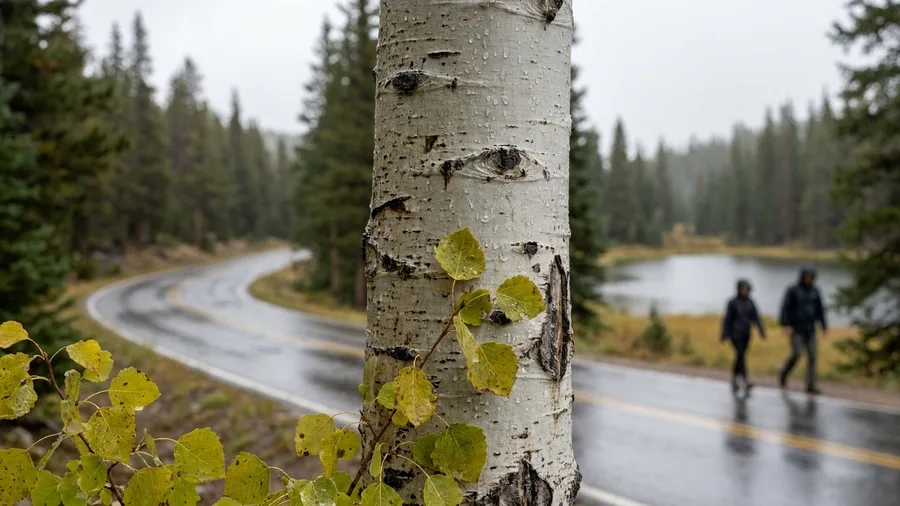
Grand Mesa is the high-altitude counterpart to a pass that asks for nerve: where a narrow Sierra crossing trades on white knuckles, this one trades on temperature. You climb out of canyon desert at the I-70 exit near Mesa and by the time you top out you have driven into another season.
The byway is CO-65, 63 miles to Cedaredge, about two hours at the wheel. The summit sits near 10,800 feet and more than 300 lakes spread along the top – pull over, walk a shoreline, and the valley heat you left is thirty degrees gone. The real doing here is the climb itself: watch the aspen and the rock change in the space of a couple of hours. Open June through October, and check the opening date before you plan any lake stops – this is a summer escape, not a shoulder-season gamble.
What a Byway Day Actually Costs
5. Wind River Canyon: Wyoming's 34-Mile Tunnel Road
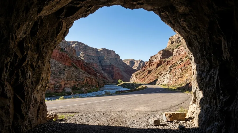
Forty minutes is all the driving takes: US-20/26 covers 34 miles from Shoshoni to Thermopolis, and the canyon squeezes that half hour into two rock tunnels and walls that close overhead. You pay nothing to drive it, and there is no gate to check. It is a good choice when the larger Wyoming route from Yellowstone out to the plains already threads this way, because it asks for a leg, not a day.
What you get in those forty minutes is rock. The road follows the Wind River through a cut in the Owl Creek and Bridger ranges, and the two tunnels are short, dark, and over fast, so the canyon opens and closes before you have settled into the drive. The whole point is the walls on both sides, and they deliver best in low evening light.
A canyon you drive through in under an hour is a stop to sit down in, and the sitting-down part is in Thermopolis. The hot springs bathhouse at the finish is free, and that is the reward – not a ticket to buy, not a tour to reserve. Soak for as long as it takes to feel the rock dust off, and the forty-minute drive earns its place.
The constraint here is time, not a closure or a booking. Nothing on this route is shut for the season or reserved ahead, which means it fits any month you are passing through. What it will not reward is a whole day of its own.
There is no food stop to tempt you off the road, and the drive does not build to a viewpoint you have to reach by a certain hour. It does the modest, useful thing: it turns a transit leg into the part of the day you remember.
💡 Tip: The bathhouse is free but has limited hours; check before you count on a soak.
6. Davis Mountains Loop: 75 Miles and a Star Party
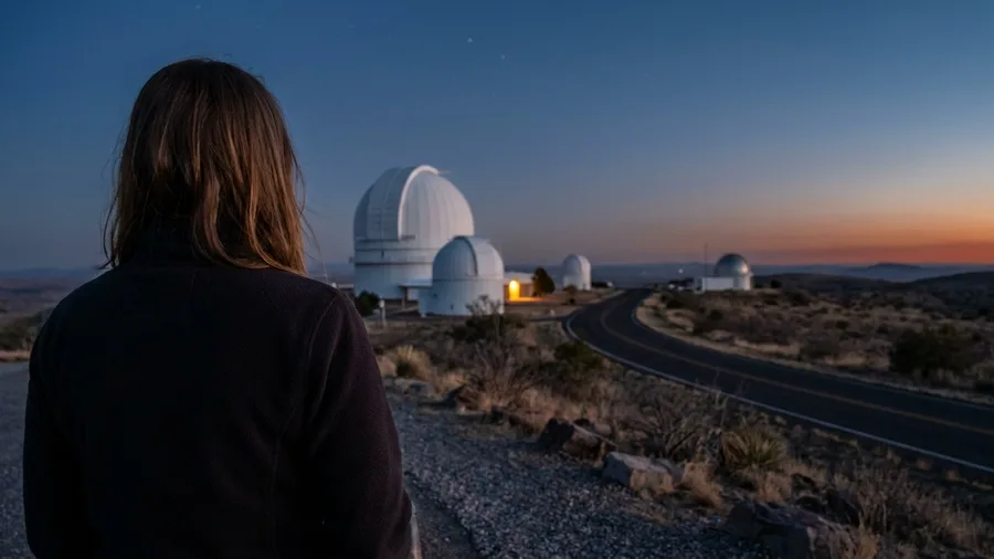
The drive alone is 75 miles along TX 118 and 166, about an hour and 45 minutes of empty mountain road with almost nothing on it. So what fills the other hours? A night sky that ranks among the darkest in the lower 48, and a star party at the McDonald Observatory that costs $12-20.
That is the question worth asking before committing the day, because the observatory event happens after dark and the loop does not hand you a reason to stay otherwise – so the honest plan is one night in Fort Davis rather than a dash out to the telescopes and back. Schedule it for late March through May or September into October; summer heat makes the drive a punishment. The loop itself is the free part – the road costs nothing, and the empty miles are what you came for. Only the overnight and the star party ticket carry a price, and both are small.
Before You Start Any Byway
- Check the pass and road status A closure turns a scenic drive into a wasted detour.
- Fill the tank at the last real town The Cherohala and Highland Scenic have no gas on the ridge.
- Pack food and water for no-service stretches The Cherohala ridge has no diner either.
- Book any timed tour or star party Fallingwater and McDonald Observatory sell out.
- Carry a jacket for elevation gain Grand Mesa is 10,800 feet; Cherohala crests at 5,390.
7. The Pig Trail: Arkansas 23 Through Ozark Forest
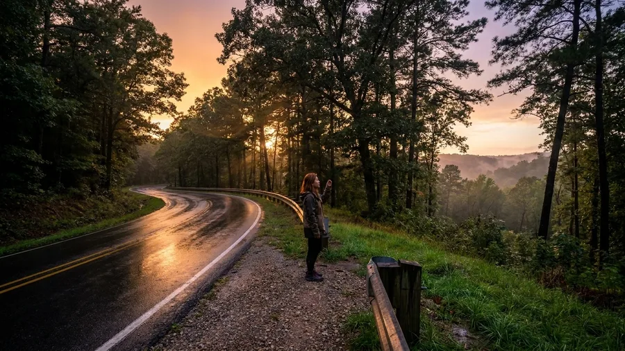
Two and a half hours against ninety minutes: that is the trade AR-23 asks you to make between the Ozarks and Eureka Springs, and it is the only reason to consider it. The 80 miles from Ozark to Eureka Springs are forest the whole way, and the faster highway gives you none of it. If you are watching the clock, take the highway. If the drive is the point, this is the road.
The Ozark National Forest overlooks are your stops, but the road between them is what you came for, so do not plan the day around a list of turnouts. Fuel is the catch: there is gas at Ozark and at Eureka Springs and nothing useful in between, so fill before you start and do not count on a station appearing on the ridge. Budget the 2.5 hours as driving and add whatever the overlooks take; it suits a traveler who would rather spend the extra hour under trees than arrive early.
Ranked by Least Fuss
8. Cherohala Skyway: 43 Miles With No Services
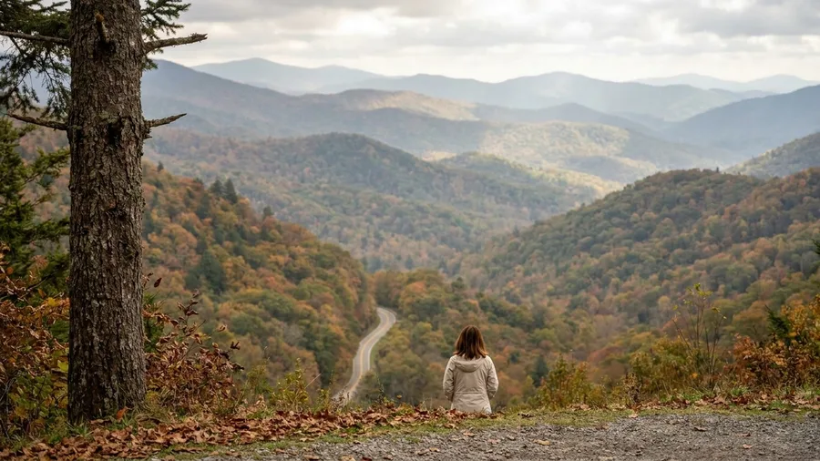
Up on the ridge the air turns cool and smells of spruce, and the only sound is wind pulling through the gap in the trees at the pullouts. The Cherohala Skyway runs 43 miles from Robbinsville, North Carolina, to Tellico Plains, Tennessee, in about an hour and a half of steady driving, and it tops out at 5,390 feet. The name is a squeeze of the two national forests it crosses, Cherokee and Nantahala, and that is exactly what the road delivers: forest, ridge, and long views down both sides.
What it does not deliver is a single service on top. No gas and no food anywhere along the crest, so fill at Robbinsville or Tellico Plains before you start and carry what you will want to eat. This is where the prep becomes the whole risk of the day; a traveler who cannot carry fuel and food should pick another road.
Wildlife is real here but not guaranteed. The forest along the crest holds white-tailed deer and wild turkey, and black bear are present though you should treat a sighting as a gift rather than a plan. Go slow at dawn and dusk, when the animals move and the light is best, and keep your distance when something does cross.
Mid-October is the window that earns the drive, when the color runs the full length of the ridge, and the crowds arrive with it. Start early. The pullouts fill as the morning goes on, and an early start buys you the crest before the procession does.
If the season and the fuel plan line up, the skyway gives you ridge views and fall color on one continuous road. If either is off, wait for the month that fits rather than forcing the day.
Cherohala Skyway — The Gap Sheet
➡️ Run it west-to-east?
Robbinsville > Tellico Plains: climbs early, crest at mile 25
⬅️ East-to-west
Tellico Plains > Robbinsville: steeper approach, same crest
⛽ Where the gas is
Robbinsville NC and Tellico Plains TN, both at the ends
⚠️ If you skip the fuel
No cell signal on the ridge — a dry tank means a walk
🍂 Peak color timing
First two weeks of October, not mid-month
Book the night before
Robbinsville and Tellico Plains motels sell out for the October weekends — reserve before you commit to the drive.
9. Highland Scenic Highway: West Virginia's Ridge Road
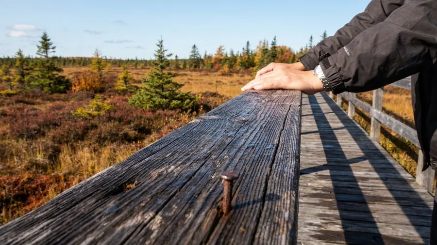
One hour of driving, 43 miles, one ridge near 4,500 feet: that is the whole shape of WV-150, and the shortness is the invitation. The road asks less of your day than a longer ridge run and still puts you up high in the Alleghenies, so you can spend the saved hours on the stops instead of the wheel.
The stop worth planning around is the Cranberry Glades boardwalk, a short walk out onto a bog that sits strangely high for country like this, with the boardwalk carrying you over ground too soft to walk. It breaks the ridge run at the right moment, giving your eyes a rest from the distance and your legs a stretch, and it costs nothing but the time you give it.
Peak color comes in the first two weeks of October, and that narrow window is the reason to go at all. Fuel is the same caution as any high ridge road: no gas along the highway, so fill at Marlinton first. The reward is Allegheny fall color on a quiet road, and the constraint is simply the month and the tank.
Worth the Detour or Not
Worth the detour
- Cherohala in mid-October — crest color, no services, start early
- Davis Mountains loop with a star party booked in Fort Davis
- Laurel Highlands with a Fallingwater tour reserved ahead
Skip or defer
- Ebbetts Pass in winter — closed November through May
- Smugglers' Notch in winter — closed, full stop
- Cascade Lakes outside July–October — snow wins
10. Laurel Highlands Byway: 68 Miles and Fallingwater
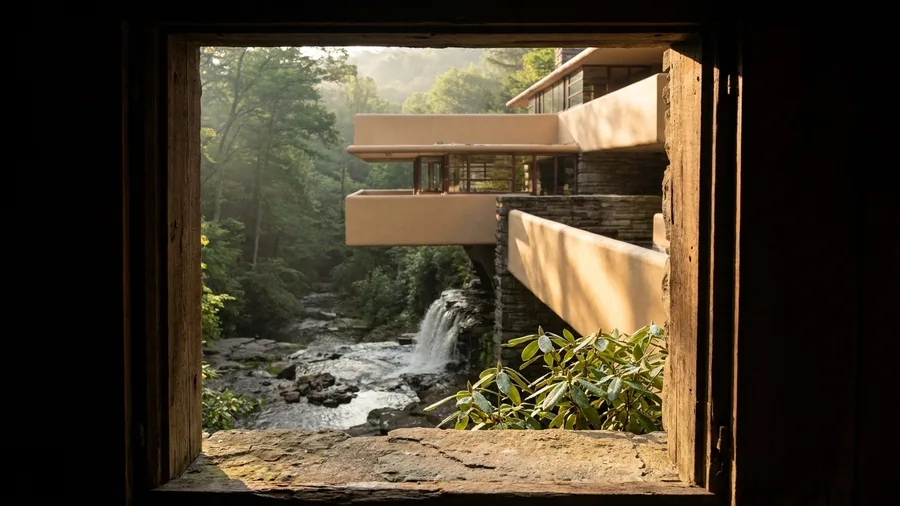
A ridge road with no reservation is one thing; a ridge road that ends at a house you had to book weeks ago is another. PA-381 runs 68 miles from Donegal to Ohiopyle, about two hours of driving, and the laurel ridge it follows works best read as the approach to a destination, not the day itself.
The destination is Fallingwater. The tour costs $20-35 depending on the option you pick, and it must be reserved in advance, especially in summer and fall, when the slots close out. The house is the anchor; the drive is what gets you there with your head out of the windshield. Locals use this stretch as their road to the Youghiogheny, not as a scenic loop to tick off, which is exactly why it stays quiet on a Saturday the turnpike is jammed.
Give the morning to the ridge and the afternoon to Ohiopyle, where the river gorge and the town's trails fill the second half without a second booking. If the river-town stop is the part you remember, historic river towns that look painted will help you pick the next one. Two hours of road, one tour, one river town: that's a full day, and the only thing that can spoil it is arriving without a reservation in your pocket.
💡 Tip: Book the earliest tour slot and drive the ridge afterward — afternoon tours fill first.
11. Smugglers' Notch: Vermont's Granite-Wall Squeeze
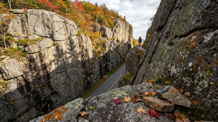
The rock wall is what hits you first, a thousand feet of gray granite rising so close on the passenger side that the light goes flat and the air in the car cools. This is the tightest fourteen miles of driving on this list, running from Stowe up through the notch and down to Jeffersonville, and it takes half an hour if you never slow down once. Longer routes with a booked tour at the end earn their miles; this squeeze is the opposite kind of stop.
Come in before nine or after five, when the tour vans from Stowe have not yet reached the pass and the pull-offs have room for one car. Go any time of season but winter. The state closes the road when snow makes it unpassable, and that closure can start as early as November and hold into April, so check current conditions at the mountain pass before you build anything around it. Park at the top for the short walk along the ridge, then continue down to Jeffersonville for lunch and turn back. As a warm-season add-on to a Stowe day, the cost is thirty minutes and the gate is a hard one, so confirm the road is open before you count on it.
12. Schoodic Scenic Byway: Acadia Without the Traffic
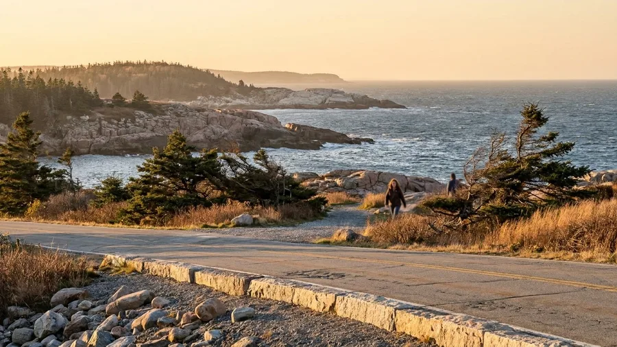
Take the quiet side of Mount Desert Island's coast and you get the Acadia you came for without the carriage-road procession. ME-186 runs 29 miles from US-1 at Hancock to Winter Harbor, about 1.5 hours of driving, past granite headlands and the Schoodic peninsula section of the park.
The splurge here isn't a ticket, it's the time and the detour: roughly half a tank of gas and a night or two of lodging on the quiet side, and in exchange you get headland scenery that most visitors to the park never reach. If you're already paying for Acadia lodging, the Schoodic loop is the add-on that makes the trip worth its cost.
September is the month to do it. The summer crowds thin, the light off the water sharpens, and the peninsula's single road stays unhurried in a way the park loop never does in August.
This suits travelers who want the coast itself, the granite and the spray and the empty pullouts, rather than a queue of taillights ahead of them. Locals on the Schoodic side will tell you the same thing without being asked: they drive this loop on a Tuesday in the fall and let the rest of the world go to Bar Harbor.
No booking, no gate, no reservation. Just a month that fits and a half-day you can spare, which is the whole test this list keeps applying.
Frequently Asked Questions
Which of these byways is easiest to do without planning?
Wind River Canyon in Wyoming. It is 34 miles, about 40 minutes, open year-round, and has no booking requirement. The free Thermopolis hot springs bathhouse at the end is a bonus, not a reservation.
Can I drive the Cherohala Skyway without a full tank?
No. There is no gas or food on the 43-mile ridge. Fill up in Robbinsville, NC, or Tellico Plains, TN, before you start, and carry water and snacks.
When is the best time for fall color on these routes?
Mid-October for the Cherohala Skyway and the first two weeks of October for the Highland Scenic Highway in West Virginia. Both windows are short and crowded, so start early.
Do I need to book anything in advance?
Yes for two stops: the Fallingwater tour on the Laurel Highlands byway ($20–35) and the McDonald Observatory star party on the Davis Mountains loop ($12–20). Everything else is drive-up.
Are any of these byways closed in winter?
Ebbetts Pass closes roughly November through May, Smugglers' Notch closes in winter, and Grand Mesa is open June through October. Check current road status before you go.
Which byway is best for a half-day rather than a full day?
Chuckanut Drive in Washington. It is 21 miles, about 45 minutes of driving, and the $10 Larrabee State Park day pass turns it into a shoreline half-day.
The Overlook Where the Pavement Ends
Choose by month, not by rank. A winter trip points you to Chuckanut Drive and Wind River Canyon, low roads with no stated winter closure, and away from Ebbetts and Smugglers' Notch. Fall color puts you on the Highland Scenic in the first two weeks of October or the Cherohala in mid-October. Summer opens Grand Mesa and Cascade Lakes.
Then match your hours. Chuckanut, Wind River Canyon and Smugglers' Notch fit a half-day; Cascade Lakes and Laurel Highlands want a full one. Before you book anything else, check the pass closure on the road you picked and reserve the Fallingwater tour if the Laurel Highlands is on your list. Those two items can cancel a day, and only one of them sells out weeks ahead.
The quiet Schoodic coast or the 14-mile Smugglers' Notch squeeze only beats a famous-road queue when the month fits. So return to the 43 miles with no gas station: fill up in Robbinsville or Tellico Plains and the road gives you the crest. Drive it dry and it does not. Pick the byway whose closure calendar, fuel stops and reservation already match your day, then go.
Check the closure before you pack the car
Pick your byway, confirm the pass is open on the day you are driving, and fill the tank before the last town. That is the whole checklist.