Everyone compares early November to the last week of October, and the one way it is different is this: the color has not vanished, it has moved downhill. You arrive with a free weekend and a fixed belief that peak is over, New England is bare, and every drive will be brown. Not so. Late color follows species and terrain, not the calendar.
Lower slopes, south-facing ridges, river bottoms, canyon shade and mild coastal air all slow the turn while the high summits strip. So you get eleven numbered drives across nine states, from Virginia to California, each with its route, mileage, drive time and the late-turning trees to expect, so you stop guessing whether the color is gone before you turn the key.
Sort them by your situation when you get there: southern and lower-elevation routes for reliable color, river valleys for reflections, coastal roads for milder weather.
With one weekend, book the low, sheltered drive first and build the day around it. The routes give you the route, the length, the time and the draw, so no hour behind the wheel is a gamble.
Quick Tips Before You Start
Go low, not high
Aim for valley floors and river bottoms; the ridges are already bare.
Start early
Overlooks fill by 10 a.m.; the light is also better before then.
Layer up
Mornings in the mountains and the gorge run cold; bring a jacket and gloves.
Check closures
Some park roads close for weather; look up current conditions the night before.
Fill up first
Gas stations are sparse on parkways; top off before you enter.
1. Blue Ridge Parkway: Rockfish Gap to Ravens Roost
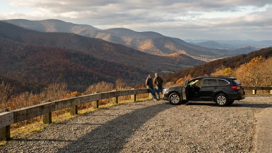
Compared with a full-day ridge run, this is the low-cost way to test whether the mountains still have anything left. Rockfish Gap to Ravens Roost runs 35 miles on the Blue Ridge Parkway, about 1 hour 15 minutes behind the wheel if you drive it straight through.
The color that survives early November sits between roughly 2,000 and 3,000 feet, where maples and beeches hold their leaves well after the highest ridgelines have gone bare. That is the whole trick here: stay low, skip the summits, and the drive rewards you. Valley overlooks and pull-offs come often enough that a half-day is plenty, and you should plan for one. It suits anyone based in the Shenandoah Valley who wants an easy sampler of the parkway without committing a whole day to it. Families with short attention spans and drivers who want to be back by lunch fit well; peak-chasers hunting bare-summit views will not.
💡 Tip: Enter at Rockfish Gap early; the first overlooks fill by mid-morning on weekends.
| Drive | State | Route length | Drive time | Late-color draw |
|---|---|---|---|---|
| Blue Ridge Parkway: Rockfish Gap to Ravens Roost | Virginia | 35 mi | 1 hr 15 min | Maples and beeches at 2,000–3,000 ft |
| Skyline Drive: Thornton Gap to Front Royal | Virginia | 31 mi | 1 hr | Oaks and hickories on south-facing slopes |
| Foothills Parkway: Wears Valley to Walland | Tennessee | 18 mi | 45 min | Late oaks with Smoky Mountain views |
| Natchez Trace: Tupelo to Cherokee | Mississippi/Alabama | 45 mi | 1 hr | Sweetgum and hickory in river bottoms |
| Ozark Riverways: Eminence to Alley Spring | Missouri | 25 mi | 50 min | Sycamore and oak along the Jacks Fork |
| Arkansas Scenic 7: Jasper to Harrison | Arkansas | 50 mi | 1 hr 15 min | Oak-hickory ridges above the Buffalo River |
| Texas Hill Country: FM 337 to Leakey | Texas | 28 mi | 50 min | Oak and cypress in cooler canyon bottoms |
| Columbia River Gorge: Historic Highway 30 | Oregon | 40 mi | 1 hr 15 min | Bigleaf maple and cottonwood |
| Laurel Highlands: Route 381 to Ligonier | Pennsylvania | 30 mi | 55 min | Beech and oak under late canopy |
| Connecticut River Valley: Route 82 | Connecticut | 12 mi | 30 min | Tupelo and oak in mild coastal air |
| Napa Valley: Silverado Trail | California | 20 mi | 45 min | Vineyard rows and valley oaks |
2. Skyline Drive: Thornton Gap to Front Royal
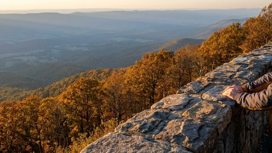
Thirty-one miles, about an hour from Thornton Gap to Front Royal, and the hour is the point. Go early, ideally within the first hour after the gates open, because the Shenandoah Valley overlooks fill their small lots by mid-morning and the low sun through the gaps is what makes the color read.
Aspect matters as much as elevation on this ridge. Oaks and hickories on south-facing slopes keep their color after higher ground has faded, since the extra sun holds the leaves longer, so what looks bare from one pull-off can be gold two bends later. The overlooks give you short stops rather than long hikes, which makes this a national-park drive without a full-day commitment. Anyone with a tight schedule or limited mobility gets the views from the car and the paved pull-offs; hikers wanting backcountry will find it elsewhere.
💡 PRO TIP
Skip the famous overlook
The most crowded pull-off is rarely the best shot. Drive two more miles to the next one; it is often empty and has a cleaner view.
3. Foothills Parkway: Wears Valley to Walland
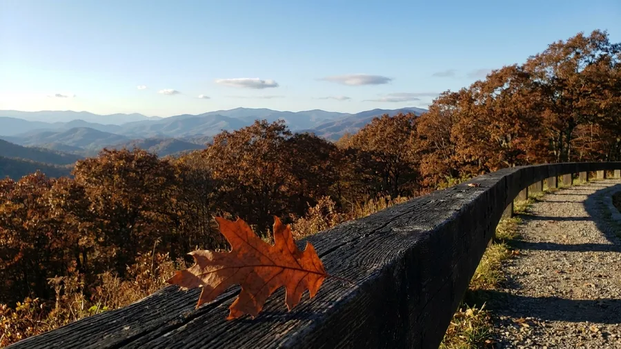
Know before you go: this is the ridge road the locals take when Cades Cove is a parking lot and Gatlinburg is a crawl. Wears Valley to Walland is 18 miles, about 45 minutes, and it delivers Smoky Mountain views without a single trail step.
Late oaks are the color here, and that is why the road still works in early November. Oaks turn after maples and hold their russet and bronze long after the birches on the high peaks have dropped, and from the ridge the view opens across those peaks in layers.
The pull-offs are built for it. You can pull in, take the shot, and be moving again in two minutes, which is what makes this the short, low-effort drive rather than a destination in itself.
Do it at sunset if you can. The oaks catch the low light and the Smokies stack up blue behind them, and the road is quiet enough then that you are not waiting for a space. A half-day version works too, with a stop in Wears Valley on the way in.
Come for the view, stay for the ease. That is the whole appeal: low effort, short distance, and a species that was always going to be late.
What Holds Color Late
From most to least reliable
4. Natchez Trace: Tupelo to Cherokee
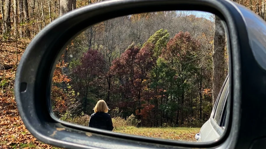
The first thing you notice on the Trace is not a view but a sound: tires on asphalt, low and steady, and beyond the window the rustle of leaves that have not dropped yet.
Take the parkway from Tupelo down to Cherokee, Alabama, and you get 45 miles in about an hour at a speed that feels almost lazy after a mountain road. What holds color here is the ground itself: sweetgum and hickory stand in the river bottoms, sheltered from the cold air that has already stripped the higher terrain bare. The sweetgum is the one to watch, its star-shaped leaves going from green to a deep burgundy that most of the ridge-top trees lost weeks ago.
💡 Tip: Stop at the exhibit pull-offs; the river-bottom views are often behind them.
Late-Color Species by Drive
Approximate share of late color by tree type
5. Ozark Riverways: Eminence to Alley Spring
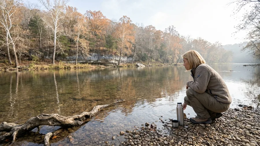
Drive Eminence to Alley Spring and you will see for yourself: 25 miles, about 50 minutes, following the Jacks Fork through bottoms where sycamore and oak are still turning when the ridges above have gone gray.
The story of this road is the mill. Alley Spring's big red mill sits at the end of the run, a water-powered grist mill from the 1800s that ground grain for the surrounding farms, and the spring beside it pours out millions of gallons of cold water a day — cold enough to keep the air in the hollow a few degrees cooler than the ridge, which is exactly why the trees down here turn late. You can walk the mill grounds for nothing, and the spring pool, blue-green and clear, photographs well against the last of the sycamore.
Pull off where the Jacks Fork runs close to the road and the low bluffs give you a reflection shot with almost no work — a ten-minute stop, not a hike. This is a relaxed half-day, not a leaf-peeping sprint: bring a thermos, take the river access points slowly, and let the water do the entertaining. If you want leaves with a water view, this is the drive that gives you both.
Ozark Riverways at a Glance
⛰️ Elevation band
Low hollows, well under the gray ridges above
🌅 Coolest hours
Mornings, while the spring chill holds the hollow
🍂 Still green in early November
Sycamore, sweetgum, hickory — bottomland species first
🚫 Skip this if
You want ridge-top vistas or a long hike
☕ Bring
A thermos and time to linger at river access points
Timing note
Color here runs a week or two behind the ridges — go after the high ground fades.
6. Arkansas Scenic 7: Jasper to Harrison
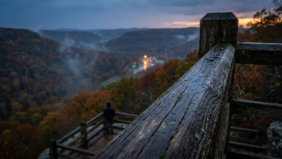
Scenic 7 from Jasper to Harrison is 50 miles and about an hour and 15 minutes of the Ozarks' classic ridge drive, oak and hickory holding color on the high ground above the Buffalo River even where there is no river bottom to shelter them.
That is the lesson of this road: species matter as much as elevation. The oaks and hickories here are built for a late turn, so the ridge stays bronze and rust long after the maples have gone. Pull into a high overlook, park, and just sit for an hour — the valley opens below you in layers and there is no reason to rush it. Small-town stops in Jasper and Harrison break up the run, and the whole thing fills a slow half-day without a single hike.
Avoid These Mistakes
7. Texas Hill Country: FM 337 to Leakey
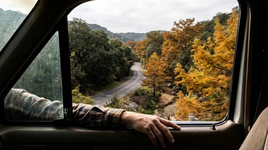
The window is down, the air smells of dust and live oak, and the road starts to bend before you have finished deciding whether to stop for the first photo. FM 337 out of Medina toward Leakey is 28 miles of ranch road that takes about 50 minutes if you never pull over, and you will pull over. This is the Hill Country answer that surprises the leaf-peepers: the color is not gone, it is just down in the bottoms, where oak and cypress sit in cooler canyon shade west of the main Hill Country towns and turn later than anything on the open ranch land around them.
The reason it works is shade, not latitude. Creeks cut these canyons deep enough that the cold settles slowly and the trees hold their leaves while the flats are already going brown, so a short route concentrates the color in a few protected stretches rather than spreading it thin over 50 miles. Go on a weekday and the road is nearly yours; go on a Saturday and the few wide shoulders fill with trucks and tripods. Budget nothing in the way of admission, and perhaps $20-30 for gas if you are topping up in Kerrville. The honest splurge here is not a ticket but the night: a room in a small Hill Country town runs roughly $180-250 in early November, and staying the night turns a 50-minute drive into a slow morning and a second pass at the cypress when the light is low.
Drive it early if you want the cypress in flat light, or in the last hour if you want the gold coming through sideways. Either way the loop is short on purpose. The color lives in the bottoms, so the route stays close to them, and you can drive it, shoot it and be back in town for lunch without wrecking the day.
💡 Tip: Fill up in Medina; gas stations are scarce west of Leakey.
The Tourist Way vs. the Better Way
The tourist way
- Drive the highest pass and find bare trees
- Stop at the first crowded overlook
- Go midday on a weekend
- Skip the river bottoms
The better way
- Stay under 3,000 feet
- Drive two miles to the next pull-off
- Go early or late
- Follow the water for late color
8. Columbia River Gorge: Historic Highway 30
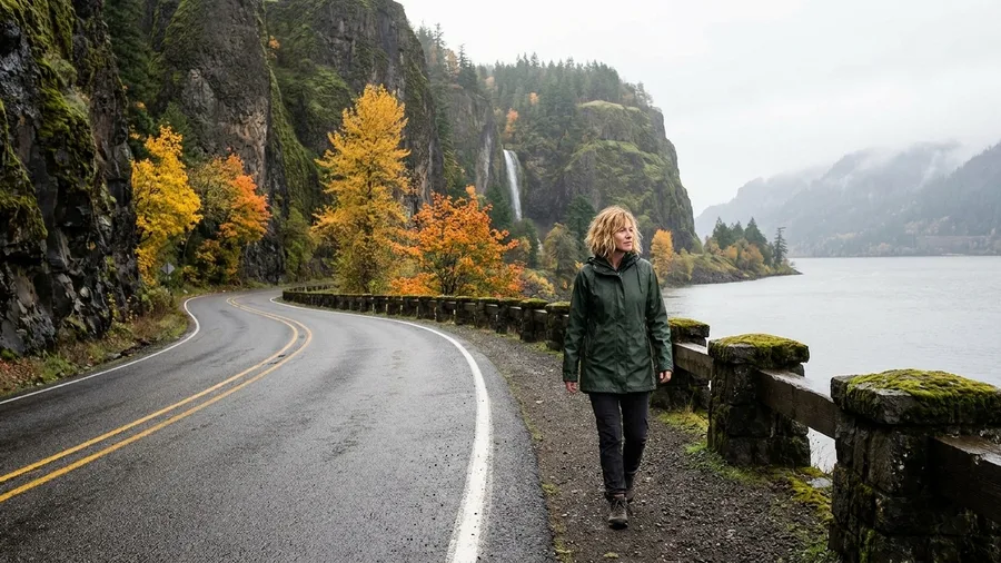
Go ahead and plan this one, but plan it wet. Historic Highway 30 from Troutdale to Hood River is 40 miles and about 1 hour 15 minutes, and the reason to take it is that the gorge's river corridor and its milder air hold bigleaf maple and cottonwood later than the mountain passes a short drive away, which have usually gone bare. That is the trade, and it is worth taking only if you accept it: November here means rain, and the gorge in a downpour is a different, moodier drive.
The route is the old road, not the interstate, and that is the whole point. You drop off the freeway and follow a two-lane shelf above the Columbia, with waterfall stops stacked one after another and viewpoints across to the Washington shore, so frequent pull-offs make it a half-day rather than a sprint. Bring rain shell, boots you do not mind soaking, and a dry bag for the camera. Some waterfall trails and the historic highway's upper sections close or change with winter weather, so check current conditions and the state's road reports the morning you go.
What you get for the soaking is cottonwood along the river turning gold while the maples along the creek cuts hold orange under the mist. It will not be a sunshine-leaf trip. It will be the one you remember, and that is a fair bargain at the price of a parking pass and a wet coat.
9. Laurel Highlands: Route 381 to Ligonier
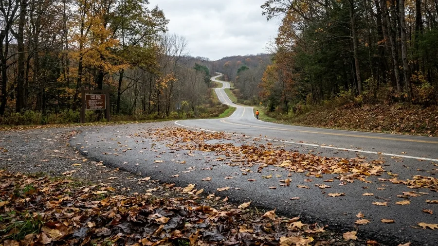
The effort is low and the wildlife is real, which is a combination worth measuring against the mountains out west. The Columbia River Gorge rewards you with waterfalls but asks for weather gear; Route 381 from Ohiopyle to Ligonier is 30 miles and about 55 minutes, mostly a ridge-and-valley road you can drive in a morning, and it holds beech and oak under a late canopy long after the higher Pennsylvania ridges have stripped. That shelter, not southern latitude, is why a November drive this far north still has color in the trees.
Start at Ohiopyle, where the Youghiogheny runs through a state park with short walks to the falls, and follow the road northeast toward Ligonier. The state-park stops are the reason to make a half-day of it: pull the car over, walk ten or fifteen minutes, and you are standing in beech woods with the leaves still on, gold going copper, leaf litter underfoot and the smell of wet bark. None of it requires a summit push.
Now the honest likelihood. White-tailed deer are the sure thing, often at the edge of the road at dusk and dawn, which is also when you should slow down. Wild turkey are common in these woods in fall, moving in small groups through the beech mast. Black bear are present, and the realistic odds are low: you may see scat or claw marks on a beech trunk and that is a good day. Do not plan a trip around a bear sighting and you will not be disappointed.
Access is the practical layer. Much of the land along the route is state forest and state park, so there are parking areas, trailheads and seasonal hunting considerations to check before you go, especially in November when hunting seasons run. Wear something visible, keep a map offline in your pocket since signal is patchy in the hollows, and check the state forest's current notices for closures.
The cost is close to zero beyond fuel, and a Ligonier coffee and lunch will run maybe $15-20. Bring layers, because a shaded ridge in November is cold in a way the parking lot is not, and give yourself three hours with stops. It is a quiet drive with a quiet payoff: the canopy above you and the chance of deer at the edge, not a view. Readers who want the payoff without any elevation should look at these flat coastal walks with paved paths and boardwalks. That is the point, and it delivers exactly what it promises.
10. Connecticut River Valley: Route 82
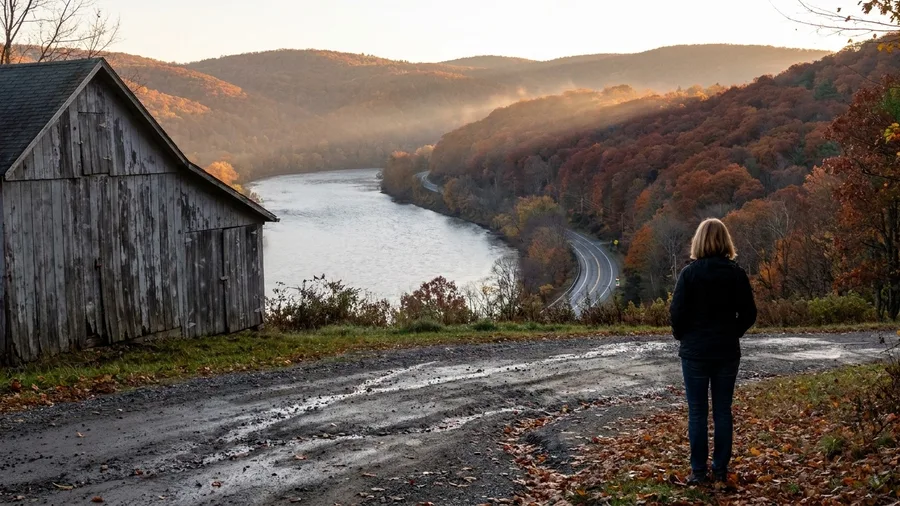
You can still find New England color in early November, and Route 82 from East Haddam to Lyme is where to get it: 12 miles, about 30 minutes. The lower Connecticut River Valley runs its own clock, warmer than the hill towns to the north and west, and tupelo and oak are the trees that hang on here after the ridgelines have gone brown. If a late beech-and-oak canopy can hold color inland under the right shelter, this valley shows the same thing happening with milder air doing the work instead of a mountainside.
Drive south toward the river mouth and the water opens up beside the road at the bends, with the low hills across the valley throwing back whatever red and copper the oak has left. Pull off where the road runs closest to the river and walk the shoulder until you can see the water and the far bank together. The late color is set against gray water and weathered barn siding rather than granite, and that contrast is the shot. Tiny center-village stops – a covered bridge, a church on a green – break up the run. Give it half a day if you stop often, and check current hours at any small museum or ferry you plan on. The mild air is the reason it works, and it is also the reason this valley is busy on a sunny November Sunday: go early.
11. Napa Valley: Silverado Trail
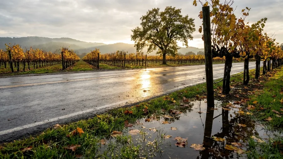
Silverado Trail in Napa Valley is 20 miles of quiet back road between the vineyards, about 45 minutes end to end without stopping. Coastal mildness is not the only thing that delays the turn – agricultural valley floor does it too, and the rows and the valley oaks along this road hold yellow long after the surrounding hills have finished. If you came this far for a short after-peak drive, you can have color and wine country on the same afternoon, which is a rarer combination than it should be.
The color here is not in a forest; it is in the geometry of the rows, gold vines running away from the road in clean lines toward the ridgeline, and oak trees standing alone in the middle of them at their own slower pace. The Trail runs parallel to Highway 29 with a fraction of the traffic, so you can drive it at 35 mph and actually look. Pull into a winery and an appointment is usually required for a seated tasting, so book ahead for any stop you care about; a walk-up pour at a walk-in bar is the easier way if you are driving. Expect roughly $25 to $45 for a tasting flight at many valley-floor wineries, more at the famous names – check current fees before you go.
Keep the day slow and low-mileage. You come here for a glass of something white and cold on a shaded terrace, not a leaf-peeping sprint, and the color is a bonus the vineyard puts on for free. Check that any winery you want is open on the day you plan, because tasting rooms close for harvest events and private bookings without much warning. The valley floor holds its gold into November, which is exactly why this drive belongs at the end of a fall trip rather than the middle.
💡 Tip: Drive north to south in the afternoon for the best light on the vines.
Frequently Asked Questions
Is early November too late for fall foliage?
Not if you choose the right route. Lower elevations, river bottoms and coastal valleys hold color after higher ridges are bare. Look for late-turning species like oak, beech, sweetgum and tupelo.
Which drive on this list is best for a short trip?
Route 82 in Connecticut is only 12 miles and takes about 30 minutes, making it easy to fit into a day. The Foothills Parkway in Tennessee is 18 miles and about 45 minutes.
Do I need a four-wheel-drive vehicle?
No. All the drives listed are on paved roads suitable for a standard car. Check conditions for ice or snow if you are driving in mountain areas.
Are these drives crowded on weekends?
Popular parkways like Skyline Drive and the Blue Ridge Parkway get busy midday on weekends. Go early or late in the day to avoid traffic and find parking at overlooks.
What should I pack for an early-November drive?
Layers, a rain jacket, gloves and sturdy shoes. Mountain mornings are cold, and the Columbia River Gorge can be wet. Bring water and snacks, since services are limited on parkways.
Can I combine two drives in one day?
Yes, many are short. For example, you can drive the Blue Ridge Parkway and Skyline Drive in one day if you start early. Just check entrance fees and road closures.
Late Leaf Holds South and Low
Sort the eleven by what keeps color late. For reliable leaf, the southern and lower-elevation runs carry it: Blue Ridge Parkway, Skyline Drive, Foothills Parkway, Scenic 7, FM 337, Silverado Trail. For reflections, take the river valleys: Natchez Trace, Ozark Riverways, Columbia River Gorge, Route 82. Route 82 doubles as the mild-weather coastal road, and Route 381, a cool late-canopy ridge, rounds out the list.
With one weekend, book the Blue Ridge Parkway from Rockfish Gap to Ravens Roost first: 35 miles, about 1 hour 15 minutes, late maples and beeches at 2,000 to 3,000 feet, with a Shenandoah Valley base for an easy half-day. New England is not finished either. Route 82 from East Haddam to Lyme is 12 miles, about 30 minutes, tupelo and oak in the lower Connecticut River Valley.
Choose by what keeps color late, low ground, river bottom or mild coastal air, not by the peak date on the calendar. Pick the drive that matches the ground you are on and go.
Check Current Conditions Before You Go
Look up road closures and color reports for your chosen drive the night before you leave. A quick check saves a wasted trip.