Which drive in this state is actually worth the gas? The one a resident takes on a Sunday, on pavement, in a car you already own.
You probably came in with Highway 1's pullouts, Trail Ridge Road, Acadia's loop, the Blue Ridge Parkway, the Road to Hana or Cades Cove already circled. All beautiful. All built for volume, and all carrying a line of cars by mid-morning.
The turn is small and consistent: residents keep naming a shorter paved road, fewer cars, a tighter window. The famous route becomes the backup, not the first call.
So this is a local pick per state, with exact distance, driving time, season and one stop that explains why the substitute beats the default. Pick the state you are already crossing and commit to it.
Every route here is paved and two-wheel-drive friendly, and no drive permits are required. Carry $10 to $35 per vehicle where a route crosses public land, plan fuel and food every 30 to 60 miles, and read the listed times as light traffic with 30 to 50 percent added for photos and meals. Then check your state DOT site the morning you leave.
Quick Tips Before You Start
Fuel early
Fill up in the last real town before the route starts; Petrolia, Houghton and Summerhaven have no gas station worth counting on.
Standard car is enough
Every route here is paved, so skip the four-wheel-drive upgrade and spend it on a better motel.
Download the map
Cell coverage drops on Mattole Road, the Cherohala Skyway and Route 550; save an offline map before the climb.
Midweek beats weekend
Anywhere with fall color or a coastline fills Friday through Sunday, so shift the drive to Tuesday or Wednesday if you can.
Sunrise is a strategy
Desert and canyon drives deliver at first light: soft color, empty pullouts, and photos nobody else is in.
Pack one meal
Most of these routes have one food stop at best, and two of them have none.
1. California's Lost Coast on Mattole Road
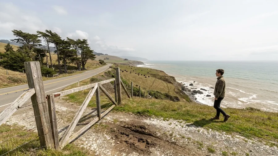
Mattole Road is the coast residents drive when they want the ocean without the queue.
From Ferndale the blacktop climbs through dairy ranches, crests a bluff, and drops you onto a shoreline with no guardrail rail of parked cars, no latte stand, no line for the view. The segment to Petrolia runs 35 miles and takes about 1.5 hours at an easy pace, one way, past working ranch gates and wind-bent cypress. Highway 1 stacks its pullouts one after another on summer weekends; this road gives you the same Pacific with a fraction of the company. Go on a dry weekday in late spring or fall, when the ranch grass is green or turning and the fog has thinned.
Fill the tank in Ferndale before you climb. Petrolia has no services at all, so water and food ride with you or you do without.
The trailheads and bluff overlooks along the segment are the stop, and the point of them is how empty they are. Pull off where the pavement widens, walk to the edge, listen to the surf hit rock below, and get back in the car when you feel like it. That absence of anything commercial is the reward, and it is also the catch: nothing will sell you a snack when you get hungry.
💡 Tip: Call the Humboldt County roads line before you go. Mattole Road can wash out in winter, and there is no handy detour.
The Default vs. The Local Pick
The Brochure Route
- Stacked pullouts by 10 a.m.
- Timed access or shuttle required
- Ranger booth and entrance queue
- Two hours at 15 mph behind brake lights
- Every photo has a stranger in it
The Local Route
- Paved two-lane, standard car
- Free or one park fee at most
- Empty pullouts midweek
- Named insider stop worth the detour
- Fuel and food planned in advance
2. Colorado's Guanella Pass Scenic Byway
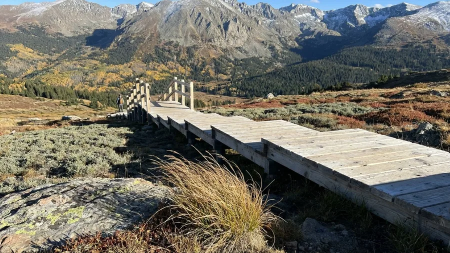
Guanella Pass is the answer locals give, and the hour you pick decides whether it works.
The coastal override trades crowds for empty bluffs; here the trade is a national-park byway for a 22-mile canyon-to-summit climb between Georgetown and Grant that takes about an hour without stops. Residents drive it in late September for the aspen, or on a weekday morning in July and August for the high-country quiet, and they do it early. Arrive by eight and the summit boardwalk is yours; arrive at eleven on a fall Saturday and you are idling behind leaf-peepers at every pullout.
Grab coffee in Georgetown before the climb. Mountain Buzz Cafe is the last easy cup before the switchbacks, and the road climbs fast enough that you will want it in hand rather than in a plan.
At the top, walk the summit boardwalk instead of stopping at the obvious pullouts on the way up. The pullouts give you the same view everyone photographs; the boardwalk gets you above the tree line with tundra underfoot and the whole Sawatch spread out in front of you.
That timing window is the whole reason the locals name it. Trail Ridge funnels every car through one park entrance and one long timed corridor; Guanella asks nothing but that you show up before the day does.
⚠️ COMMON MISTAKE
The tank you should have filled
Petrolia, Oquossoc, Cooke City and Summerhaven are not places to arrive on a quarter tank. Fill up in the last real town before each route and carry water; three of these drives have no services for an hour or more.
3. Vermont's Route 100 Through the Green Mountains
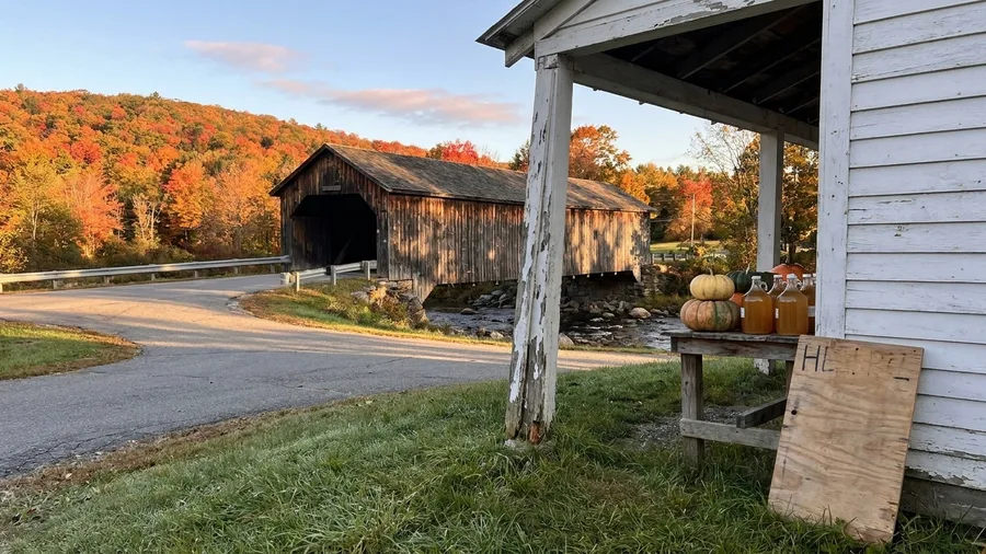
The smell hits first, woodsmoke and cold maple sap, and then the light through the yellow canopy folds over the windshield.
Route 100 runs the Green Mountains spine from Stowe to Killington, 70 miles and about two hours without stops, and residents drive it in late September and early October on a weekday. Go on a Saturday and you sit in the Stowe village lot behind every other car in New England; go on a Tuesday and the covered bridges and farm stands come at you one at a time, half empty. This is the pricier of the local picks, because you will spend: forty or fifty dollars on syrup and cheese and a farm-stand lunch, more at a sugarhouse. If the syrup stops tempt you toward a European feel without the airfare, there are American towns that feel like Europe for a shorter drive.
Detour to Bragg Farm for the sugarhouse tour and a bottle of the dark stuff, then stop in Warren at the general store, where the porch and the sandwiches cost you a half-hour you will be glad to lose. Skip the crowded Stowe lot entirely; the color is all out on the road.
💡 Tip: Book your lodging three months out for foliage season. The towns along 100 sell out before the leaves do.
Four Drives, Four Spec Sheets
🛣️ Shortest
Cape Perpetua, 10 mi
⏱️ Longest
Creole Nature Trail, 180 mi
⛰️ Highest climb
Guanella Pass, ~11,600 ft
💵 Typical park fee
$10-$35 per vehicle
📷 Add for stops
30-50% more time
Best value
Route 128 outside Moab delivers canyon scenery for zero dollars and no entrance booth.
4. Utah's Route 128 Along the Colorado River
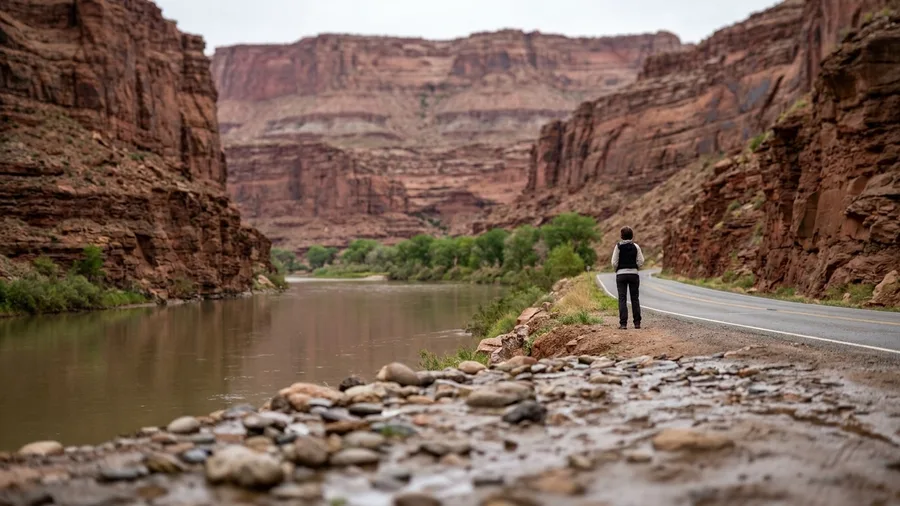
The river runs brown-green below the road and you hear it before you see it, a flat hiss that fills the window with the AC off. Route 128 leaves Moab and follows the Colorado for 25 miles into Castle Valley, about 45 minutes each way, and a half-day is all it asks. Residents take it instead of the busier park road because the red rock is the same and the entrance traffic is not.
5. Maine's Rangeley Lakes Route 17
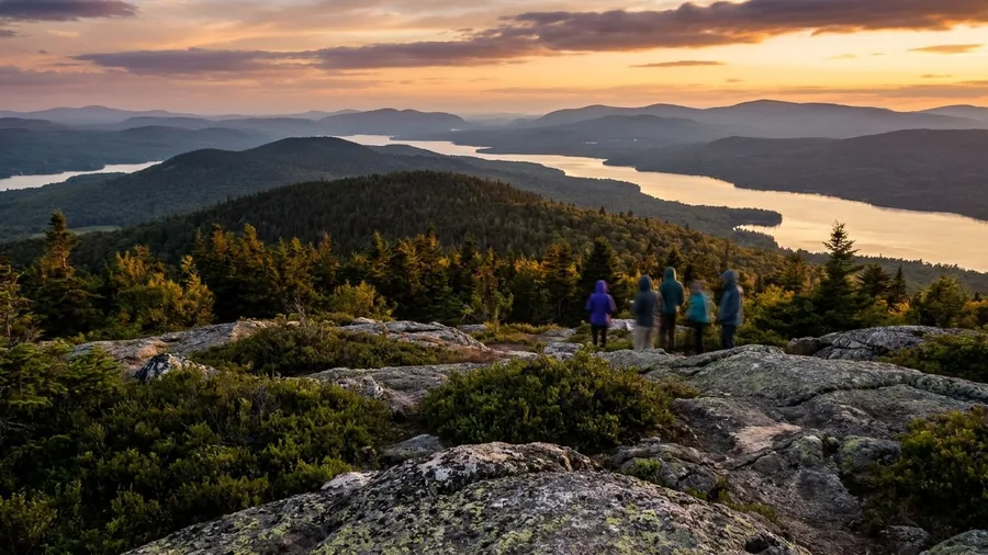
Route 17 from Rangeley through Oquossoc to Houghton is the best free half-day in western Maine, and you should not pay an entrance fee or a queue for a lake view again. Thirty miles, about 45 minutes ridge to ridge. When Acadia's loop slows to a crawl on a July weekend, residents drive this instead and see water in every direction from the passenger seat.
A short paved river canyon shows the logic plainly: a small road can beat a famous park road. Maine runs the same play in stone and freshwater. Start early, buy a sandwich in Oquossoc before the ridge, and stop at Height of Land overlook, where the lakes stack up behind you. Rangeley Lake State Park has a shoreline to sit on when the drive ends.
A Week Built From the List
6. Oregon's Cape Perpetua Scenic Loop
The Maine ridge road earns its quiet over thirty miles and three lakes' worth of windshield. Cape Perpetua does the same job in ten miles and half an hour, which is why it belongs on a coast where the other stops are a parking lot in front of a store.
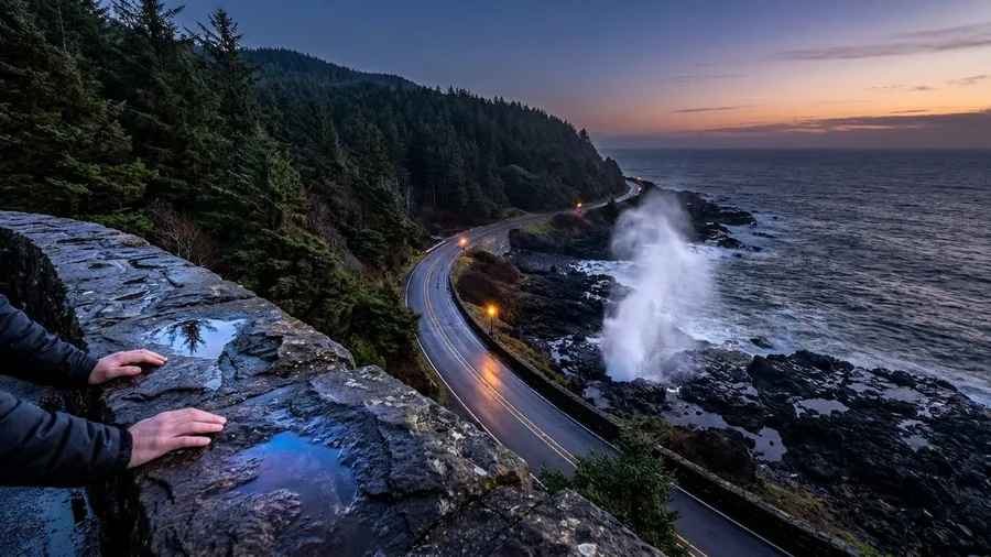
The loop runs from Yachats south on Highway 101 and returns on Forest Road 55, a paved ten-mile circuit that takes roughly thirty minutes with no stops. Two-wheel-drive is fine the whole way. You want high tide for Spouting Horn and Thor's Well, when the swell hits the basalt ledge and throws water forty feet up through the rock; at low tide it is a wet hole in a rock and nothing else. Check the tide table before you leave Yachats, and be at the overlook fifteen minutes before the peak, because the spray only reads at full push.
Weekday, and not at noon. The Devil's Churn lot fills late morning with people doing the same thing, and a weekday puts you in the pullout with a dozen cars instead of a hundred.
From there the paved summit road climbs to the top of the cape and the view runs up and down the coast in one unbroken green-and-blue line, with the ocean on one side and old-growth forest dropping to it on the other. This is the slow part: bring a jacket, take the top pullout, sit on the stone wall, and give it an hour of doing nothing. You came for that.
Then drive back into Yachats for chowder at Luna Sea Fish House, a small counter spot a few blocks off 101, and budget time for a line at lunch in summer. It is the same idea the mountain drivers know: the local pick is shorter, cheaper, and ends in a bowl of soup.
🚗 The Morning of the Drive
Check the road
Open your state DOT site the night before and again at breakfast for closures and pass status.
Fill the tank
Fuel up in the last real town and buy water and a sandwich before the services end.
Save the map
Download an offline map for the stretch where coverage drops.
Leave early
Be rolling by seven to beat both the tour buses and the afternoon clouds.
Take the long stop
Walk one named trailhead or boardwalk instead of only using the windshield.
Budget the return
Add 30 to 50 percent to the drive time for photos, lunch and a wrong turn.
7. New Mexico's Turquoise Trail on NM-14
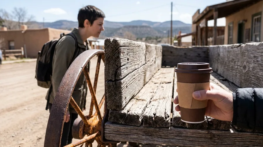
Fifty miles, roughly an hour and fifteen minutes, and you get off the interstate without ever leaving pavement. NM-14 runs Albuquerque to Santa Fe through the Ortiz and Sandia foothills, and residents take it over I-25 for one reason: the coal towns. Golden, Madrid, Cerrillos, each one a cluster of old headframes and false-front storefronts that the freeway whizzed past decades ago.
Morning is the window, spring or fall. Stop in Madrid for coffee, then walk a hundred feet to the Madrid Mercantile or any Main Street gallery and stand with your back to the door. The old coal loader still stands over the town and the hills stack behind it in that particular high-desert light that makes every color look overexposed and true at the same time. If the afternoon is still free, follow the sign for the Sandia Crest turnoff and keep climbing.
8. North Carolina's Cherohala Skyway
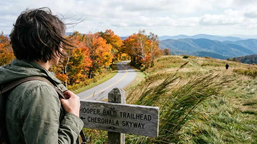
The Cherohala Skyway is a mountain crossing with almost nothing on it, so fill the tank in Robbinsville before you climb and buy your lunch there too; the Tennessee end at Tellico Plains is a small town, not a service station. The road runs 43 miles between the two, and with light traffic you can cover it in about an hour and a quarter without stopping, which you will not do.
Locals here pick the Skyway over the Blue Ridge Parkway without hesitating: the Parkway is a 45 mph crawl with timed access and traffic stacked behind every overlook, while the Skyway gives you empty curves and long ridge views where the road seems to fall away into the trees on both sides. Go mid-October for the color or on a summer morning with an early start. Pull off at the Hooper Bald trailhead rather than settling for the state-line overlook, where the cars bunch up; a short walk in puts you on grass with the ridges stacked behind you.
💡 Tip: This crosses a state line, so check both North Carolina and Tennessee DOT conditions before you commit.
9. Arizona's Catalina Highway to Mount Lemmon
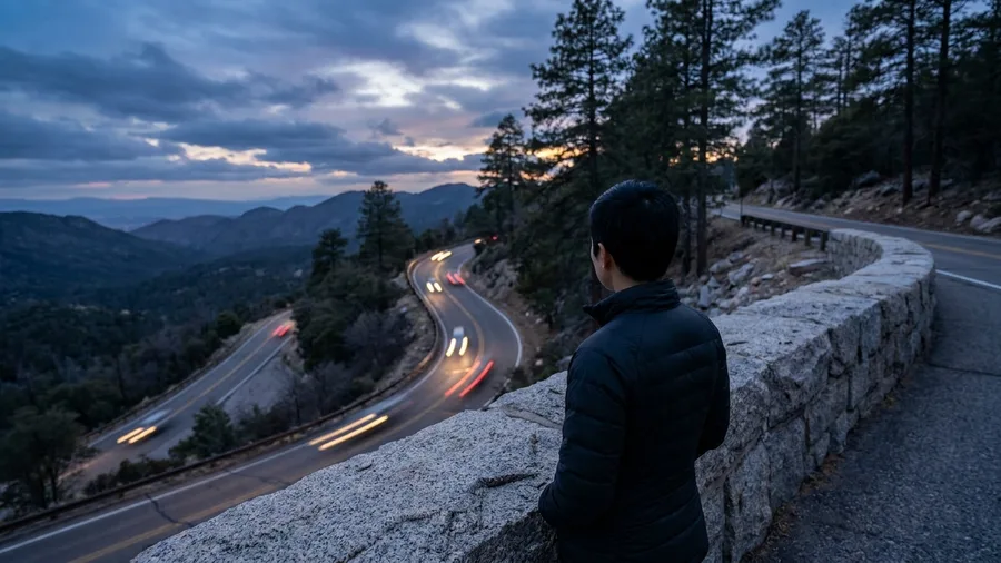
The air at the bottom of Catalina Highway is hot and dry, the smell of creosote and dust, and within twenty minutes of climbing it turns cool and smells like pine needles. That is the whole trick of this drive: Tucson sits in desert and Mount Lemmon sits in a forest, and the road between them crosses five life zones in 27 miles.
The story locals tell is about the Civilian Conservation Corps, which built the highway in the 1930s with hand tools and mule teams, cutting the switchbacks into the north face of the range one ledge at a time. The men who built it worked in the same heat you are escaping, and the road they left behind is still the only paved way up. You climb for about an hour and step out of the car into air twenty degrees cooler than the valley floor.
Pull off at Windy Point Vista for the view back over Tucson, then keep going to Summerhaven for a slice of pie. Larger rigs should check the vehicle-length caution signs before the switchbacks; the road is paved and two-wheel-drive, but the turns are tight. Sunset or early morning is the light, and summer is the season for the temperature drop.
10. Washington's Chuckanut Drive on SR 11
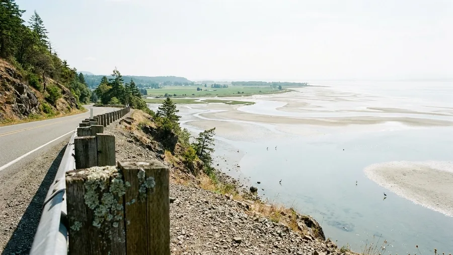
A mountain climb like Catalina's costs you a toll road and a lineup at the gate; Chuckanut Drive costs you 21 miles and 40 minutes between Burlington and Bellingham, and you eat oysters at the end. It runs on SR 11, hugging the cliff above the water with the Skagit Valley farmland opening out on the inland side, which is why residents from the Bellingham side take it on a free afternoon instead of booking anything. Spring through fall, go at low tide or toward sunset.
The wildlife is the honest part: harbor seals hauled out on the rocks below the road, herons and eagles working the flats, and a real chance of all three – though low tide is what loads the odds, so time your run to the tide chart rather than guessing. Drive past the first pullout everyone brakes for, because the crowd clears at the second and third, and the view is no worse. Beach access comes at Larrabee State Park, which charges a small day-use fee per vehicle, typically around $10.
Then stop at Taylor Shellfish Farms on the Samish Bay side for oysters pulled that morning, where a plate of them runs you what a single order would cost in the city. The trick locals use is to drive it south to north in late afternoon and eat last, with the light going gold across the water. It's a half-day, not a full one.
11. Montana's Beartooth Highway
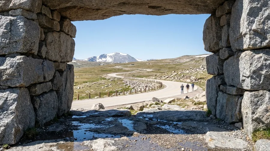
For sheer scale, Beartooth beats Going-to-the-Sun, and it does it with a fraction of the cars. The run from Red Lodge to Cooke City on US-212 is 68 miles, roughly two hours without stops, climbing to high alpine tundra where the trees give out and the road rolls over open switchbacks above the treeline. Going-to-the-Sun gives you a timed permit and a bumper in front of you; Beartooth gives you the pass.
The window is July through September once the snow clears, and you should check the pass opening date before you commit, because it varies by year and the highway shuts entirely in winter. Stop at Rock Creek Vista Point on the way up, not just the summit, since the view back down the valley is the one that explains the whole road. Fuel and a weather check in Red Lodge or Cooke City before the climb, both because services on the pass are thin and because the weather at 10,000 feet does what it wants.
12. Louisiana's Creole Nature Trail
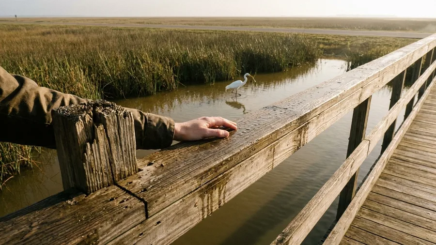
It looks like 180 miles of marsh and beach, four hours or so from Lake Charles to Cameron and back on LA-27 and LA-82, mostly at or below sea level. Residents take it for birds, gators, and Gulf air, and October through April is when both the weather and the migration cooperate – start early and bring bug spray.
The odd stop that earns the trip is the boardwalk at Sabine National Wildlife Refuge, free to walk, where the marsh opens up around you and the crowd is usually a few fishermen. Gators show in the canals along the loop if the sun's out, and there's no guarantee, which is the honest version. Finish with seafood at Steamboat Bill's in Lake Charles, where the gumbo costs what a fast-food combo does. The loop is paved the whole way, and fuel comes every 30 to 60 miles if you fill up before Cameron.
13. Michigan's Tunnel of Trees on M-119
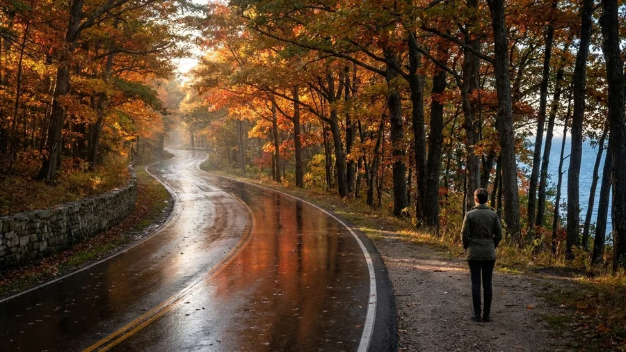
The hard part of M-119 is the shoulders, not the color. Between Harbor Springs and Cross Village, the pavement runs 20 miles along a bluff with a rock wall on the inland side and almost nothing on the lake side, so there is nowhere to pull off except the numbered turnouts. Watch for them and take the second or third, not the first; the crowd stops early, and the water opens up above the tree line further along.
The drive itself takes around 45 minutes at an honest pace, and that pace is the point. This is the short, tight counterpart to a long flat coastal run: 20 miles of oak and maple tunnel with the lake flashing through gaps on the inland side, the pedal down well below the posted limit because the road bends back on itself every few hundred yards. Late September through early October, put it on a weekday. Weekend leaf traffic makes the turnouts a slow-motion puzzle.
Do active things with the stops rather than marathon them. Swing the car into a turnout, get out, walk a few hundred feet of the bluff, and read the color from there; it looks different from standing height than through a windshield. End in Cross Village at the Legs Inn garden for lunch, stone and timber and carved oddities, with the lake right in front of you. You will not need to rush any part of it.
14. Tennessee's Foothills Parkway
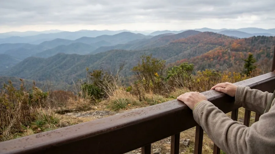
The first thing your body registers at dawn on the Foothills Parkway is the cold, and the second is the silence, so bring a jacket and plan to be at the opening pullout before the sun clears the ridge. From Wears Valley to Walland the road runs 33 miles along the crest, roughly an hour at a steady pace, and the whole reason residents drive it instead of Cades Cove is that this ridge gives you Smokies ridges without the loop's stop-and-crawl.
The catch is real, and it should shape your timing. The Foothills Parkway has no services, no concessions, and very few places to turn around once you commit, so leave Wears Valley full of fuel and food or you will be riding hungry. Midday weekends in October turn the overlook lots into a slow shuffle, and the tight pullouts punish anyone who arrives late and turns wide. Sunrise or sunset fixes most of that.
Here is where the doing comes in. At Look Rock Tower trailhead, park, then walk the short paved path to the observation tower and climb it; the ridge and valley spread out in layers and you understand the shape of the range in a way the windshield never gives you. It is a short climb, and the payoff is the best single view on this road.
Fall is the operating window most people want, and it works because the ridgeline color arrives slightly ahead of the valley floor. If you go in late September or early October, the tower climb alone justifies the detour. Otherwise, an early summer morning gives you the same views with haze settled low and nobody else at the rail.
Skip the part where you treat this as a quick scenic drive. Budget the hour for the road and another for the tower and the pullouts, and treat the Parkway as a half-day rather than an errand. If you have already crawled Cades Cove once and want the Smokies without the queue, this is the substitute locals reach for.
15. New York's Route 73 in the Adirondacks
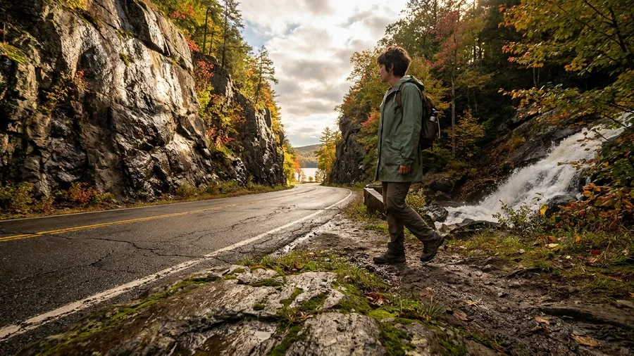
Route 73 is the Adirondack drive residents use when they want the High Peaks without the High Peaks parking lot. From Keene to Lake Placid it runs 18 miles, about 35 minutes at a steady pace, and every mile of it is working landscape: gorge walls on one side, trailheads and thin lake glimpses on the other.
The timing that makes it sing is late September for foliage or a summer morning before the heat and the hikers arrive. Roaring Brook Falls trailhead is the stop most people skip, and it is the one worth taking; a short walk brings you to the base of the falls. Then finish in Lake Placid with a picnic at Mirror Lake, where the water and the village face each other and everything slows down. Skip the crowded High Peaks lot entirely.
The local logic here is the same logic that saves Smokies drivers from the loop: take the drive that does the work of the famous one without its congestion, and let the stops carry the day. Eighteen miles of gorge and trailhead is easy to fit around a Lake Placid base, and it leaves the afternoon free.
16. Hawaii's Waimea Canyon Drive on Route 550
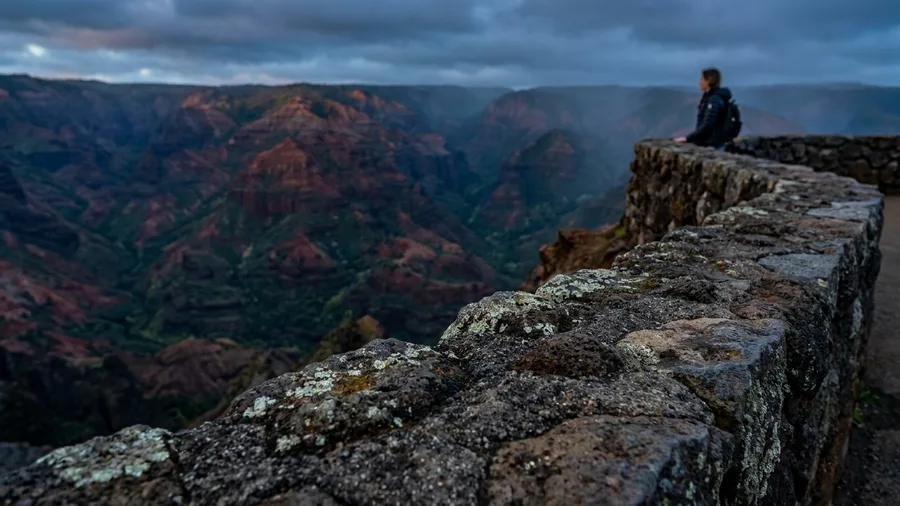
Eighteen miles, about forty-five minutes, and the whole climb fits in a morning. Route 550 runs from Waimea town up to Kokee State Park, and residents on Kauai name it over the Road to Hana for the simple reason that you get the big scenery without losing the day to a traffic crawl.
Where the Adirondack lakes give way to High Peaks, here the road trades them for canyon walls that open up on the switchbacks and keep opening. The drop on your left fills in with layered red and green as you climb, and each pullout gives you a slightly different view of the same canyon. You are above the weather by the top, which is why the drive rewards an early start, May through September, before the clouds stack up against the ridge and the canyon fills with haze.
Fill the tank and eat in Waimea before you climb. There is no fuel on the road and no food to speak of until Kokee, and a family that skips breakfast in town ends up rationing granola bars at a lookout. Puu Hinahina is the stop to build the drive around: a paved overlook with a clean rail, level ground, room to park, and the canyon laid out below in one wide pull. Then keep going.
Push on to the Kalalau Valley overlook at the end of the road if the sky is holding clear. It is the shot people remember, a green valley dropping to the sea, but it sits in cloud more afternoons than not, so the early start matters twice over.
This is the drive to pick if you have kids, a rental sedan, or relatives who do not do well on a long winding haul. There are no cliff-edge hairpins that spook a nervous passenger and no off-road segments, just switchbacks that need steady nerves on the way down. The honest caveat is the car: large rigs and RVs should think twice about the upper stretch, and anyone prone to motion sickness should grab the front seat. For everyone else, the compact car and the half-day are the whole point.
💡 PRO TIP
Drive the famous road backward
On any of these routes, locals go the opposite direction of the tour flow. Start at the far end in the morning and you meet the crowd head-on instead of sitting behind it.
Frequently Asked Questions
Do I need a four-wheel-drive car for any of these drives?
No. Every route on this list is paved and fine in a standard two-wheel-drive car. The only cautions are narrow shoulders on Michigan's M-119 and switchbacks on Arizona's Catalina Highway, both of which reward a smaller vehicle.
How much should I budget for park fees on these routes?
Figure $10 to $35 per vehicle wherever a drive crosses state or national park land. Many of the local picks, including Utah's Route 128 and Washington's Chuckanut Drive, have no entrance fee at all.
When is the best time to drive the fall foliage routes?
Late September through early October for Vermont's Route 100, Michigan's Tunnel of Trees and New York's Route 73. Go midweek if you possibly can, since the weekends double the traffic on all three.
Can I do these drives as day trips?
Most of them, yes. Every route listed runs between 10 and 180 miles, and only the Louisiana loop takes a full four hours. The rest fit comfortably into a half day with stops.
What should I check before setting out?
Your state DOT road conditions, seasonal closures on mountain passes, and current park hours. Montana's Beartooth Highway and Colorado's Guanella Pass both close with snow, and Mattole Road can wash out in winter.
Are these routes crowded on weekends?
Some are. The foliage drives and the coastal routes fill Friday through Sunday, which is exactly why locals run them midweek. Desert and canyon drives are fine any day if you start at sunrise.
Sort Your Pick by Trip Type, Then Check the Closures
The verdict is plain: take the local override whenever it comes with a named reason, and settle your state pick by trip type. Coastal: Mattole Road in California, Cape Perpetua in Oregon, Chuckanut in Washington, the Creole Nature Trail in Louisiana. Mountain: Guanella Pass, Maine's Route 17, the Cherohala Skyway, Catalina Highway, Beartooth, the Foothills Parkway, Route 73, Waimea Canyon. Desert: Utah's Route 128 and New Mexico's NM-14, with Catalina's desert-to-pine climb if you want both. Fall foliage: Vermont's Route 100, Michigan's M-119, Route 73, the Cherohala and Maine's Route 17.
Before you book anything, do the boring part: check state DOT road conditions and seasonal closures, and buy the park pass where your route crosses public land. Budget $10 to $35 per vehicle, plan fuel and food every 30 to 60 miles, and remember no drive permits are needed.
The brochure roads are still there, still beautiful, still queuing by ten. The resident route is the one to put on the map. Set the alarm for the timing window, take the local stop, and let the drive fit a half-day instead of a lineup.
Pick your state, then pick your hour
Scroll back to the entry for the state you are driving through, note its timing window, and put the insider stop in your calendar before you leave.