The mistake is booking around scenery first and road conditions second, then white-knuckling a pass you never needed to cross.
You want winter scenery but you picture snow, ice, and a road with no services for fifty miles. The range here is wide: Miami to Key West is 113 miles with no snow or ice at all, while a 38-mile Georgia loop can hold ice at elevation. That spread is the point.
Ten routes, all on paved, maintained roads, each with one specific thing that cuts the winter risk: no snow, low elevation, plowing, light traffic, or services within easy reach. A typical winter rental runs $45 to $70 a day and motels $90 to $250 a night, so the comparison stays concrete.
Choose by the route's easy reason, not by a state's winter reputation. Read the distance, the drive time, and the winter temperature, then shortlist two. Check your state DOT road conditions the morning you leave and book lodging you can cancel. Neither takes long, and together they cover more risk than a trunk full of gear.
Quick Tips Before You Start
Check the DOT first
Every state has a road-conditions site or 511 line; look at it the morning you drive, not the week before.
Rent the boring car
A standard sedan handles all ten routes; you do not need AWD unless you plan to add a mountain pass.
Book refundable
Winter rates drop in most of these places, but a cancelable reservation protects you if a storm shuts the road.
Layer, don't bundle
Coastal routes swing 20 degrees between morning and afternoon; a fleece and a shell beat a heavy coat.
Fill up before the empty stretch
On the Natchez Trace and Oregon Coast, gas stations are sparse; top off when you see one.
1. Florida Keys Overseas Highway
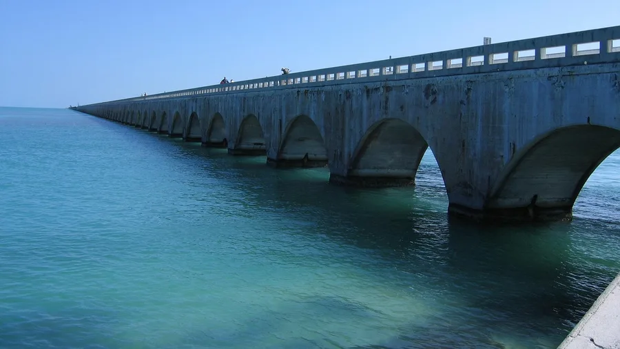
Miami to Key West, 113 miles on the Overseas Highway, roughly three and a half to four hours at an easy pace. No snow, no ice, no mountain pass to time between storms. The Seven Mile Bridge is the moment the trip earns its name, blue water opening on both sides at once, and services and cell signal run most of the way down, so a single-day drive is realistic rather than heroic.
Book the room first. Winter is high season in the Keys and lodging fills months out, so the reservation is the real planning constraint here, not the road. This is the best pick for a family with small kids or anyone traveling with someone who hates winter driving. Skip it if what you actually want is mountain towns prettier in winter.
💡 Tip: Drive the Seven Mile Bridge heading south in the morning; the sun is behind you and the water reads turquoise on both sides.
| Route | Distance | Drive time | Winter temps | Why it's easy |
|---|---|---|---|---|
| Florida Keys Overseas Highway | 113 mi | 3.5–4 hrs | 70s°F | No snow or ice; services most of the way |
| Sedona Red Rock Scenic Byway | 7.5 mi one-way | 20 min | 50s–60s°F | Low elevation; plowed; base from town |
| Pacific Coast Highway (Monterey to Big Sur) | 30 mi one-way | 1 hr | 50–60°F | Mild coast; check Caltrans for slides |
| Texas Hill Country Loop | 35 mi | 1 hr | 50–65°F | Paved ranch roads; low traffic |
| Natchez Trace Parkway (Tupelo to Cherokee) | 110 mi | 2 hrs | 40s–50s°F | Gentle curves; low traffic; plowed |
| Virginia's Colonial Parkway | 23 mi | 40 min | 40s°F | Flat, low-speed, near services |
| Oregon Coast Highway 101 | 80 mi | 2 hrs | 40–50°F | Main highway; plowed; services in towns |
| New Mexico's Turquoise Trail | 50 mi | 1 hr | 35–55°F | Plowed; low traffic; city-to-city |
| Georgia's Russell-Brasstown Scenic Byway | 38 mi loop | 1.5 hrs | 40–55°F | Paved; mild; occasional ice at elevation |
| Hudson Valley Route 9W | 30 mi | 1 hr | 30–40°F | Plowed; short; easy from NYC |
2. Sedona's Red Rock Scenic Byway
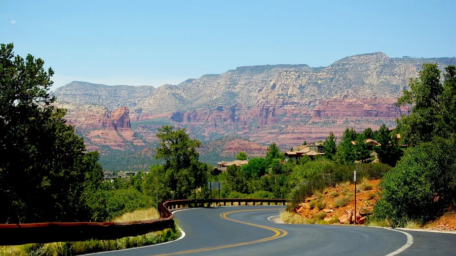
Take the red-rock route from town, not over a pass. Sedona's Red Rock Scenic Byway runs 7.5 miles one way, about twenty minutes if you never stop, and you will stop. The road sits at 4,000 to 4,500 feet, low enough that winter days stay mild, high enough to see the formations lit red in the low afternoon sun.
Why it counts as a splurge: you sleep in Sedona, and winter rates for a decent room run somewhere in the $150 to $300 range depending on the weekend. Add the vortex sites and the pullouts, and you can spend two days in the same handful of miles. Everything hangs off town, which is the point. You drive out, look, and come back to dinner.
Add Oak Creek Canyon for 14 more miles when the road is clear. Check current conditions before you commit to that stretch, since it climbs and can hold a dusting when the town stays dry.
Pullouts are generous, so you are not hunting for a shoulder to park on. That matters with kids or anyone who needs a low-stress stop to get out and walk, much like winter hikes without snowshoes.
The trade-off is a dusting now and then, and the plows handle it. You are checking a forecast, not planning around deep snow or chains. Skip it if you want solitude, because Sedona in winter is still busy.
How much winter driving risk each route carries
Position on the scale reflects snow, ice, and remoteness — not scenery
- Florida Keys: No snow, no ice, services most of the way
- Texas Hill Country: Paved ranch roads, low traffic, mild temps
- Colonial Parkway: Flat and slow, but cold air and nearby services
- Turquoise Trail: High desert cold, plowed but exposed
- Russell-Brasstown: Ice possible at elevation; check conditions
3. Pacific Coast Highway to Big Sur
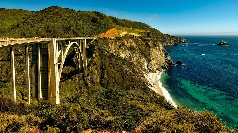
The air off the water at Monterey in January sits around 50 to 60 degrees, cool and salt-tinged, and the light goes flat silver over the swells. That mildness is why this famous drive works in winter. Monterey to Big Sur is 30 miles one way, an hour to drive, or 60 miles and about two hours if you turn and come back the way you came.
The winter hazard here is not snow. It is slides after heavy rain, so check Caltrans before you set out and choose a dry stretch of days. On a clear day you get the coast without the summer traffic that crawls bumper to bumper through the pullouts.
Worth the crowd or not? Bixby Bridge earns its fame once, and off-season you may get a photo without a stranger's elbow in the frame. Pfeiffer Beach is the stop most people rush. Give it an hour.
💡 Tip: Pfeiffer Beach has a narrow, unsigned turnoff; if you pass the yellow post, you have gone too far.
4. Texas Hill Country Loop
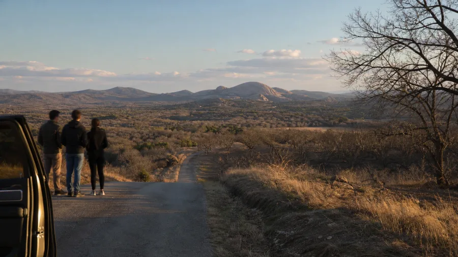
If the coast left you watching a forecast for rain slides, the Hill Country asks nothing of you but a dry afternoon and a full tank. Fredericksburg to the Willow City Loop is 35 miles, about an hour on paved ranch roads, with winter days landing between 50 and 65 degrees. The elevations here roll; they do not climb. You get scenery without a mountain pass to time or a chain to fit.
Stand at the Willow City Loop overlook in the late afternoon, when the low sun rakes across the bare peach orchards and the granite rises warm against a pale sky, and that is your photograph. Enchanted Rock fills the middle distance, and the loop's shoulders let you pull off without a crowd pressing behind you. Lunch in Fredericksburg, then drive it slowly. The winter risk is close to nothing because the road stays paved and lightly traveled; the reward is rolling country, not mountain drama.
💡 PRO TIP
The one check that saves every winter drive
Before you leave, open your state DOT road-conditions map and look at the specific route, not the region. Conditions change by the mile on elevation, and a green region can still hide one icy pass.
5. Natchez Trace Parkway
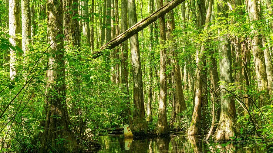
110 miles, two hours, is the parkway stretch from Tupelo to Cherokee, and the driving is the activity, not the thing between stops. The Trace was laid out for gentle curves and low speeds, so you hold a steady pace through bare trees that open onto cypress swamp at the pull-offs, where the winter mist sits low over the water and the only sound is your own engine. No grade pitches you into a curve, and no truck traffic rides your bumper. That is the whole safety case: a road built to be unhurried, plowed through the cold months.
Do the swamp boardwalks, not just the pavement. Step out at the cypress stops, walk the short loops, read the markers on the old Trace history, and let the two hours stretch to four. The parkway rewards a driver who treats it as a series of small walks rather than a line to cover.
This is your distance without the mountain, your slow winter run for the days when you want trees and water and time. It is not the trip for dramatic peaks: come for the quiet, the birds, and the low-stress road that lets you drive it in cold weather without gambling on a pass.
💡 Tip: Gas stations are sparse on the parkway; fill up in Tupelo or Cherokee before you get on.
6. Virginia's Colonial Parkway
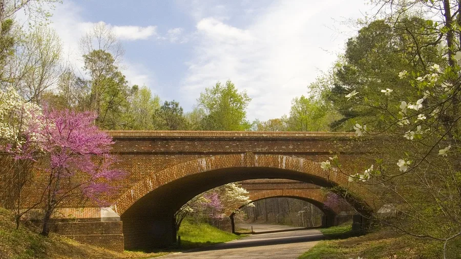
The cold comes off the James River first, a damp gray light across the water before you see anything else, and the road ahead lies flat and open.
Jamestown to Yorktown is 23 miles in about 40 minutes, and the Colonial Parkway keeps a low speed limit the whole way. Flat, plowed, and threaded past the historic sites, it puts services within a few minutes of the pavement at almost every point. You are never far from a warm room or a gas station, which is the winter safety package in full: no grades, no isolation, no reason to white-knuckle a mountain road.
Pull off at a river overlook, park, and sit. Winter empties the parkway, so the bench above the James is yours alone and the water moves past in that flat, silver winter light without a single engine breaking it.
The stops come close together: the settlement at Jamestown, the battlefield at Yorktown, the quiet in between. Families do well here because nothing demands more of a child than a short walk and an overlook, and a driver wary of winter mountain roads finds nothing to fear on this flat ribbon of pavement.
Give it a whole unhurried half day. Stop often, warm up at the sites, return to the river bend that caught your eye. The reward is a slow winter afternoon where the doing is simply sitting and letting the cold water and the old ground handle the rest.
Winter coast driving: what to do and what to skip
Do this
- Check the DOT and Caltrans before you leave
- Stay off beaches during high surf and sneaker-wave warnings
- Book refundable lodging in case a storm closes the road
- Fill up before long empty stretches
- Drive the scenic stretch in the morning light
Skip this
- Crossing a mountain pass you do not need
- Driving the coast in a downpour just to keep the schedule
- Assuming a rental car has all-season tires that grip
- Relying on one gas station being open in a small town
- Booking nonrefundable before checking road conditions
7. Oregon Coast Highway 101
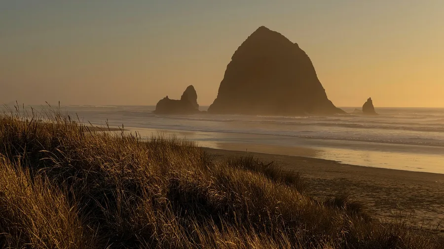
The Coast Range does not block the ocean weather on this drive, so treat the surf as the hazard, not the pavement. Cannon Beach to Newport runs 80 miles on US-101 in about 2 hours, a main highway that gets plowed, with winter air sitting at 40-50°F. No mountain pass, no chains, no deep snow. What you get instead is storm watching: gray swells folding over Haystack Rock and the lighthouses strung south along the headlands, all of it reachable from a warm car with gas and food close by.
Residents do this run in winter and stay back from the water. Sneaker waves are the real danger here, the ones that surge far up a flat beach without warning and take people with them, so keep your distance from the tideline and don't turn your back on the surf for a photo. The safety plan is simple: drive the highway, watch the ocean from the seawall or an overlook, and pull into Cannon Beach or Newport for a coffee and a look at the rock from dry land. It is the storm without the exposure.
Oregon Coast Highway 101 — At a Glance
🗓️ Storm-watch window
Nov to Mar, pick a blow
✅ Worth the drive if
You want surf, not snow tires
⛔ Skip it if
You need to walk the beach
🔭 Best viewing
Seawall, overlooks, dry rock
☕ Safe stops
Cannon Beach and Newport
The rule
Park. Never turn your back on the surf.
8. New Mexico's Turquoise Trail
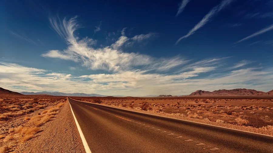
The Turquoise Trail is the short, sunny high-desert run between Albuquerque and Santa Fe, 50 miles and about an hour by way of the old mining town of Madrid. Roads are plowed, traffic is light, and winter temperatures hold around 35-55°F. Where the coast throws storms at you, this route gives you clear skies instead. Your real winter variable is cold air, not a snowbound road.
Time it for the afternoon. Madrid's galleries and shops keep short winter hours and several close early, but the low sun on the Sandia Mountains and the painted storefronts on the main street are best from about two o'clock until the light goes gold. Arrive at midday and you may find half of it shuttered for the day.
Drive it as a city-to-city run: leave Albuquerque late morning, stop in Madrid for an hour or two, and roll into Santa Fe by dark with the cold, empty road behind you. Plowing and light traffic keep it simple, which is the whole appeal of a high-desert crossing in the middle of winter.
The tourist way vs the better way on the Turquoise Trail
Same 50 miles, very different drive
9. Georgia's Russell-Brasstown Scenic Byway
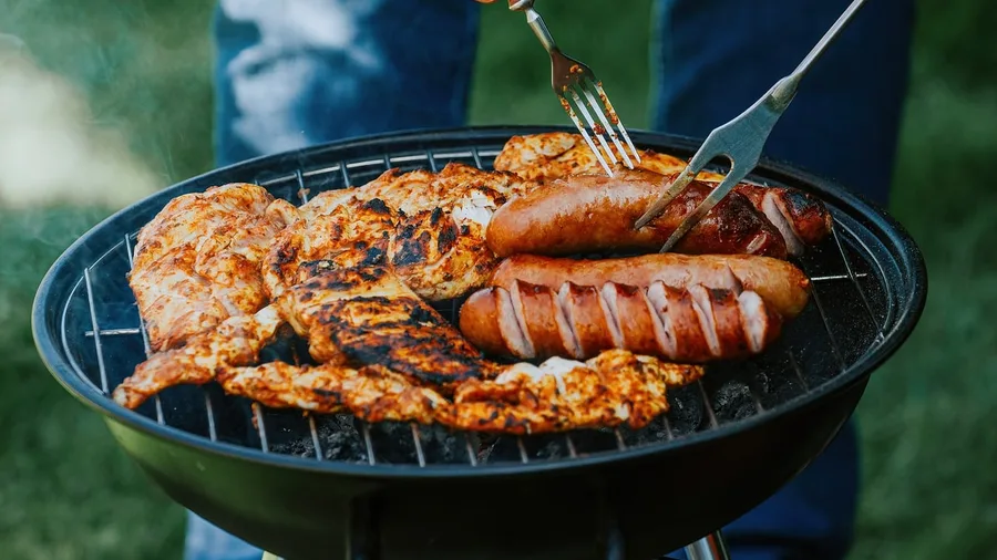
The smell of woodsmoke hits you before the waterfalls do, drifting from a roadside barbecue shack near the base of the loop, and a pulled-pork sandwich there runs around $10. That is the reward after the Russell-Brasstown Scenic Byway, a 38-mile loop out of the north Georgia mountains in about an hour and a half of driving. Winter here is mild, 40-55°F, and the road is paved, so a Southern mountain fix comes without the deep snow you would brace for farther north.
The catch is elevation, and only elevation. Up high, patches of ice can linger when the valleys are clear, and the spur road to the Brasstown Bald summit may close without much warning, so check conditions before you climb. The waterfalls and the long ridge views are the draw. Treat this as a mild loop with one icy spot to respect, not a white-knuckle winter drive.
10. Hudson Valley Route 9W
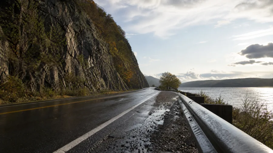
Route 9W from Nyack to Newburgh is a short, plowed river road, and its winter case is that the risk is cold air, not isolation. The 30-mile run takes about an hour, and there is no long empty stretch where a stalled car becomes a problem; houses, side roads and towns sit close the whole way. From the city this is a morning out and a day back.
The history starts at the cliffs. Storm King is the mountain that breaks off into the Hudson above the road, and the fight to stop a power plant from cutting into its face in the 1960s became one of the founding cases of American environmental law. You drive the waterline under the slope and the river opens out on the left; pull into a signed riverside lot, step out, and feel how compressed the miles are. Then there is the corridor itself: Nyack's main street of small storefronts, the old river towns stacked up the bank, and Newburgh's brick blocks on the far north end, all roughly an hour of driving with a stop or two, maybe two hours if you walk a street and eat lunch.
Winter here is 30 to 40°F and the state keeps the road cleared, so the plan is simple: pick a clear day, drive it south to north, and let the cold be the only thing you manage rather than distance, snowpack or a mountain pass. Check the state road conditions before you leave anyway, because river fog and a passing squall can both slow it. It is a day trip, not an expedition, and that short, serviced corridor is exactly why it works in January.
Frequently Asked Questions
Do I need a four-wheel-drive car for these winter road trips?
No. All ten routes are on paved, maintained roads at low elevation, and a standard sedan handles them. Four-wheel drive helps on mountain passes, but none of these routes requires one. Rent the cheaper car and put the money toward lodging.
What if a winter storm hits during my trip?
Check your state DOT road-conditions site or 511 line the morning you drive. If a storm is coming, shift the drive a day or stay put. Refundable lodging makes that decision easy; nonrefundable lodging makes you drive through weather you should not.
Are these routes expensive?
Roughly $45 to $70 a day for a rental and $90 to $250 a night for a motel or hotel, depending on the town. The Florida Keys and Sedona run toward the high end in winter; the Natchez Trace and the Texas Hill Country run toward the low end.
Which of these is the easiest for someone nervous about winter driving?
The Florida Keys Overseas Highway, because there is no snow or ice at all, or Virginia's Colonial Parkway, because it is flat, slow, and never far from services. Both let you focus on the scenery instead of the road.
How far ahead should I book?
For the Florida Keys and Sedona, book several weeks ahead in winter; those are the two that fill up. The other eight are easier, but a refundable reservation a week or two out is still the smart move.
Can I do these as day trips?
Several, yes. The Colonial Parkway, the Red Rock Scenic Byway, the Turquoise Trail, and Route 9W are all under an hour of driving each way and work as day trips from a nearby city. The Florida Keys and the Natchez Trace are better as overnighters.
The One Winter Drive You Keep
The worry that sent you looking was snow, ice, and remote roads, and it gets answered route by route: all ten sit on paved, maintained roads, with a typical winter rental at $45 to $70 a day and motels at $90 to $250 a night.
Now pick the condition you want to avoid. Florida Keys for warmth and no snow. Sedona for mild red-rock scenery. Hudson Valley for a quick escape from New York City. Natchez Trace for slow driving and history.
Then check state DOT road conditions for that specific route and book refundable lodging before you commit. Match the easy reason to your winter worry, and the pass you were dreading stops being on your map.
Check the road, then book the room
Open your state DOT site now and look up the route you are considering. If it is clear, book a refundable room and go.